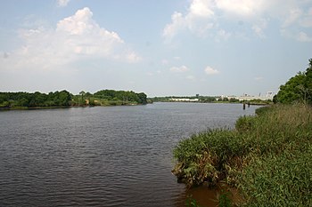
Sampit River

The Sampit River begins in a swampy area of western Georgetown County, South Carolina, USA. It flows in an easterly direction to Winyah Bay at Georgetown.[1] Only small crafts can navigate the upper parts of the river. The lower river merges into the bay and is deepened by tidal flows, and (to Georgetown harbor) by dredging.[2][3][4]
During colonial and antebellum years, areas near the river were developed extensively for rice cultivation,[5] on large plantations[6] dependent on labor of African slaves.[7] They created complex earthworks with dams and other elements to irrigate the rice fields using tidewaters.[8][9] In this and other areas of the Low Country, African Americans developed the Gullah people and culture,[10] a distinct creole culture with strong connections through culture, language and cuisine to West African peoples.[11]
Invasive species[edit]
In July 2006, a red-bellied pacu fish (Piaractus brachypomus) was caught in the upper portion of the river.[12][13] Pacus are relatives of piranhas native to South America. South Carolina DNR officials say this find highlights the danger of individuals releasing non-native fish to the wild. Non-native species can sometimes outcompete local species for habitat and food, killing them off, or introduce diseases, with devastating effects on fisheries.[12]
References[edit]
- ^ "Sampit River at Georgetown, SC". United States Geological Survey. Retrieved 23 March 2023.
- ^ "Project Fact Sheet: Georgetown Harbor, SC" (PDF). U.S. Army Corps of Engineers, Charleston District. 10 April 2018. Retrieved 23 March 2023.
- ^ Sokoloski, Chris (20 June 2022). "Engineers outline plan for dredging port's inner harbor". Coastal Observer. Retrieved 23 March 2023.
- ^ James, Andrew (2 January 2023). "CCU study suggests another option for Georgetown's inner harbor silting issue". ABC15 News. Retrieved 23 March 2023.
- ^ David Soliday (2010). "Aerial photograph of the Sampit River flowing through Friendfield Plantation". National Museum of African American History & Culture. Photograph by David Soliday. Smithsonian. Retrieved 23 March 2023.
- ^ "Friendfield Plantation, Georgetown County". National Register Properties in South Carolina. South Carolina Department of Archives and History. Retrieved 23 March 2023.
- ^ Ivey, Page (2023). "Discover Georgetown, A Quiet Spot on the Coast". Discover South Carolina. South Carolina Department of Parks, Recreation and Tourism.
- ^ "Sampit River". South Carolina Picture Project. 2022. Retrieved 23 March 2023.
- ^ Linder, Suzanne (23 August 2022) [Originally published 20 June 2016]. "Rice Trunks". South Carolina Encyclopedia. University of South Carolina, Institute for Southern Studies. Retrieved 23 March 2023.
- ^ Tommy Howard; Georgetown Times (22 April 2022). "Georgetown County's natural beauty intertwined with its history". The Post and Courier. Retrieved 23 March 2023.
- ^ Sumpter, Althea (16 September 2020) [Originally published 31 March 2006]. "Geechee and Gullah Culture". New Georgia Encyclopedia. Retrieved 23 March 2023.
- ^ a b "Non-native Pacu fish caught in Sampit River". DNR News. South Carolina Department of Natural Resources. 28 August 2006. #06-224. Archived from the original on 19 July 2010.
- ^ Nico, L.G.; Fuller, P.L.; Neilson, M.E. (22 December 2020) [Peer reviewed 22 October 2013]. "Piaractus brachypomus (Cuvier, 1818)". Nonindigenous Aquatic Species Database. Gainesville, Florida: U.S. Geological Survey. Retrieved 23 March 2023.
