
Raymond, Kansas
Raymond, Kansas | |
|---|---|
 Location within Rice County and Kansas | |
 | |
| Coordinates: 38°16′41″N 98°24′52″W / 38.27806°N 98.41444°W[1] | |
| Country | United States |
| State | Kansas |
| County | Rice |
| Township | Raymond |
| Founded | 1871 |
| Incorporated | 1954 |
| Named for | Emmons Raymond |
| Area | |
| • Total | 0.31 sq mi (0.80 km2) |
| • Land | 0.31 sq mi (0.80 km2) |
| • Water | 0.00 sq mi (0.00 km2) |
| Elevation | 1,726 ft (526 m) |
| Population | |
| • Total | 85 |
| • Density | 270/sq mi (110/km2) |
| Time zone | UTC-6 (CST) |
| • Summer (DST) | UTC-5 (CDT) |
| ZIP code | 67573 |
| Area code | 620 |
| FIPS code | 20-58550 |
| GNIS ID | 2396327[1] |
Raymond is a city in Rice County, Kansas, United States.[1] It is named after Emmons Raymond, former Director of the Atchison, Topeka and Santa Fe Railway.[4][5] As of the 2020 census, the population of the city was 85.[3]
History[edit]
For millennia, the land now known as Kansas was inhabited by Native Americans. In 1803, most of modern Kansas was secured by the United States as part of the Louisiana Purchase. In 1854, the Kansas Territory was organized, then in 1861 Kansas became the 34th U.S. state. In 1867, Rice County was founded.
Raymond was founded in 1871, making it the oldest town in Rice County.[4] The first post office in Raymond was established in 1872.[6] At one point in its history Raymond was known as a wild "cowtown" and was a stop on the Santa Fe Railroad, but the town has been in decline since the 1950s.
Geography[edit]
According to the United States Census Bureau, the city has a total area of 0.32 square miles (0.83 km2), all of it land.[7]
Area events[edit]
- Labor Day Parade, has been held in Raymond since 1997.
Demographics[edit]
| Census | Pop. | Note | %± |
|---|---|---|---|
| 1880 | 87 | — | |
| 1890 | 137 | 57.5% | |
| 1960 | 143 | — | |
| 1970 | 133 | −7.0% | |
| 1980 | 132 | −0.8% | |
| 1990 | 125 | −5.3% | |
| 2000 | 95 | −24.0% | |
| 2010 | 79 | −16.8% | |
| 2020 | 85 | 7.6% | |
| U.S. Decennial Census | |||
2020 census[edit]
The 2020 United States census counted 85 people, 42 households, and 27 families in Raymond.[8][9] The population density was 274.2 per square mile (105.9/km2). There were 43 housing units at an average density of 138.7 per square mile (53.6/km2).[9][10] The racial makeup was 87.06% (74) white or European American (87.06% non-Hispanic white), 0.0% (0) black or African-American, 0.0% (0) Native American or Alaska Native, 2.35% (2) Asian, 0.0% (0) Pacific Islander or Native Hawaiian, 1.18% (1) from other races, and 9.41% (8) from two or more races.[11] Hispanic or Latino of any race was 4.71% (4) of the population.[12]
Of the 42 households, 26.2% had children under the age of 18; 45.2% were married couples living together; 23.8% had a female householder with no spouse or partner present. 19.0% of households consisted of individuals and 11.9% had someone living alone who was 65 years of age or older.[9] The average household size was 1.8 and the average family size was 2.2.[13] The percent of those with a bachelor’s degree or higher was estimated to be 3.5% of the population.[14]
17.6% of the population was under the age of 18, 4.7% from 18 to 24, 22.4% from 25 to 44, 32.9% from 45 to 64, and 22.4% who were 65 years of age or older. The median age was 48.5 years. For every 100 females, there were 77.1 males.[9] For every 100 females ages 18 and older, there were 94.4 males.[9]
The 2016-2020 5-year American Community Survey estimates show that the median household income was $45,000 (with a margin of error of +/- $23,960) and the median family income was $50,417 (+/- $25,190).[15] Females had a median income of $21,667 (+/- $14,587). The median income for those above 16 years old was $22,250 (+/- $17,987).[16] Approximately, 15.8% of families and 29.9% of the population were below the poverty line, including 100.0% of those under the age of 18 and 0.0% of those ages 65 or over.[17][18]
2010 census[edit]
As of the census[19] of 2010, there were 79 people, 39 households, and 20 families residing in the city. The population density was 246.9 inhabitants per square mile (95.3/km2). There were 51 housing units at an average density of 159.4 per square mile (61.5/km2). The racial makeup of the city was 100.0% White.
There were 39 households, of which 15.4% had children under the age of 18 living with them, 48.7% were married couples living together, 2.6% had a male householder with no wife present, and 48.7% were non-families. 38.5% of all households were made up of individuals, and 18% had someone living alone who was 65 years of age or older. The average household size was 2.03 and the average family size was 2.75.
The median age in the city was 52.4 years. 12.7% of residents were under the age of 18; 10.1% were between the ages of 18 and 24; 15.2% were from 25 to 44; 35.4% were from 45 to 64; and 26.6% were 65 years of age or older. The gender makeup of the city was 51.9% male and 48.1% female.
2000 census[edit]
As of the census[20] of 2000, there were 95 people, 43 households, and 28 families residing in the city. The population density was 299.3 inhabitants per square mile (115.6/km2). There were 51 housing units at an average density of 160.7 per square mile (62.0/km2). The racial makeup of the city was 94.74% White, 1.05% Asian, 1.05% from other races, and 3.16% from two or more races. Hispanic or Latino of any race were 5.26% of the population.
There were 43 households, out of which 20.9% had children under the age of 18 living with them, 48.8% were married couples living together, 11.6% had a female householder with no husband present, and 32.6% were non-families. 32.6% of all households were made up of individuals, and 20.9% had someone living alone who was 65 years of age or older. The average household size was 2.21 and the average family size was 2.72.
In the city, the population was spread out, with 22.1% under the age of 18, 4.2% from 18 to 24, 20.0% from 25 to 44, 29.5% from 45 to 64, and 24.2% who were 65 years of age or older. The median age was 46 years. For every 100 females, there were 97.9 males. For every 100 females age 18 and over, there were 111.4 males.
The median income for a household in the city was $20,000, and the median income for a family was $28,750. Males had a median income of $13,125 versus $12,500 for females. The per capita income for the city was $12,654. There were 23.1% of families and 33.7% of the population living below the poverty line, including 87.5% of under eighteens and 5.9% of those over 64.
Education[edit]
The community is served by Chase–Raymond USD 401 public school district.
See also[edit]
References[edit]
- ^ a b c d U.S. Geological Survey Geographic Names Information System: Raymond, Kansas
- ^ "2019 U.S. Gazetteer Files". United States Census Bureau. Retrieved July 24, 2020.
- ^ a b "Profile of Raymond, Kansas in 2020". United States Census Bureau. Archived from the original on March 29, 2022. Retrieved March 29, 2022.
- ^ a b Raymond - History
- ^ The Atchison, Topeka, and Santa Fe Railway and Auxiliary Companies - Annual Meetings, and Directors and Officers; January 1, 1902
- ^ "Kansas Post Offices, 1828-1961". Kansas Historical Society. Archived from the original on October 9, 2013. Retrieved June 22, 2014.
- ^ "US Gazetteer files 2010". United States Census Bureau. Archived from the original on January 25, 2012. Retrieved July 6, 2012.
- ^ "US Census Bureau, Table P16: HOUSEHOLD TYPE". data.census.gov. Retrieved January 3, 2024.
- ^ a b c d e "US Census Bureau, Table DP1: PROFILE OF GENERAL POPULATION AND HOUSING CHARACTERISTICS". data.census.gov. Retrieved January 3, 2024.
- ^ Bureau, US Census. "Gazetteer Files". Census.gov. Retrieved December 30, 2023.
- ^ "US Census Bureau, Table P1: RACE". data.census.gov. Retrieved January 3, 2024.
- ^ "US Census Bureau, Table P2: HISPANIC OR LATINO, AND NOT HISPANIC OR LATINO BY RACE". data.census.gov. Retrieved January 3, 2024.
- ^ "US Census Bureau, Table S1101: HOUSEHOLDS AND FAMILIES". data.census.gov. Retrieved January 3, 2024.
- ^ "US Census Bureau, Table S1501: EDUCATIONAL ATTAINMENT". data.census.gov. Retrieved January 3, 2024.
- ^ "US Census Bureau, Table S1903: MEDIAN INCOME IN THE PAST 12 MONTHS (IN 2020 INFLATION-ADJUSTED DOLLARS)". data.census.gov. Retrieved January 3, 2024.
- ^ "US Census Bureau, Table S2001: EARNINGS IN THE PAST 12 MONTHS (IN 2020 INFLATION-ADJUSTED DOLLARS)". data.census.gov. Retrieved January 3, 2024.
- ^ "US Census Bureau, Table S1701: POVERTY STATUS IN THE PAST 12 MONTHS". data.census.gov. Retrieved January 3, 2024.
- ^ "US Census Bureau, Table S1702: POVERTY STATUS IN THE PAST 12 MONTHS OF FAMILIES". data.census.gov. Retrieved January 3, 2024.
- ^ "U.S. Census website". United States Census Bureau. Retrieved July 6, 2012.
- ^ "U.S. Census website". United States Census Bureau. Retrieved January 31, 2008.
Further reading[edit]
External links[edit]
Municipalities and communities of Rice County, Kansas, United States | ||
|---|---|---|
| Cities | 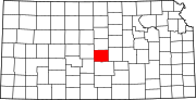 | |
| Unincorporated communities | ||
| Ghost towns | ||
| Townships | ||
| International | |
|---|---|
| National | |