
Pryor, Montana
Pryor, Montana
Baáhpuuo | |
|---|---|
 Location of Pryor, Montana | |
| Coordinates: 45°24′56″N 108°32′29″W / 45.41556°N 108.54139°W | |
| Country | United States |
| State | Montana |
| County | Big Horn |
| Area | |
| • Total | 39.81 sq mi (103.11 km2) |
| • Land | 39.80 sq mi (103.09 km2) |
| • Water | 0.01 sq mi (0.02 km2) |
| Elevation | 4,062 ft (1,238 m) |
| Population (2020) | |
| • Total | 637 |
| • Density | 16.00/sq mi (6.18/km2) |
| Time zone | UTC-7 (Mountain (MST)) |
| • Summer (DST) | UTC-6 (MDT) |
| ZIP code | 59066 |
| Area code | 406 |
| FIPS code | 30-59950 |
| GNIS feature ID | 0775473[2] |
Pryor (Crow: Baáhpuuo)[3] is a census-designated place (CDP) in Big Horn County, Montana, United States. The community is located on Crow Tribe's reservation.[4] The population was 618 at the 2010 census.[5] The area is named for Nathaniel Hale Pryor, a sergeant in the Lewis and Clark Expedition.
The first post office opened in 1892 with Emma C. Stoeckel as postmaster. The Chicago, Burlington and Quincy Railroad built a line through the valley in 1900.[6]
It is home to Chief Plenty Coups State Park.
Geography[edit]
Pryor is located at 45°24′56″N 108°32′29″W / 45.41556°N 108.54139°W (45.415605, -108.541472).[7]
According to the United States Census Bureau, the CDP has a total area of 39.8 square miles (103.0 km2), of which 0.0077 square miles (0.02 km2), or 0.02%, is water.[5]
Climate[edit]
According to the Köppen Climate Classification system, Pryor has a semi-arid climate, abbreviated "BSk" on climate maps.[8]
Demographics[edit]
| Census | Pop. | Note | %± |
|---|---|---|---|
| 2020 | 637 | — | |
| U.S. Decennial Census[9] | |||
As of the census[10] of 2000, there were 628 people, 166 households, and 140 families residing in the CDP. The population density was 15.8 people per square mile (6.1/km2). There were 197 housing units at an average density of 5.0 per square mile (1.9/km2). The racial makeup of the CDP was 12.58% White, 84.87% Native American, 0.16% Asian, and 2.39% from two or more races. Hispanic or Latino of any race were 1.27% of the population.
There were 166 households, out of which 44.6% had children under the age of 18 living with them, 56.0% were married couples living together, 23.5% had a female householder with no husband present, and 15.1% were non-families. 13.9% of all households were made up of individuals, and 6.0% had someone living alone who was 65 years of age or older. The average household size was 3.78 and the average family size was 4.16.
In the CDP, the population was spread out, with 39.5% under the age of 18, 9.4% from 18 to 24, 23.7% from 25 to 44, 19.3% from 45 to 64, and 8.1% who were 65 years of age or older. The median age was 26 years. For every 100 females, there were 106.6 males. For every 100 females age 18 and over, there were 88.1 males.
The median income for a household in the CDP was $25,096, and the median income for a family was $25,865. Males had a median income of $20,000 versus $14,625 for females. The per capita income for the CDP was $7,640. About 21.8% of families and 27.2% of the population were below the poverty line, including 35.6% of those under age 18 and 34.3% of those age 65 or over.
Education[edit]
Pryor Public Schools educates students from kindergarten through 12th grade.[11] There is Arrow Creek Elementary and Plenty Coups Jr./Sr. High. They are known as the Warriors.[12]
See also[edit]
References[edit]
- ^ "ArcGIS REST Services Directory". United States Census Bureau. Retrieved September 5, 2022.
- ^ a b U.S. Geological Survey Geographic Names Information System: Pryor, Montana
- ^ Crow Language Consortium, Crow Dictionary Online, "Pryor" Link
- ^ 2020 CENSUS - TRIBAL TRACT MAP: Crow Reservation and Off-Reservation Trust Land Link
- ^ a b "Geographic Identifiers: 2010 Demographic Profile Data (G001): Pryor CDP, Montana". U.S. Census Bureau, American Factfinder. Archived from the original on February 12, 2020. Retrieved June 25, 2013.
- ^ "Pryor". Montana Place Names Companion. Montana Historical Society. Retrieved April 8, 2021.
- ^ "US Gazetteer files: 2010, 2000, and 1990". United States Census Bureau. February 12, 2011. Retrieved April 23, 2011.
- ^ Climate Summary for Pryor, Montana
- ^ "Census of Population and Housing". Census.gov. Retrieved June 4, 2016.
- ^ "U.S. Census website". United States Census Bureau. Retrieved January 31, 2008.
- ^ "Pryor Public Schools". Pryor Public Schools. Retrieved April 14, 2021.
- ^ "Member Schools". Montana High School Association. Retrieved April 19, 2021.
Municipalities and communities of Big Horn County, Montana, United States | ||
|---|---|---|
| City | 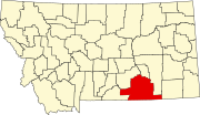 | |
| Town | ||
| CDPs | ||
| Other communities | ||
| Indian reservations | ||
| Footnotes | ‡This populated place also has portions in an adjacent county or counties | |