
Prairie Dog Township, Decatur County, Kansas
Prairie Dog Township | |
|---|---|
 Location in Decatur County | |
| Coordinates: 39°35′30″N 100°33′32″W / 39.59167°N 100.55889°W | |
| Country | United States |
| State | Kansas |
| County | Decatur |
| Area | |
| • Total | 35.76 sq mi (92.62 km2) |
| • Land | 35.76 sq mi (92.61 km2) |
| • Water | 0 sq mi (0.01 km2) 0.01% |
| Elevation | 2,769 ft (844 m) |
| Population (2000) | |
| • Total | 50 |
| • Density | 1.4/sq mi (0.5/km2) |
| GNIS feature ID | 0471064 |
Prairie Dog Township is a township in Decatur County, Kansas, USA. As of the 2000 census, its population was 50.
Geography[edit]
Prairie Dog Township covers an area of 35.76 square miles (92.6 km2) and contains no incorporated settlements. According to the USGS, it contains one cemetery, Shibboleth.
References[edit]
External links[edit]
Municipalities and communities of Decatur County, Kansas, United States | ||
|---|---|---|
| Cities | 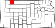 | |
| Unincorporated communities | ||
| Ghost towns | ||
| Townships | ||
| Footnotes | ‡This community also has portions in an adjacent county or counties. | |
This article about a location in Decatur County, Kansas is a stub. You can help Wikipedia by expanding it. |