
Powell County, Montana
Powell County | |
|---|---|
 Powell County Courthouse, Deer Lodge | |
 Location within the U.S. state of Montana | |
 Montana's location within the U.S. | |
| Coordinates: 46°51′N 112°56′W / 46.85°N 112.94°W | |
| Country | |
| State | |
| Founded | February 2, 1901[1] |
| Named for | Mount Powell, which was named in turn for John Wesley Powell |
| Seat | Deer Lodge |
| Largest city | Deer Lodge |
| Area | |
| • Total | 2,333 sq mi (6,040 km2) |
| • Land | 2,326 sq mi (6,020 km2) |
| • Water | 6.3 sq mi (16 km2) 0.3% |
| Population (2020) | |
| • Total | 6,946 |
| • Estimate (2022) | 7,051 |
| • Density | 3.0/sq mi (1.1/km2) |
| Time zone | UTC−7 (Mountain) |
| • Summer (DST) | UTC−6 (MDT) |
| Congressional district | 1st |
| Website | www |
| |
Powell County is a county in the U.S. state of Montana. As of the 2020 census, the population was 6,946.[2] Its county seat is Deer Lodge.[3]
Geography[edit]

According to the United States Census Bureau, the county has a total area of 2,332.7 square miles (6,042 km2), of which 2,326.4 square miles (6,025 km2) is land and 6.3 square miles (16 km2) (0.3%) is water.[4]
Major highways[edit]
Adjacent counties[edit]
- Flathead County - north
- Lewis and Clark County - east
- Jefferson County - southeast
- Deer Lodge County - south
- Granite County - southwest
- Missoula County - west
National protected areas[edit]
Demographics[edit]
| Census | Pop. | Note | %± |
|---|---|---|---|
| 1910 | 5,904 | — | |
| 1920 | 6,909 | 17.0% | |
| 1930 | 6,202 | −10.2% | |
| 1940 | 6,152 | −0.8% | |
| 1950 | 6,301 | 2.4% | |
| 1960 | 7,002 | 11.1% | |
| 1970 | 6,660 | −4.9% | |
| 1980 | 6,958 | 4.5% | |
| 1990 | 6,620 | −4.9% | |
| 2000 | 7,180 | 8.5% | |
| 2010 | 7,027 | −2.1% | |
| 2020 | 6,946 | −1.2% | |
| 2022 (est.) | 7,051 | [5] | 1.5% |
| U.S. Decennial Census[6] 1790–1960,[7] 1900–1990,[8] 1990–2000,[9] 2010–2020[2] | |||
2020 census[edit]
As of the 2020 census, there were 6,946 people living in the county.[citation needed]
2010 census[edit]
As of the 2010 census, there were 7,027 people, 2,466 households, and 1,582 families in the county. The population density was 3.0 inhabitants per square mile (1.2/km2). There were 3,105 housing units at an average density of 1.3 units per square mile (0.50 units/km2). The racial makeup of the county was 92.4% white, 4.4% American Indian, 1.0% black or African American, 0.5% Asian, 0.4% from other races, and 1.3% from two or more races. Those of Hispanic or Latino origin made up 1.7% of the population. In terms of ancestry, 27.9% were German, 19.1% were Irish, 14.6% were English, 8.5% were Norwegian, and 4.7% were American.
Of the 2,466 households, 26.5% had children under the age of 18 living with them, 50.8% were married couples living together, 8.8% had a female householder with no husband present, 35.8% were non-families, and 32.2% of all households were made up of individuals. The average household size was 2.23 and the average family size was 2.79. The median age was 45.1 years.
The median income for a household in the county was $39,851 and the median income for a family was $45,339. Males had a median income of $30,163 versus $24,837 for females. The per capita income for the county was $17,849. About 12.3% of families and 17.3% of the population were below the poverty line, including 32.4% of those under age 18 and 13.0% of those age 65 or over.
Government and infrastructure[edit]
The current Montana State Prison facility is located in an unincorporated area in the county, near Deer Lodge.[10]
Powell County voters have supported Republican Party candidates in every national election since 1964.
| Year | Republican | Democratic | Third party | |||
|---|---|---|---|---|---|---|
| No. | % | No. | % | No. | % | |
| 2020 | 2,355 | 74.08% | 752 | 23.66% | 72 | 2.26% |
| 2016 | 2,029 | 72.62% | 551 | 19.72% | 214 | 7.66% |
| 2012 | 1,806 | 65.03% | 888 | 31.98% | 83 | 2.99% |
| 2008 | 1,683 | 59.81% | 1,021 | 36.28% | 110 | 3.91% |
| 2004 | 1,993 | 70.42% | 761 | 26.89% | 76 | 2.69% |
| 2000 | 1,971 | 69.60% | 638 | 22.53% | 223 | 7.87% |
| 1996 | 1,274 | 45.47% | 952 | 33.98% | 576 | 20.56% |
| 1992 | 1,058 | 36.01% | 989 | 33.66% | 891 | 30.33% |
| 1988 | 1,574 | 56.31% | 1,174 | 42.00% | 47 | 1.68% |
| 1984 | 1,877 | 62.32% | 1,066 | 35.39% | 69 | 2.29% |
| 1980 | 1,770 | 59.14% | 883 | 29.50% | 340 | 11.36% |
| 1976 | 1,610 | 54.56% | 1,302 | 44.12% | 39 | 1.32% |
| 1972 | 1,720 | 59.68% | 1,050 | 36.43% | 112 | 3.89% |
| 1968 | 1,301 | 47.50% | 1,206 | 44.03% | 232 | 8.47% |
| 1964 | 1,140 | 37.50% | 1,896 | 62.37% | 4 | 0.13% |
| 1960 | 1,497 | 49.49% | 1,522 | 50.31% | 6 | 0.20% |
| 1956 | 1,683 | 58.09% | 1,214 | 41.91% | 0 | 0.00% |
| 1952 | 1,783 | 57.85% | 1,281 | 41.56% | 18 | 0.58% |
| 1948 | 1,163 | 43.49% | 1,427 | 53.37% | 84 | 3.14% |
| 1944 | 1,100 | 41.59% | 1,527 | 57.73% | 18 | 0.68% |
| 1940 | 1,116 | 38.46% | 1,765 | 60.82% | 21 | 0.72% |
| 1936 | 799 | 27.42% | 2,060 | 70.69% | 55 | 1.89% |
| 1932 | 1,031 | 34.42% | 1,869 | 62.40% | 95 | 3.17% |
| 1928 | 1,568 | 59.80% | 1,031 | 39.32% | 23 | 0.88% |
| 1924 | 982 | 40.39% | 559 | 22.99% | 890 | 36.61% |
| 1920 | 1,345 | 57.19% | 787 | 33.46% | 220 | 9.35% |
| 1916 | 939 | 39.75% | 1,340 | 56.73% | 83 | 3.51% |
| 1912 | 335 | 23.18% | 545 | 37.72% | 565 | 39.10% |
| 1908 | 599 | 49.63% | 560 | 46.40% | 48 | 3.98% |
| 1904 | 721 | 60.54% | 422 | 35.43% | 48 | 4.03% |
Communities[edit]
City[edit]
- Deer Lodge (county seat)
Census-designated places[edit]
Other unincorporated communities[edit]
- Carpenter's Bar
- Danielsville[13]
- Jens[14]
- Pioneer[15]
- Wall City[16]
See also[edit]
- List of lakes in Powell County, Montana
- List of mountains in Powell County, Montana
- National Register of Historic Places listings in Powell County, Montana
References[edit]
- ^ Powell County History
- ^ a b "State & County QuickFacts". United States Census Bureau. Retrieved May 8, 2023.
- ^ "Find a County". National Association of Counties. Retrieved June 7, 2011.
- ^ "2010 Census Gazetteer Files". United States Census Bureau. August 22, 2012. Archived from the original on December 5, 2014. Retrieved November 29, 2014.
- ^ "Annual Estimates of the Resident Population for Counties: April 1, 2020 to July 1, 2022". United States Census Bureau. Retrieved May 8, 2023.
- ^ "U.S. Decennial Census". United States Census Bureau. Retrieved November 29, 2014.
- ^ "Historical Census Browser". University of Virginia Library. Retrieved November 29, 2014.
- ^ "Population of Counties by Decennial Census: 1900 to 1990". United States Census Bureau. Retrieved November 29, 2014.
- ^ "Census 2000 PHC-T-4. Ranking Tables for Counties: 1990 and 2000" (PDF). United States Census Bureau. Archived (PDF) from the original on March 27, 2010. Retrieved November 29, 2014.
- ^ Montana State Prison Archived November 19, 2010, at the Wayback Machine. Montana Department of Corrections. Retrieved on December 2, 2010. "Address: 400 Conley Lake Road; Deer Lodge, MT; 59722"
- ^ Leip, David. "Atlas of US Presidential Elections". uselectionatlas.org. Retrieved April 3, 2018.
- ^ The leading "other" candidate, Progressive Theodore Roosevelt, received 418 votes, while Socialist candidate Eugene Debs received 147 votes.
- ^ Danielsville MT Google Maps (accessed January 4, 2019)
- ^ Jens MT Google Maps (accessed January 4, 2019)
- ^ Pioneer MT Google Maps (accessed January 4, 2019)
- ^ Wall City MT Google Maps (accessed January 4, 2019)
46°51′N 112°56′W / 46.85°N 112.94°W
External links[edit]
- Grant-Kohrs Ranch National Historic Site
- Montana State Prison
- Clark Fork Watershed Education Program
- Old Montana Prison Museums
- Powell County Chamber of Commerce
- Powell County Website
Places adjacent to Powell County, Montana | |
|---|---|
Municipalities and communities of Powell County, Montana, United States | ||
|---|---|---|
| City | 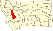 | |
| CDPs | ||
| Other community | ||
| International | |
|---|---|
| National | |