
Puerto Rico Highway 12
Highway 12 | ||||
|---|---|---|---|---|
| Ruta 12 | ||||
| Avenida Santiago de los Caballeros | ||||
 | ||||
| Route information | ||||
| Maintained by Puerto Rico DTPW | ||||
| Length | 6.4 km[1] (4.0 mi) | |||
| Existed | 1960[2][note 1]–present | |||
| Major junctions | ||||
| South end | Port of Ponce in Playa | |||
| North end | ||||
| Location | ||||
| Country | United States | |||
| Territory | Puerto Rico | |||
| Municipalities | Ponce | |||
| Highway system | ||||
| ||||

Puerto Rico Highway 12 (PR-12), also called Avenida Malecón,[3] and Avenida Santiago de los Caballeros, is a 6.4-kilometer,[4] limited-access highway entirely located within the city limits of Ponce, Puerto Rico, and connecting Puerto Rico Highway 14 to the La Guancha area in Barrio Playa in Ponce.[5] It is similar to a freeway but has one traffic light near its intersection with PR-14. In addition to its northern and southern terminus, the highway has four full interchange exits: PR-52, PR-2, PR-133/Calle Comercio, and Avenida Las Américas. Since PR-12's southern terminus is at the Port of Ponce, its traffic volume is expected to grow as construction in the new Port of the Americas is completed.[6]
History[edit]
The 2.5 kilometer section of this road, from the Ponce Bypass to just a few feet from the Caribbean Sea at PR-123, was the first segment built; it was built in 1960.[2] It was called "Avenida Malecón" (Pier Avenue), as it led from the then-urbanized area of Ponce to the Ponce wharf. The segment north of PR-12's intersection with PR-2, that is, between PR-2 and Avenida Tito Castro was built in the 1990s, and completed in 2002, as part of the Ponce en Marcha project.[7]
PR-12 used to be signed as part of 'PR-14' before construction of the new PR-10 took place. The PR-14 signing has since been moved into another route (ending at Monumento a la abolición de la esclavitud, near downtown Ponce, while the PR-12 signing was assigned to the southernmost 5.28 kilometers of the old PR-14 route. As of 2008, the Puerto Rico Department of Transportation and Public Works had not yet updated the signing on the road, but by 2011 it had.
-
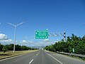
 Southbound lanes of PR-12, near exit to PR-133 (Calle Comercio), in Ponce
 -
 2008 PR-12 photo with old PR-14 signing
 -
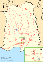 Detailed map of PR-12
,_en_Ponce,_PR_(DSC01665).jpg)
,_en_Barrio_San_Ant%C3%B3n,_Ponce,_PR,_mostrando_antiguo_letrero_de_la_PR-14.jpg)
.svg)
Major intersections[edit]
The entire route is located in Ponce. All exits are unnumbered.
-
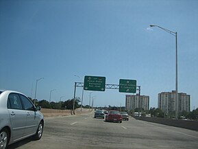
 PR-12 north at its exit to Avenida Caribe
 -
 PR-12 north at its exit to Avenida Rafael Cordero Santiago
 -
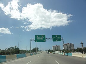
 PR-12 north near its exit to PR-163 (Avenida Las Américas)
.jpg)
.jpg)
.jpg)
| Location | km[1] | mi | Destinations | Notes | |
|---|---|---|---|---|---|
| Playa | 0.0 | 0.0 | Rafael Cordero Santiago Port of the Americas (Calle A) | At-grade intersection; southern terminus of PR-12; access to the Complejo Recreativo y Cultural La Guancha | |
| 0.4 | 0.25 | At-grade intersection; southern terminus of PR-123; access to Ponce Playa | |||
| 1.0– 1.1 | 0.62– 0.68 | Avenida Caribe | Access to Hilton Ponce Golf & Casino Resort | ||
| 1.3 | 0.81 | Ponce Playa (Calle Puerto Viejo) | Southbound exit and entrance; access to the Puerto Rico Department of Labor and Human Resources | ||
| 2.1 | 1.3 | Cloverleaf interchange; PR-52 (unsigned PRI-1) exits 104A and 104B | |||
| 2.5 | 1.6 | Partial cloverleaf interchange; access to the University of Puerto Rico at Ponce, Judicial Center and the Puerto Rico State Insurance Fund Corporation | |||
| San Antón | 3.3 | 2.1 | Diamond interchange; the Pontifical Catholic University of Puerto Rico access is via PR-2 west | ||
| 4.1 | 2.5 | Diamond interchange; Museo de Arte de Ponce and the Pontifical Catholic University of Puerto Rico access is via PR-163 west | |||
| 5.2 | 3.2 | Diamond interchange | |||
| 5.1 | 3.2 | Incomplete diamond interchange; southbound exit and entrance; access to Ponce Centro | |||
| Machuelo Abajo | 5.7 | 3.5 | Calle Obispado (unsigned) | At-grade intersection | |
| 6.4 | 4.0 | Seagull intersection; northern terminus of PR-12; access to Ponce Centro and Juana Díaz | |||
| 1.000 mi = 1.609 km; 1.000 km = 0.621 mi | |||||
- ^ Avenida Las Américas is also known as Bulevar Luis A. Ferré.
See also[edit]
Notes[edit]
References[edit]
- ^ a b Google (28 February 2020). "PR-12" (Map). Google Maps. Google. Retrieved 28 February 2020.
- ^ a b Carmelo Rosario Natal. Ponce En Su Historia Moderna: 1945–2002. Published by Secretaría de Cultura y Turismo of the Government of the Autonomous Municipality of Ponce. Ponce, Puerto Rico. 2003. p. 53.
- ^ General Purpose Population Data, Census 2000. Unidad de Sistemas de Información Geográfica, Área de Tecnología de Información Gubernamental, Oficina de Gerencia y Presupuesto. Gobierno de Puerto Rico. Archived 12 August 2010 at the Wayback Machine Retrieved March 15, 2010.
- ^ Guía de Carreteras Principales, Expresos y Autopistas. (In Spanish) Puerto Rico Autoridad de Carreteras y Transportacion (ACT). 17 November 2010.
- ^ Highways and Transportation Authority. Office of Traffic Data Compilation and Analysis. (2010). Transito Promedio Diario [Average Daily Traffic (AADT)] (PDF) (Report) (in Spanish). San Juan, PR: Department of Transportation and Public Works. pp. 28–30. Archived from the original (PDF) on 5 November 2010. Retrieved 9 May 2018.
- ^ Links to Port of the Americas
- ^ Neysa Rodriguez Deynes. Brevario sobre la Historia de Ponce. Published by Oficina de Cultura y Turismo of the Government of the Autonomous Municipality of Ponce. Ponce, Puerto Rico. 2002. p. 111.
External links[edit]
 Media related to Puerto Rico Highway 12 at Wikimedia Commons