
Olpe, Kansas
Olpe, Kansas | |
|---|---|
 Location within Lyon County and Kansas | |
 | |
| Coordinates: 38°15′43″N 96°09′57″W / 38.26194°N 96.16583°W[1] | |
| Country | United States |
| State | Kansas |
| County | Lyon |
| Founded | 1850s |
| Incorporated | 1905 [2] |
| Named for | Olpe, Germany |
| Government | |
| • Type | Mayor–Council |
| Area | |
| • Total | 0.83 sq mi (2.14 km2) |
| • Land | 0.70 sq mi (1.82 km2) |
| • Water | 0.13 sq mi (0.33 km2) |
| Elevation | 1,204 ft (367 m) |
| Population | |
| • Total | 519 |
| • Density | 630/sq mi (240/km2) |
| Time zone | UTC-6 (CST) |
| • Summer (DST) | UTC-5 (CDT) |
| ZIP code | 66865 |
| Area code | 620 |
| FIPS code | 20-52800 |
| GNIS ID | 2396061[1] |
| Website | cityofolpe.com |
Olpe is a city in Lyon County, Kansas, United States.[1] As of the 2020 census, the population of the city was 519.[4]
History[edit]
Olpe had its start in the year 1879 by the building of the railroad through that territory.[5] It had formerly been known as Eagle Creek Station before the name had been changed to Bitlertown for the owner of the townsite, Gilbert Bitler. A large share of the early settlers being natives of Olpe, Germany, caused the name to be selected.[6][7][8]
Olpe was incorporated as a city in 1905.[9]
Geography[edit]
According to the United States Census Bureau, the city has a total area of 0.80 square miles (2.07 km2), of which 0.67 square miles (1.74 km2) is land and 0.13 square miles (0.34 km2) is water.[10]
Climate[edit]
The climate in this area is characterized by hot, humid summers and generally mild to cool winters. According to the Köppen Climate Classification system, Olpe has a humid subtropical climate, abbreviated "Cfa" on climate maps.[11]
Demographics[edit]
| Census | Pop. | Note | %± |
|---|---|---|---|
| 1910 | 215 | — | |
| 1920 | 235 | 9.3% | |
| 1930 | 317 | 34.9% | |
| 1940 | 331 | 4.4% | |
| 1950 | 293 | −11.5% | |
| 1960 | 722 | 146.4% | |
| 1970 | 453 | −37.3% | |
| 1980 | 477 | 5.3% | |
| 1990 | 431 | −9.6% | |
| 2000 | 504 | 16.9% | |
| 2010 | 546 | 8.3% | |
| 2020 | 519 | −4.9% | |
| U.S. Decennial Census | |||
Olpe is part of the Emporia Micropolitan Statistical Area.
2020 census[edit]
The 2020 United States census counted 519 people, 205 households, and 140 families in Olpe.[12][13] The population density was 739.3 per square mile (285.5/km2). There were 230 housing units at an average density of 327.6 per square mile (126.5/km2).[13][14] The racial makeup was 93.83% (487) white or European American (93.06% non-Hispanic white), 0.39% (2) black or African-American, 0.39% (2) Native American or Alaska Native, 0.39% (2) Asian, 0.0% (0) Pacific Islander or Native Hawaiian, 0.77% (4) from other races, and 4.24% (22) from two or more races.[15] Hispanic or Latino of any race was 2.7% (14) of the population.[16]
Of the 205 households, 36.1% had children under the age of 18; 56.6% were married couples living together; 21.5% had a female householder with no spouse or partner present. 29.8% of households consisted of individuals and 15.1% had someone living alone who was 65 years of age or older.[13] The average household size was 2.6 and the average family size was 3.4.[17] The percent of those with a bachelor’s degree or higher was estimated to be 13.5% of the population.[18]
28.5% of the population was under the age of 18, 7.7% from 18 to 24, 21.0% from 25 to 44, 27.7% from 45 to 64, and 15.0% who were 65 years of age or older. The median age was 38.4 years. For every 100 females, there were 104.3 males.[13] For every 100 females ages 18 and older, there were 101.6 males.[13]
The 2016-2020 5-year American Community Survey estimates show that the median household income was $66,875 (with a margin of error of +/- $17,467) and the median family income was $79,464 (+/- $9,813).[19] Males had a median income of $51,250 (+/- $8,106) versus $18,750 (+/- $8,086) for females. The median income for those above 16 years old was $34,306 (+/- $11,303).[20] Approximately, 0.0% of families and 4.1% of the population were below the poverty line, including 0.0% of those under the age of 18 and 2.3% of those ages 65 or over.[21][22]
2010 census[edit]
As of the census[23] of 2010, there were 546 people, 220 households, and 151 families residing in the city. The population density was 814.9 inhabitants per square mile (314.6/km2). There were 239 housing units at an average density of 356.7 per square mile (137.7/km2). The racial makeup of the city was 98.7% White, 0.2% African American, 0.2% from other races, and 0.9% from two or more races. Hispanic or Latino of any race were 0.5% of the population.
There were 220 households, of which 34.5% had children under the age of 18 living with them, 58.6% were married couples living together, 5.0% had a female householder with no husband present, 5.0% had a male householder with no wife present, and 31.4% were non-families. 25.9% of all households were made up of individuals, and 13.6% had someone living alone who was 65 years of age or older. The average household size was 2.48 and the average family size was 3.00.
The median age in the city was 39 years. 27.3% of residents were under the age of 18; 4.8% were between the ages of 18 and 24; 26.2% were from 25 to 44; 24% were from 45 to 64; and 17.8% were 65 years of age or older. The gender makeup of the city was 49.8% male and 50.2% female.
2000 census[edit]
As of the census[24] of 2000, there were 504 people, 196 households, and 137 families residing in the city. The population density was 1,604.1 inhabitants per square mile (619.3/km2). There were 215 housing units at an average density of 684.3 per square mile (264.2/km2). The racial makeup of the city was 98.81% White, 0.40% African American, 0.60% Native American, and 0.20% from two or more races. Hispanic or Latino of any race were 2.58% of the population.
There were 196 households, out of which 39.3% had children under the age of 18 living with them, 56.1% were married couples living together, 10.7% had a female householder with no husband present, and 30.1% were non-families. 28.6% of all households were made up of individuals, and 16.3% had someone living alone who was 65 years of age or older. The average household size was 2.57 and the average family size was 3.20.
In the city, the population was spread out, with 31.7% under the age of 18, 7.9% from 18 to 24, 28.6% from 25 to 44, 17.7% from 45 to 64, and 14.1% who were 65 years of age or older. The median age was 33 years. For every 100 females, there were 96.9 males. For every 100 females age 18 and over, there were 90.1 males.
The median income for a household in the city was $34,643, and the median income for a family was $37,813. Males had a median income of $30,625 versus $18,542 for females. The per capita income for the city was $13,623. About 5.8% of families and 7.3% of the population were below the poverty line, including 10.8% of those under age 18 and 8.3% of those age 65 or over.

Attractions[edit]
The Chicken House is a restaurant that has been in operation since 1958 with roots to 1934.[25] The restaurant has acted as a town hall, playing host to governors and state representatives[26] and was named by USA Today as one of 50 Great Plates From 50 Great States in 2000.[27] The restaurant has raised notice as far away as New Jersey.[28]
Education[edit]
The community is served by Southern Lyon County USD 252 public school district.
Olpe High School[edit]
Olpe Elementary School[edit]
Before Olpe Elementary was a school, the school was called Harmony Hill, that started as a one-room school house and had later additions. It was located in the countryside, approximately three miles north of Olpe. In December 1991, Olpe Elementary School was completed. The elementary wing of the building adjoins the cafeteria to the west of the high school. In 1997, two additional classrooms and a library were added to the elementary school.[29]
St. Joseph's Catholic School[edit]
Prior to the 1950s there was no public high school in Olpe. Area students attended St. Joseph's Catholic School. Olpe High School was built in the early 1950s. The first class graduated from Olpe Rural High School in 1952; however, the new building was then incomplete. That first year, the old St. Joseph's High School building was rented and classes were held there. Students began attending the newly constructed building the next year. Since then, it has housed kindergarten through sixth grade classes. After the 2012–2013 school year, Saint Joseph's Catholic School closed, due to the economy.[29]
References[edit]
- ^ a b c d U.S. Geological Survey Geographic Names Information System: Olpe, Kansas
- ^ a b "City of Olpe". The League of Kansas Municipalities. May 24, 2019.
- ^ "2019 U.S. Gazetteer Files". United States Census Bureau. Retrieved July 24, 2020.
- ^ a b "Profile of Olpe, Kansas in 2020". United States Census Bureau. Archived from the original on May 3, 2022. Retrieved May 3, 2022.
- ^ French, Laura M. (1929). History of Emporia and Lyon County, Kansas. Heritage Books. p. 137. ISBN 9780788403460.
- ^ Rydjord, John (1972). Kansas Place-Names. University of Oklahoma Press, Norman, Oklahoma. p. 178. ISBN 0-8061-0994-7.
- ^ Heim, Michael (2007). Exploring Kansas Highways. p. 11. ISBN 9780974435886.
- ^ Capace, Nancy (June 1, 2000). Encyclopedia of Kansas. North American Book Dist LLC. p. 246. ISBN 978-0-403-09312-0.
- ^ Blackmar, Frank Wilson (1912). Kansas: A Cyclopedia of State History, Volume 2. Standard Publishing Company. p. 389.
- ^ "US Gazetteer files 2010". United States Census Bureau. Archived from the original on July 2, 2012. Retrieved July 6, 2012.
- ^ Climate Summary for Olpe, Kansas
- ^ "US Census Bureau, Table P16: HOUSEHOLD TYPE". data.census.gov. Retrieved January 3, 2024.
- ^ a b c d e "US Census Bureau, Table DP1: PROFILE OF GENERAL POPULATION AND HOUSING CHARACTERISTICS". data.census.gov. Retrieved January 3, 2024.
- ^ Bureau, US Census. "Gazetteer Files". Census.gov. Retrieved December 30, 2023.
- ^ "US Census Bureau, Table P1: RACE". data.census.gov. Retrieved January 3, 2024.
- ^ "US Census Bureau, Table P2: HISPANIC OR LATINO, AND NOT HISPANIC OR LATINO BY RACE". data.census.gov. Retrieved January 3, 2024.
- ^ "US Census Bureau, Table S1101: HOUSEHOLDS AND FAMILIES". data.census.gov. Retrieved January 3, 2024.
- ^ "US Census Bureau, Table S1501: EDUCATIONAL ATTAINMENT". data.census.gov. Retrieved January 3, 2024.
- ^ "US Census Bureau, Table S1903: MEDIAN INCOME IN THE PAST 12 MONTHS (IN 2020 INFLATION-ADJUSTED DOLLARS)". data.census.gov. Retrieved January 3, 2024.
- ^ "US Census Bureau, Table S2001: EARNINGS IN THE PAST 12 MONTHS (IN 2020 INFLATION-ADJUSTED DOLLARS)". data.census.gov. Retrieved January 3, 2024.
- ^ "US Census Bureau, Table S1701: POVERTY STATUS IN THE PAST 12 MONTHS". data.census.gov. Retrieved January 3, 2024.
- ^ "US Census Bureau, Table S1702: POVERTY STATUS IN THE PAST 12 MONTHS OF FAMILIES". data.census.gov. Retrieved January 3, 2024.
- ^ "U.S. Census website". United States Census Bureau. Retrieved July 6, 2012.
- ^ "U.S. Census website". United States Census Bureau. Retrieved January 31, 2008.
- ^ "Olpe Chicken House". Kansas Travel. Retrieved February 20, 2016.
- ^ Murphy, Jesse (July 31, 2014). "Brownback, Mast make Olpe visit". Emporia Gazette. Retrieved February 20, 2016.
- ^ "USA Today Names 50 Great Plates From 50 Great States". PR Newswire. May 26, 2000. Retrieved February 20, 2016.
- ^ "Editorial column: On fall weekends I went to Olpe, Kansas but my son celebrates Octoberfest in Munich". Hunterdon County Democrat. October 13, 2011. Retrieved February 20, 2016.
- ^ a b Olpe High School history Archived 2014-08-12 at the Wayback Machine
Further reading[edit]
External links[edit]
Municipalities and communities of Lyon County, Kansas, United States | ||
|---|---|---|
| Cities | 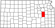 | |
| Unincorporated communities | ||
| Townships | ||