
Oberhavel
Oberhavel | |
|---|---|
 Flag  Coat of arms | |
 | |
| Country | Germany |
| State | Brandenburg |
| Capital | Oranienburg |
| Government | |
| • District admin. | Alexander Tönnies (SPD) |
| Area | |
| • Total | 1,795.3 km2 (693.2 sq mi) |
| Population (31 December 2021)[1] | |
| • Total | 215,795 |
| • Density | 120/km2 (310/sq mi) |
| Time zone | UTC+01:00 (CET) |
| • Summer (DST) | UTC+02:00 (CEST) |
| Vehicle registration | OHV |
| Website | www |
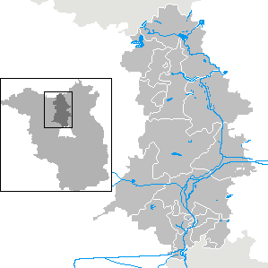
Oberhavel is a Kreis (district) in the northern part of Brandenburg, Germany. Its neighbouring districts are (clockwise from the north): Mecklenburg-Strelitz in Mecklenburg-Western Pomerania, the districts of Uckermark and Barnim, the Bundesland of Berlin, and the districts of Havelland and Ostprignitz-Ruppin.
Geography[edit]
The district is located on the upper course of the Havel river from its source to the outskirts of Berlin. The north is characterised by many lakes including the Großer Stechlinsee, which is well known thanks to a novel by Theodor Fontane called Der Stechlin.
History[edit]
The district was created on 6 December 1993 through the merging of the old Gransee and Oranienburg districts.
Coat of arms[edit]
The coat of arms shows the eagle as the symbol of Brandenburg in the upper part. In the lower half are two flying swans on green background representing nature with many lakes. The coat of arms was unofficially used by the precursor district of Oranienburg before the merger, though not then officially granted. It was granted to the district of Oberhavel on 18 May 1994.
Towns and municipalities[edit]
| Amt-free towns | Amt-free municipalities | Ämter |
|---|---|---|
|
1seat of the Amt; 2town |
Demography[edit]
-
 Development of Population since 1875 within the Current Boundaries (Blue Line: Population; Dotted Line: Comparison to Population Development of Brandenburg state; Grey background: Time of Nazi rule; Red background: Time of communist rule)
 -
 Recent Population Development and Projections (Population Development before Census 2011 (blue line); Recent Population Development according to the Census in Germany in 2011 (blue bordered line); Official projections for 2005-2030 (yellow line); for 2020-2030 (green line); for 2017-2030 (scarlet line)


|
|
|
Sport[edit]
The district is home to three rugby union clubs, the RU Hohen Neuendorf, Veltener RC and Stahl Hennigsdorf Rugby. The latter was the most successful rugby club in East Germany, winning 27 national championships from 1952 to 1990.[3]
References[edit]
- ^ "Bevölkerungsentwicklung und Flächen der kreisfreien Städte, Landkreise und Gemeinden im Land Brandenburg 2021" (PDF). Amt für Statistik Berlin-Brandenburg (in German). June 2022.
- ^ Detailed data sources are to be found in the Wikimedia Commons.Population Projection Brandenburg at Wikimedia Commons
- ^ Rugby in Hennigsdorf - Eine Chronologie Archived 2010-06-10 at the Wayback Machine (in German) Stahl Hennigsdorf website - club history, accessed: 10 April 2010
External links[edit]
![]() Media related to Oberhavel at Wikimedia Commons
Media related to Oberhavel at Wikimedia Commons
- Official website (German)
| Urban districts | |
|---|---|
| Rural districts | |
52°53′N 13°15′E / 52.883°N 13.250°E
| International | |
|---|---|
| National | |