
North Dakota Highway 13
North Dakota Highway 13 | ||||
|---|---|---|---|---|
 ND 13 highlighted in red | ||||
| Route information | ||||
| Maintained by NDDOT | ||||
| Length | 205.533 mi[1] (330.773 km) | |||
| Major junctions | ||||
| West end | ||||
| East end | ||||
| Location | ||||
| Country | United States | |||
| State | North Dakota | |||
| Counties | Emmons, McIntosh, Logan, LaMoure, Dickey, Sargent, Richland | |||
| Highway system | ||||
| ||||
| ||||
.svg)
North Dakota Highway 13 (ND 13) is an approximately 205-mile-long (330 km) highway that serves southeast North Dakota. For the most part, the highway is a rural two-lane road, but for the final 12 miles (19 km) east of I-29 it is a four-lane divided road. Its eastern terminus is at the Minnesota state line over the Bois de Sioux River. The western terminus is located at ND 1804 about 13 miles (21 km) west of Linton and about 50 miles (80 km) south of Bismarck.
Route description[edit]
North Dakota Highway 13 has its western terminus in Emmons County with ND 1804 and travels east about thirteen miles before entering Linton and beginning a concurrency with US 83. This concurrency is entirely within the Linton city limits, and after the highway leaves Linton, ND 13 travels east to the McIntosh county line. About five miles east of the county line, ND 13 starts a concurrency with ND 3. This concurrency travels about ten miles east to Wishek, where the highways part and ND 3 heads south. ND 13 then travels about eleven miles northeast to Lehr. In Lehr, the highway serves as the southern terminus of ND 30. A short distance northeast of Lehr, ND 13 travels along the McIntosh-Logan county line for about nine miles before curving northeast and into Logan County.
Northeast of here is the start of a concurrency with ND 56. The concurrency heads three miles east and enters LaMoure County. Still concurrent, ND 13 and ND 56 travel four miles east before ND 56 heads south to Kulm and ND 13 heads north and east to the city of Edgeley. In Edgeley, ND 13 intersects US 281. After this intersection, the highway heads eighteen miles due east to LaMoure. After traveling six miles east, the highway curves to the east-northeast for about five miles to parallel nearby railroad tracks. The highway reaches Verona and begins a concurrency with ND 1. The concurrency heads due south for six miles before heading west along the LaMoure-Dickey county line for about half of a mile. After this, the highways curve south once more and enter Dickey County. ND 13's concurrency with ND 1 continues southward for four miles, then ND 1 continues to head south toward Oakes, while ND 13 forks to the east and travels to Gwinner, entering Sargent County in the process. Just east of Gwinner, ND 13 is concurrent with ND 32 for a mile east. ND 13 travels eight miles east of this concurrency, then a mile north and about a mile and a half northeast to reach the southeast corner of Milnor. ND 13 then travels east to the Richland county line.
.jpg)
About six miles east of the county line, ND 13 intersects ND 18 in Wyndmere. A few miles east of Wyndmere is the small community of Barney. East of Barney is the city of Mooreton and east of Mooreton, ND 13 intersects Interstate 29 and US 81. From the I-29/US 81 interchange to its interchange with ND 210 in Wahpeton, a stretch of 12 miles (19 km), ND 13 is a divided four-lane highway. Through Wahpeton, the road is also known as Dakota Avenue. The highway's eastern terminus is over the Bois de Sioux River, on the state line with Minnesota.
Major intersections[edit]
| County | Location | mi[1] | km | Destinations | Notes |
|---|---|---|---|---|---|
| Emmons | | 0.000 | 0.000 | Western terminus | |
| Linton | 12.902 | 20.764 | Northern end of US 83 concurrency | ||
| 13.918 | 22.399 | Southern end of US 83 concurrency | |||
| McIntosh | | 36.540 | 58.805 | Western end of ND 3 concurrency | |
| Wishek | 46.428 | 74.719 | Eastern end of ND 3 concurrency | ||
| Lehr | 57.555 | 92.626 | Southern terminus of ND 30 | ||
| Logan | | 70.236 | 113.034 | Western end of ND 56 concurrency | |
| LaMoure | | 77.250 | 124.322 | Eastern end of ND 56 concurrency | |
| Edgeley | 92.037 | 148.119 | |||
| | 122.109 | 196.515 | Northern end of ND 1 concurrency | ||
| Dickey | | 132.303 | 212.921 | Southern end of ND 1 concurrency | |
| Sargent | Gwinner | 153.243 | 246.621 | Western end of ND 32 concurrency | |
| 154.243 | 248.230 | Eastern end of ND 32 concurrency | |||
| Richland | Wyndmere | 179.383 | 288.689 | ||
| | 194.112 | 312.393 | I-29 Exit 23 | ||
| | 202.981 | 326.666 | Only signed eastbound | ||
| Wahpeton | 204.048 | 328.383 | Interchange; exit not signed westbound | ||
| 204.738 | 329.494 | Serves Harry Stern Airport | |||
| Bois de Sioux River | 205.533 | 330.773 | North Dakota–Minnesota line | ||
| Continuation into Minnesota | |||||
1.000 mi = 1.609 km; 1.000 km = 0.621 mi
| |||||
Gallery[edit]
-
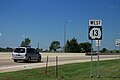 ND 13 westbound in Wahpeton
.jpg)
References[edit]
- ^ a b Cartography Section, Planning/Asset Management Section (2015). Route and Mileage Map (PDF) (Map). c. 1:1,900,800. Bismarck: North Dakota Department of Transportation. Retrieved May 3, 2017.
External links[edit]
- The North Dakota Highways Page by Chris Geelhart
- North Dakota Signs by Mark O'Neil
- State highways in North Dakota
- Transportation in Emmons County, North Dakota
- Transportation in McIntosh County, North Dakota
- Transportation in Logan County, North Dakota
- Transportation in LaMoure County, North Dakota
- Transportation in Dickey County, North Dakota
- Transportation in Sargent County, North Dakota
- Transportation in Richland County, North Dakota