
Nettleton, Mississippi
Nettleton, Mississippi | |
|---|---|
 Flag  Seal | |
 Location in Monroe County and the state of Mississippi | |
 Nettleton, Mississippi Location in the United States | |
| Coordinates: 34°5′18″N 88°37′22″W / 34.08833°N 88.62278°W | |
| Country | United States |
| State | Mississippi |
| Counties | Monroe, Lee |
| Government | |
| • Mayor | Phillip Baulch[1] |
| Area | |
| • Total | 4.04 sq mi (10.46 km2) |
| • Land | 4.03 sq mi (10.43 km2) |
| • Water | 0.01 sq mi (0.03 km2) |
| Elevation | 259 ft (79 m) |
| Population | |
| • Total | 1,935 |
| • Density | 480.63/sq mi (185.56/km2) |
| Time zone | UTC-6 (Central (CST)) |
| • Summer (DST) | UTC-5 (CDT) |
| FIPS code | 28-50880 |
| GNIS feature ID | 0674562 |
| Website | nettletonms |
Nettleton is a city in Lee and Monroe counties in the U.S. state of Mississippi. The population was 1,935 at the 2020 census.[3] Incorporated in 1888, the town was named after George Henry Nettleton, president of the Kansas City, Memphis and Birmingham Railroad (KCM&B).
Geography[edit]
The city sits on the boundary line between Lee County on the north and Monroe County on the south, with approximately equal portions of the city in either county.[4] As of the 2020 census, 1,090 of the city's 1,935 residents (56.3%) lived in Monroe County[5] and 845 (43.7%) in Lee County.[6]
U.S. Routes 45 and 278 pass through the west side of the city on a four-lane bypass. The two highways lead north 15 miles (24 km) to Tupelo, the Lee county seat. US 45 leads south from Nettleton 20 miles (32 km) to Aberdeen, the Monroe county seat, while US 278 leads south and east 15 miles (24 km) to Amory. Mississippi Highway 6 is a two-lane road that leads southeast 11 miles (18 km) to Amory and north 15 miles (24 km) to Tupelo.
According to the U.S. Census Bureau, Nettleton has a total area of 4.0 square miles (10 km2), of which 0.01 square miles (0.03 km2), or 0.29%, are water.[2] The west side of the city drains toward Town Creek, a tributary of the Tombigbee River, while Roberts Creek, a tributary of Town Creek, passes through the east side of the city.
Demographics[edit]
| Census | Pop. | Note | %± |
|---|---|---|---|
| 1900 | 570 | — | |
| 1910 | 733 | 28.6% | |
| 1920 | 653 | −10.9% | |
| 1930 | 834 | 27.7% | |
| 1940 | 861 | 3.2% | |
| 1950 | 1,204 | 39.8% | |
| 1960 | 1,389 | 15.4% | |
| 1970 | 1,591 | 14.5% | |
| 1980 | 1,911 | 20.1% | |
| 1990 | 2,462 | 28.8% | |
| 2000 | 1,932 | −21.5% | |
| 2010 | 1,992 | 3.1% | |
| 2020 | 1,935 | −2.9% | |
| U.S. Decennial Census[7] | |||
2020 census[edit]
| Race | Num. | Perc. |
|---|---|---|
| White | 1,169 | 60.41% |
| Black or African American | 647 | 33.44% |
| Native American | 3 | 0.16% |
| Asian | 3 | 0.16% |
| Pacific Islander | 1 | 0.05% |
| Other/Mixed | 60 | 3.1% |
| Hispanic or Latino | 52 | 2.69% |
As of the 2020 United States Census, there were 1,935 people, 808 households, and 551 families residing in the city.
2000 census[edit]
As of the census[9] of 2000, there were 1,932 people, 794 households, and 546 families residing in the city. The population density was 714.8 inhabitants per square mile (276.0/km2). There were 868 housing units at an average density of 321.1 per square mile (124.0/km2). The racial makeup of the city was 66.56% White, 32.51% African American, 0.10% Native American, 0.36% Asian, 0.16% from other races, and 0.31% from two or more races. Hispanic or Latino of any race were 0.36% of the population.
There were 794 households, out of which 31.5% had children under the age of 18 living with them, 47.5% were married couples living together, 17.5% had a female householder with no husband present, and 31.2% were non-families. 28.8% of all households were made up of individuals, and 14.9% had someone living alone who was 65 years of age or older. The average household size was 2.43 and the average family size was 3.00.
In the city, the population was spread out, with 26.3% under the age of 18, 8.1% from 18 to 24, 26.8% from 25 to 44, 23.9% from 45 to 64, and 14.9% who were 65 years of age or older. The median age was 37 years. For every 100 females, there were 85.4 males. For every 100 females age 18 and over, there were 76.7 males.
The median income for a household in the city was $25,951, and the median income for a family was $31,510. Males had a median income of $26,220 versus $18,974 for females. The per capita income for the city was $12,006. About 16.8% of families and 20.8% of the population were below the poverty line, including 20.3% of those under age 18 and 30.9% of those age 65 or over.
Education[edit]
The city is served by the Nettleton School District.
After high school, many of the students attend the Itawamba Community College in Fulton.
Notable people[edit]
- Fred Beckett, jazz trombone player[10]
- Jason Ferguson, professional American football player
- Bill Hall, former Major League Baseball player
- Brandon Presley, politician
- Jim Price, former American Football League linebacker
- Paul Thorn, singer/songwriter
References[edit]
- ^ "Mayor Phillip Baulch". City of Nettleton, Mississippi. Retrieved March 8, 2024.
- ^ a b "2023 U.S. Gazetteer Files: Mississippi". United States Census Bureau. Retrieved March 8, 2024.
- ^ a b "P1. Race – Nettleton city, Mississippi: 2020 DEC Redistricting Data (PL 94-171)". U.S. Census Bureau. Retrieved March 8, 2024.
- ^ "American FactFinder Reference Map". Archived from the original on March 3, 2007. Retrieved July 2, 2006.
- ^ "P1. Total Population – Nettleton city (part), District 5, Monroe County, Mississippi: 2020 DEC Demographic and Housing Characteristics Data (PL 94-171)". U.S. Census Bureau. Retrieved March 8, 2024.
- ^ "P1. Total Population – Nettleton city (part), District 5, Lee County, Mississippi: 2020 DEC Demographic and Housing Characteristics Data (PL 94-171)". U.S. Census Bureau. Retrieved March 8, 2024.
- ^ "Census of Population and Housing". Census.gov. Retrieved June 4, 2015.
- ^ "Explore Census Data". data.census.gov. Retrieved December 8, 2021.
- ^ "U.S. Census website". United States Census Bureau. Retrieved January 31, 2008.
- ^ "Fred Beckett". AllMusic.com. Retrieved January 19, 2023.
External links[edit]
Municipalities and communities of Lee County, Mississippi, United States | ||
|---|---|---|
| Cities | 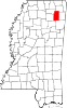 | |
| Towns | ||
| CDP | ||
| Other communities | ||
| Ghost town | ||
| Footnotes | ‡This populated place also has portions in an adjacent county or counties | |
Municipalities and communities of Monroe County, Mississippi, United States | ||
|---|---|---|
| Cities |  | |
| Towns | ||
| Village | ||
| CDPs | ||
| Other communities | ||
| Ghost towns | ||
| Footnotes | ‡This town also has portions in adjacent county or counties | |
| International | |
|---|---|
| National | |