
Nes, Ameland
This article needs additional citations for verification. (May 2012) |
Nes | |
|---|---|
Village | |
 Nes | |
 Location in Ameland municipality | |
 Nes Location in the province of Friesland  Nes Nes (Netherlands) | |
| Coordinates: 53°26′42″N 5°46′23″E / 53.44500°N 5.77306°E | |
| Country | |
| Province | |
| Municipality | |
| Area | |
| • Total | 12.66 km2 (4.89 sq mi) |
| Elevation | 1.7 m (5.6 ft) |
| Population (2021)[1] | |
| • Total | 1,235 |
| • Density | 98/km2 (250/sq mi) |
| Time zone | UTC+1 (CET) |
| • Summer (DST) | UTC+2 (CEST) |
| Postal code | 9163 |
| Dialing code | 0519 |
Nes is the second largest village on the island of Ameland, one of the West Frisian Islands in the northern Netherlands.
It constitutes the main village of the eastern, Roman Catholic part of Ameland and had a population of 1,155 as of January 2017.[3] In the past, the Catholic Amelanders were involved in many conflicts with the western, Protestant Amelanders living in Hollum and Ballum. Nes has since become a popular tourist destination, as the place where the ferry from the mainland arrives. The village has many small shops and restaurants, a microdistillery,[4] and a windmill, De Phenix.[5]
Harbour[edit]
At Nes, on the south side of Ameland, lie the spring dock and marina on the island, one of the 17 Wadden Sea ports. The rescue station KNRM has separate these facilities in the Ballumerbocht, about 4 km east of the causeway. The marina is managed by the Foundation Marina Leyegat and is open from April 1 until November 1. At low tide, the port only to sail on small boats because of the shallow depth of 0.60 to 0.80 m at the harbor entrance. Acceptances route through the Reegeul is straight and clearly marked out. The harbor entrance is on the east side of the ferry jetty, from the Reegeul should be considered separately and accepts ferries and excursion boats. Traps can dry in various places, such as the east of the marina. The port has floating docks with power, a port office with meteorological and tidal information and sanitation.
Gallery[edit]
-
 Windmill De Phenix
 -
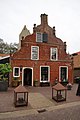 House in Nes
 -
 Village pump
 -
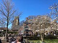 Centre of Nes
 -
 Tourists emerge from the ferry

_(30632502693).jpg)


_(30632503533).jpg)
References[edit]
- ^ a b "Kerncijfers wijken en buurten 2021". Central Bureau of Statistics. Retrieved 26 April 2022.
two entries
- ^ "Postcodetool for 9163EA". Actueel Hoogtebestand Nederland (in Dutch). Het Waterschapshuis. Retrieved 26 April 2022.
- ^ Kerncijfers wijken en buurten 2017 - CBS (in Dutch)
- ^ Destilleerderij Nes
- ^ Nes, Ameland - Nederlandse Molen Database
External links[edit]
![]() Media related to Nes, Ameland at Wikimedia Commons
Media related to Nes, Ameland at Wikimedia Commons