Moses Lake–Othello combined statistical area
(Redirected from Moses Lake-Othello, WA Combined Statistical Area)
This article relies largely or entirely on a single source. (June 2017) |
Moses Lake–Othello Combined Statistical Area | |
|---|---|
| Moses Lake–Othello, WA Combined Statistical Area | |
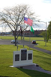
 Moses Lake War Memorial | |
 | |
| Country | |
| State | |
| Largest city | Moses Lake (22,082) |
| Other cities | - Ephrata (8,047) - Othello (7,809) - Quincy (7,365) - Ritzville (1,665) |
| Area | |
| • Total | 4,604.5 sq mi (11,926 km2) |
| Highest elevation | 2,899 ft (884 m) |
| Lowest elevation | ~400 ft (~122 m) |
| Population | |
| • Total | 112,514 |
| • Density | 24.4/sq mi (9.4/km2) |
| Time zone | UTC-8 (PST) |
| • Summer (DST) | UTC-7 (PDT) |
| Area code | 509 |
Moses Lake-Othello, WA CSA is the United States Census Bureau's official name for the combined statistical area that includes the Moses Lake micropolitan area (Grant County) as well as the Othello micropolitan area (Adams County). The population was 112,514 as of 2015.[1] The CSA is anchored by the cities of Moses Lake, and Othello (although the city of Ephrata is larger than Othello). The CSA also contains the city of Ritzville—the county seat of Adams County.
Demographics[edit]
| Census | Pop. | Note | %± |
|---|---|---|---|
| 1910 | 19,618 | — | |
| 1920 | 17,394 | −11.3% | |
| 1930 | 13,385 | −23.0% | |
| 1940 | 20,877 | 56.0% | |
| 1950 | 30,930 | 48.2% | |
| 1960 | 56,406 | 82.4% | |
| 1970 | 53,895 | −4.5% | |
| 1980 | 61,789 | 14.6% | |
| 1990 | 68,361 | 10.6% | |
| 2000 | 91,126 | 33.3% | |
| 2010 | 107,848 | 18.4% | |
| 2015 (est.) | 112,514 | 4.3% |
See also[edit]
References[edit]
- ^ "Census Reporter". United States Census Bureau. Retrieved 2017-05-03.
