
Lodge Grass, Montana
Lodge Grass, Montana
Eelalapiío Aashbacheeitche | |
|---|---|
 Landforms near Lodge Grass, Montana | |
 Location of Lodge Grass, Montana | |
| Coordinates: 45°18′48″N 107°22′0″W / 45.31333°N 107.36667°W | |
| Country | United States |
| State | Montana |
| County | Big Horn |
| Area | |
| • Total | 0.26 sq mi (0.67 km2) |
| • Land | 0.26 sq mi (0.67 km2) |
| • Water | 0.00 sq mi (0.00 km2) |
| Elevation | 3,366 ft (1,026 m) |
| Population (2020) | |
| • Total | 441 |
| • Density | 1,709.30/sq mi (659.83/km2) |
| Time zone | UTC-7 (Mountain (MST)) |
| • Summer (DST) | UTC-6 (MDT) |
| ZIP code | 59050 |
| Area code | 406 |
| FIPS code | 30-44275 |
| GNIS feature ID | 0773532[2] |
Lodge Grass (Crow: Eelalapiío)[3] is a town in Big Horn County, Montana, United States. The population was 441 at the 2020 census.[4]
It is at the confluence of Lodge Grass Creek and the Little Bighorn River, on the Crow Indian Reservation.
Source and derivation of name[edit]
The two words of the name of "Lodge Grass" are not usually put together, in that order, to make a commonly used name, or meaningful phrase. This is because the name "Lodge Grass" came from a mistake of interpretation of the Crow Indian name for "Greasy Grass".
Lodge Grass is named after Lodge Grass Creek, which flows through the town, but as explained in a video viewed in 2013 on YouTube by Joe Medicine Crow, Crow tribal historian, the correct Crow name for Lodge Grass Creek is Greasy Grass Creek.[5]
Crow tradition holds that when the Crows camped on the bottoms of the Lodge Grass Creek or the Little Bighorn River in the spring and summer, when the grass in the valley would be high and when the dew was heavy the bellies and legs of the horses would become wet and glisten as if covered with grease.[5] In another traditional version of the same derivation of the name, when the Crows camped on the creek and walked through the thick grass in the morning when it held dew, their moccasins and leggings would get wet and they would look greasy. Thus the Crows called the valley areas of the Little Bighorn River and Lodge Grass Creek "the Greasy Grass".
The Sioux also called the Little Horn River the Greasy Grass Creek.
The Crow name for "greasy" and the Crow name for "lodge" sound very much alike. The Crow word for "greasy" is Tah-shay, and the Crow word for "lodge" is Ah-shay,[5] and the words sound so much alike that an early interpreter mistakenly interpreted the Crow name for "Greasy Grass" as "Lodge Grass".[5]
The misinterpreted name stuck, and so the creek, and then the town became known as Lodge Grass.
Geography[edit]
Lodge Grass is located at 45°18′48″N 107°22′0″W / 45.31333°N 107.36667°W (45.313419, -107.366733).[6] Interstate 90 passes near the community, with access from Exit 530. Grey Blanket Creek runs nearby.
According to the United States Census Bureau, the town has a total area of 0.24 square miles (0.62 km2), all land.[7]
A traditional camping area near the town is called Iishipia in the Crow language.[8]
Climate[edit]
According to the Köppen Climate Classification system, Lodge Grass has a semi-arid climate, abbreviated "BSk" on climate maps.[9]
| Climate data for Lodge Grass, Montana | |||||||||||||
|---|---|---|---|---|---|---|---|---|---|---|---|---|---|
| Month | Jan | Feb | Mar | Apr | May | Jun | Jul | Aug | Sep | Oct | Nov | Dec | Year |
| Mean daily maximum °C (°F) | 3 (38) |
7 (44) |
11 (51) |
16 (61) |
22 (71) |
27 (80) |
32 (90) |
32 (89) |
26 (78) |
18 (64) |
9 (49) |
4 (40) |
17 (63) |
| Mean daily minimum °C (°F) | −8 (17) |
−6 (22) |
−3 (27) |
2 (36) |
7 (45) |
11 (52) |
14 (58) |
14 (57) |
9 (48) |
4 (39) |
−2 (28) |
−7 (20) |
3 (37) |
| Average precipitation mm (inches) | 23 (0.9) |
18 (0.7) |
33 (1.3) |
53 (2.1) |
74 (2.9) |
66 (2.6) |
33 (1.3) |
25 (1) |
46 (1.8) |
43 (1.7) |
23 (0.9) |
20 (0.8) |
450 (17.8) |
| Source: Weatherbase [10] | |||||||||||||
Demographics[edit]
| Census | Pop. | Note | %± |
|---|---|---|---|
| 1930 | 373 | — | |
| 1940 | 839 | 124.9% | |
| 1950 | 536 | −36.1% | |
| 1960 | 687 | 28.2% | |
| 1970 | 806 | 17.3% | |
| 1980 | 499 | −38.1% | |
| 1990 | 517 | 3.6% | |
| 2000 | 510 | −1.4% | |
| 2010 | 428 | −16.1% | |
| 2020 | 441 | 3.0% | |
| U.S. Decennial Census[11][4] | |||
2010 census[edit]
As of the census[12] of 2010, there were 428 people, 114 households, and 95 families residing in the town. The population density was 1,783.3 inhabitants per square mile (688.5/km2). There were 133 housing units at an average density of 554.2 per square mile (214.0/km2). The racial makeup of the town was 9.6% White, 86.7% Native American, 0.2% Asian, 0.2% from other races, and 3.3% from two or more races. Hispanic or Latino of any race were 1.4% of the population.
There were 114 households, of which 59.6% had children under the age of 18 living with them, 43.9% were married couples living together, 26.3% had a female householder with no husband present, 13.2% had a male householder with no wife present, and 16.7% were non-families. 16.7% of all households were made up of individuals, and 7.1% had someone living alone who was 65 years of age or older. The average household size was 3.75 and the average family size was 4.05.
The median age in the town was 24.7 years. 39.7% of residents were under the age of 18; 10.7% were between the ages of 18 and 24; 20% were from 25 to 44; 20.7% were from 45 to 64; and 8.6% were 65 years of age or older. The gender makeup of the town was 47.2% male and 52.8% female.
2000 census[edit]
As of the census[13] of 2000, there were 510 people, 147 households, and 115 families residing in the town. The population density was 2,141.7 inhabitants per square mile (826.9/km2). There were 164 housing units at an average density of 688.7 per square mile (265.9/km2). The racial makeup of the town was 11.57% White, 86.67% Native American, 0.59% from other races, and 1.18% from two or more races. Hispanic or Latino of any race were 1.57% of the population.
There were 147 households, out of which 57.1% had children under the age of 18 living with them, 47.6% were married couples living together, 27.2% had a female householder with no husband present, and 21.1% were non-families. 18.4% of all households were made up of individuals, and 6.1% had someone living alone who was 65 years of age or older. The average household size was 3.47 and the average family size was 3.90.
In the town, the population was spread out, with 42.4% under the age of 18, 9.6% from 18 to 24, 29.0% from 25 to 44, 13.5% from 45 to 64, and 5.5% who were 65 years of age or older. The median age was 23 years. For every 100 females there were 92.5 males. For every 100 females age 18 and over, there were 77.1 males.
The median income for a household in the town was $22,120, and the median income for a family was $22,222. Males had a median income of $20,833 versus $20,375 for females. The per capita income for the town was $8,130. About 37.1% of families and 40.3% of the population were below the poverty line, including 47.4% of those under age 18 and 31.4% of those age 65 or over.
Education[edit]
The Lodge Grass city limits and surrounding is located within School District 2 & 27, or Lodge Grass Schools. The public school system has been in existence since 1908. The mascot for Lodge Grass Schools are the Indians and Lady Indians.[14] The Lodge Grass High School boys' basketball program is noted for having won five Class B state championships from 1980 to 1990, under Coach Gordon Real Bird.
Notable people[edit]
- Hairy Moccasin (c.1854 — October 9, 1922), a scout for the Seventh Cavalry and survivor of the Battle of the Little Big Horn; retired to the vicinity
- Tuff Harris (b. 1983), National Football League, 2007–2011, Miami Dolphins, New Orleans Saints, Tennessee Titans, Pittsburgh Steelers, and in 2011, Canadian Football League's Edmonton Eskimos, safety; born and attended school in Lodge Grass, graduating from the University of Montana
- Joe Medicine Crow (October 27, 1913 – April 3, 2016), author and historian of the Crow Nation; born near town
- Clara Nomee (May 12, 1938 – January 31, 2012), former five-term chairwoman of the Crow Nation (1990-2000)
- Kevin Red Star (b. 1943), Native American artist; born and lives in Lodge Grass
- Pauline Small (November 30, 1924 – March 9, 2005), first woman to be elected to any office of the Crow Nation; born in Lodge Grass
- White Man Runs Him (c. 1858 – June 2, 1929), a scout and source for the history of the Battle of the Little Bighorn; retired to the area. Grandfather to Pauline Small.
- Thomas Yellowtail (March 7, 1903 - November 24, 1993), medicine man and Sun Dance chief of the Crow Nation; born in Lodge Grass[15]
- Rezcoast Grizz (William Driftwood Jr.), known professionally as Rezcoast Grizz, is a Native American rapper, singer, song-writer & online personality from the Apsáalooke Nation. His music ranges from rap to rock and R&B to emo-punk. He is known for his live stage show and vibrant style, which resonates with younger audiences and makes him a standout among his peers. His music is infectious and hits you in the chest with melody, emotion, soul & gut-wrenching truth.
References[edit]
- ^ "ArcGIS REST Services Directory". United States Census Bureau. Retrieved September 5, 2022.
- ^ a b U.S. Geological Survey Geographic Names Information System: Lodge Grass, Montana
- ^ Crow Language Consortium, Crow Dictionary Online, "Lodge Grass" Link
- ^ a b "U.S. Census website". United States Census Bureau. Retrieved November 2, 2021.
- ^ a b c d Medicine Crow, Joe. "Dr. Joe Medicine Crow at Lodge Grass Creek, March 25, 2012". WYman Scott. Archived from the original on 2014-02-01. Retrieved 12 June 2013.
- ^ "US Gazetteer files: 2010, 2000, and 1990". United States Census Bureau. 2011-02-12. Retrieved 2011-04-23.
- ^ "US Gazetteer files 2010". United States Census Bureau. Archived from the original on 2012-07-02. Retrieved 2012-12-18.
- ^ "Apsáalooke Place Names Database". Library @ Little Big Horn College. Retrieved 2013-04-27.
- ^ Climate Summary Lodge Grass, Montana
- ^ "Weatherbase.com". Weatherbase. 2013. Retrieved on September 24, 2013.
- ^ "Census of Population and Housing". Census.gov. Retrieved June 4, 2015.
- ^ "U.S. Census website". United States Census Bureau. Retrieved 2012-12-18.
- ^ "U.S. Census website". United States Census Bureau. Retrieved 2008-01-31.
- ^ "Member Schools". Montana High School Association. Retrieved 19 April 2021.
- ^ Yellowtail, Crow Medicine Man and Sun Dance Chief, Autobiography, Thomas Yellowtail and Michael Oren Fitzgerald, March 15, 1994. Retrieved 10 June 2016.
Municipalities and communities of Big Horn County, Montana, United States | ||
|---|---|---|
| City | 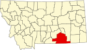 | |
| Town | ||
| CDPs | ||
| Other communities | ||
| Indian reservations | ||
| Footnotes | ‡This populated place also has portions in an adjacent county or counties | |