
Liberty Township, Decatur County, Kansas
Liberty Township | |
|---|---|
| Coordinates: 39°53′54″N 100°34′07″W / 39.89833°N 100.56861°W | |
| Country | United States |
| State | Kansas |
| County | Decatur |
| Area | |
| • Total | 35.2 sq mi (91.17 km2) |
| • Land | 35.19 sq mi (91.15 km2) |
| • Water | 0.01 sq mi (0.02 km2) 0.02% |
| Elevation | 2,802 ft (854 m) |
| Population (2000) | |
| • Total | 48 |
| • Density | 1.4/sq mi (0.5/km2) |
| GNIS feature ID | 0470919 |
Liberty Township is a township in Decatur County, Kansas, USA. As of the 2000 census, its population was 48.
Geography[edit]
Liberty Township covers an area of 35.2 square miles (91 km2) and contains no incorporated settlements. The county seat of Oberlin sits on the township's southeastern border.
Transportation[edit]
Liberty Township contains two airports or landing strips: Oberlin Municipal Airport and R and D Aerial Spraying Airport.
References[edit]
External links[edit]
Municipalities and communities of Decatur County, Kansas, United States | ||
|---|---|---|
| Cities | 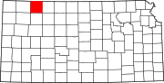 | |
| Unincorporated communities | ||
| Ghost towns | ||
| Townships | ||
| Footnotes | ‡This community also has portions in an adjacent county or counties. | |
This article about a location in Decatur County, Kansas is a stub. You can help Wikipedia by expanding it. |