
Knob Fork, West Virginia
Knob Fork | |
|---|---|
 Knob Fork Location within the state of West Virginia  Knob Fork Knob Fork (the United States) | |
| Coordinates: 39°38′55″N 80°32′48″W / 39.64861°N 80.54667°W | |
| Country | United States |
| State | West Virginia |
| County | Wetzel |
| Time zone | UTC-5 (Eastern (EST)) |
| • Summer (DST) | UTC-4 (EDT) |
Knob Fork is a diffuse, unincorporated hamlet in Wetzel County, West Virginia, United States. It lies at an elevation of 1050 feet (320 m). Its only business or service is a wholesale nursery. Other names for the community have included Geaneytown, Jolliff, Jolliffe, Jolliffes Store, Knobfork Store, Sugar Run, and Uniontown.[1] The present name is derived from the nearby Knob Fork creek.[2]
References[edit]
- ^ U.S. Geological Survey Geographic Names Information System: Knob Fork, West Virginia
- ^ Kenny, Hamill (1945). West Virginia Place Names: Their Origin and Meaning, Including the Nomenclature of the Streams and Mountains. Piedmont, WV: The Place Name Press. pp. 354–355.
Municipalities and communities of Wetzel County, West Virginia, United States | ||
|---|---|---|
| Cities | 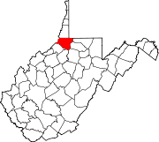 | |
| Towns | ||
| CDPs | ||
| Unincorporated communities |
| |
| Ghost towns | ||
| Footnotes | ‡This populated place also has portions in an adjacent county or counties | |
This article about a location in Wetzel County, West Virginia is a stub. You can help Wikipedia by expanding it. |