
Iytwelepenty / Davenport Range National Park
| Iytwelepenty / Davenport Range National Park Davenport[1], Northern Territory | |
|---|---|
 Iytwelepenty/Davenport Range National Park (outlined in green) | |
| Nearest town or city | Tennant Creek |
| Established | 1993 |
| Area | 1,278.47 km2 (493.6 sq mi)[2] |
| Managing authorities | Parks and Wildlife Commission of the Northern Territory |
| Website | Iytwelepenty / Davenport Range National Park |
| See also | Protected areas of the Northern Territory |
Iytwelepenty / Davenport Range, or Davenport Ranges National Park (Iytwellepenty),[3] previously the Davenport Murchison National Park,[4] is a national park in the Northern Territory of Australia about 1,033 kilometres (642 mi) south-east of the territorial capital of Darwin,[5] occupying around 1,120 km2 (430 sq mi)s of the Davenport Range.[3] It lies within the Davenport Murchison Ranges bioregion, an area of 58,050 km2 (22,410 sq mi), with a climate ranging from semiarid to subtropical.[4]
The mountains were caused by a tectonic event hundreds of millions of years ago, but recent images from space have shown that erosion occurred that exposed the ridges and valleys only around 100 million years ago.[6] Amelia Creek crater, an ancient eroded impact crater lies within the Davenport Range in the area.[7]
See also[edit]
Gallery[edit]
-
 Old Police Station Waterhole
 -
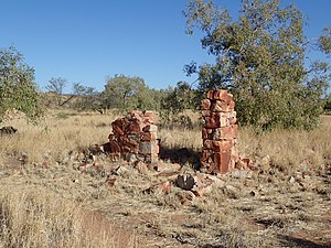 Old Police Station ruins


References[edit]
- ^ "Place Names Register Extract for "Iytwelepenty / Davenport Ranges National Park"". NT Place Names Register. Northern Territory Government. Retrieved 5 February 2020.
- ^ a b "CAPAD 2012 Northern Territory Summary (see 'DETAIL' tab)". CAPAD 2012. Australian Government - Department of the Environment. 7 February 2014. Retrieved 7 February 2014.
- ^ a b "Northern Territory For Everyone: Davenport Murchision National Park". Northern Territory for Everyone. Retrieved 9 August 2021.
- ^ a b Davenport Murchison Ranges bioregion (PDF). Archived (PDF) from the original on 13 March 2014. Retrieved 9 August 2021.
{{cite book}}:|website=ignored (help) - ^ Hema, Maps (2007). Australia Road and 4WD Atlas (Map). Eight Mile Plains Queensland: Hema Maps. p. 101. ISBN 978-1-86500-456-3.
- ^ "Davenport-Murchison Range, Northern Territory, Australia". NASA Earth Observatory. Retrieved 9 August 2021.
- ^ "Earth Impact Database: Amelia Creek". Planetary and Space Science Centre, University of New Brunswick. Retrieved 11 September 2022.
External links[edit]
20°51′36″S 134°56′28″E / 20.8600°S 134.9410°E
This Northern Territory geography article is a stub. You can help Wikipedia by expanding it. |
This Australian protected areas-related article is a stub. You can help Wikipedia by expanding it. |