
Interstate 255
Interstate 255 | |||||||
|---|---|---|---|---|---|---|---|
 I-255 highlighted in red | |||||||
| Route information | |||||||
| Auxiliary route of I-55 | |||||||
| Maintained by IDOT and MoDOT | |||||||
| Length | 30.82 mi[1] (49.60 km) | ||||||
| Existed | 1986–present | ||||||
| History | Completed by 1989[2] | ||||||
| NHS | Entire route | ||||||
| Major junctions | |||||||
| West end | |||||||
| |||||||
| North end | |||||||
| Location | |||||||
| Country | United States | ||||||
| Counties | MO: St. Louis IL: Monroe, St. Clair, Madison | ||||||
| Highway system | |||||||
| |||||||

Interstate 255 (I-255) is a bypass route of I-55 in Greater St. Louis. Along with I-270, it forms a loop around the central portion of the bi-state metro area; a majority of I-255 is located on the Illinois half. It shares its southern terminus with I-270 at the junction with I-55; I-270 and I-255 go to the west and east, respectively. U.S. Route 50 (US 50) joins I-255 at Lemay Ferry Road. It crosses the Mississippi River on the Jefferson Barracks Bridge, enters Illinois, and then turns northeast. There is a junction with I-64, where US 50 breaks off and goes east, and then further north there is a junction with I-55 again, I-70, and US 40, all of which are all cosigned together. The next junction is another one with I-270, which is the northern terminus of I-255. After that, the limited-access freeway continues on as Illinois Route 255 (IL 255). I-255 is 30.82 miles (49.60 km) in length.
Route description[edit]

I-255's counterclockwise terminus is at an interchange with I-55 and I-270 in Mehlville, Missouri. The beltway is designated as I-270 (with Kansas City as the control city) west of this interchange and as I-255 east (with Chicago as the control city) east of this interchange. The section of I-255 east from this interchange to the Jefferson Barracks Bridge was first built in the 1960s to carry US 50 traffic across the Mississippi River. The roadway was upgraded between 2002 and 2004. Repairs included both new pavement and the replacement of the Telegraph Road bridge.
Once it crosses the Mississippi River and enters Illinois, I-255 is signed as a north–south highway. It is considerably newer than the Missouri section; it was constructed in the 1980s. At the IL 3 interchange, I-255 turns sharply to the north. It briefly overlaps with IL 3 in Dupo. After Dupo, I-255 turns northeast, skirting Cahokia and East St. Louis. An interchange at Mousette Lane in Sauget was constructed in the 1990s and provides motorist access to GCS Ballpark (home to the Gateway Grizzlies baseball team) and the St. Louis Downtown Airport. Given its proximity to the airport, this section of I-255 features shorter light poles to better accommodate takeoffs and landings.
North of Sauget, I-255 traverses a portion of the Frank Holten State Recreation Area before an interchange with I-64 west of Caseyville. This section of freeway opened in 1986.[3] Traffic can enter and exit I-255 at an interchange with Collinsville Road (formerly US 40) just east of the Fairmont Park Racetrack.
I-255 meets I-55/I-70 at an interchange in Collinsville, its original intended terminus. North of this interchange, the control city for I-255 changes from "Chicago" to "To I-270". In the 1980s, I-255 was extended approximately five miles (8.0 km) north to meet I-270 in Pontoon Beach, its current terminus. While the I-255 designation ends at the I-270 interchange, the freeway continues north and west (parallelling the bend in the Mississippi River) for approximately 23 miles (37 km) as IL 255. The decision to not extend the I-255 designation to the new freeway reflects the fact that state and not federal funds were used to pay for construction.
History[edit]

I-255 route was proposed from I-55/I-244 near Green Park to I-55/70 west of Cahokia Mounds near the intersection with IL 111 when plans surfaced in the 1950s Yellow Book.[4] It was originally designed to be a four lane highway but was changed to six lanes.[5]
Since that routing was to go through the American Bottoms, archaeological investigations had to be conducted prior to any construction, which would later become known as the FAI 270 Series.[6] When Cahokia Mounds was designated in the federal register, an alternative alignment for I-255 from I-64 to I-55/70 was selected.[7] This delayed construction of I-255 until the late 1970s, making it the last Interstate Highway in metropolitan St. Louis to be built.
Both the western (I-270) and eastern (I-255) portions of the Interstate loop around St. Louis were originally designated as I-270.[8] However, the route that Illinois selected ("Corridor 413"[9]) included an interchange in Pontoon Beach between the new beltway (running north and south parallel to the Mississippi River) and the existing beltway (running east and west to a terminus at I-55/I-70). As such, two intersecting Interstate Highways would have carried the same route number.[10] As such, the Illinois Department of Transportation (IDOT) concluded a different route number would be necessary for the eastern leg of the beltway. While I-870 was initially considered,[11] informal use of I-255 in contemporary local media coverage led to its widespread adoption. By 1980, IDOT announced that the eastern portion of the St. Louis beltway was to be designated as I-255.
Exit list[edit]
| State | County | Location | mi | km | Exit | Destinations | Notes |
|---|---|---|---|---|---|---|---|
| Missouri | St. Louis | Concord | 0.00 | 0.00 | Clockwise terminus; continuation beyond I-55 | ||
| Concord–Mehlville line | 1 | I-55 exit 196; signed as exits 1A (south) & 1B (north); westbound exits and eastbound entrances | |||||
| Mehlville | 0.5 | 0.80 | 1B | Eastbound exit and westbound entrance | |||
| 1.2 | 1.9 | 1C | West end of US 50 overlap; westbound exit and eastbound entrance | ||||
| 2.2 | 3.5 | 2 | |||||
| 3.2 | 5.1 | 3 | Koch Road | Orientation changes from east-west to north-south | |||
| Mississippi River | 3.5– 4.0 | 5.6– 6.4 | Jefferson Barracks Bridge | ||||
| Illinois | Monroe | Columbia | 6.0– 6.9 | 9.7– 11.1 | 6 | South end of IL 3 / GRR overlap | |
| St. Clair | Dupo | 9.2 | 14.8 | 9 | S. Main Street/Old Route 3 – Dupo | ||
| 10.6 | 17.1 | 10 | North end of IL 3 / GRR overlap | ||||
| Cahokia | 13.0 | 20.9 | 13 | ||||
| Centreville | 15.0 | 24.1 | 15 | Mousette Lane | |||
| Alorton | 16.7 | 26.9 | 17 | Signed as exits 17A (east) and 17B (west) | |||
| East St. Louis | 18.6 | 29.9 | 19 | State Street – East St. Louis | |||
| Caseyville | 20.1 | 32.3 | 20 | I-64 exit 7; north end of US 50 overlap | |||
| St. Clair–Madison county line | Collinsville | 23.6 | 38.0 | 24 | Collinsville Road | ||
| Madison | 24.8 | 39.9 | 25 | I-55/I-70 exit 10; signed as exits 25A (north/east) & 25B (south/west) | |||
| Pontoon Beach | 26.0 | 41.8 | 26 | Horseshoe Lake Road | |||
| 29.2 | 47.0 | 29 | |||||
| 30.82 | 49.60 | 30 | I-270 exit 7A westbound, 7 eastbound; counterclockwise terminus | ||||
| Continuation north beyond I-270 | |||||||
1.000 mi = 1.609 km; 1.000 km = 0.621 mi
| |||||||
References[edit]
- ^ Price, Jeff (May 6, 2019). "Table 2: Auxiliary Routes of the Dwight D. Eisenhower National System of Interstate and Defense Highways as of December 31, 2018". Route Log and Finder List. Federal Highway Administration. Retrieved March 23, 2021.
- ^ Illinois Department of Transportation (1989). Illinois Highway Map (Map) (1989–1990 ed.). [1:762,500]. Springfield: Illinois Department of Transportation. Retrieved November 24, 2022 – via Illinois Digital Archives.
- ^ Alton Telegraph. October 24, 1986.
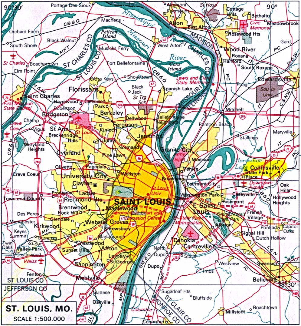
{{cite news}}: Missing or empty|title=(help)[full citation needed] - ^ St. Louis, Missouri (Map). 1:500,000.
- ^ Alton Telegraph. April 29, 1977.
{{cite news}}: Missing or empty|title=(help)[full citation needed] - ^ "FAI-270 Series: American Bottom Archaeology". Illinois Transportation Archaeological Research Program. Archived from the original on July 20, 2011. Retrieved March 12, 2022.
- ^ Edwardsville Intelligencer. July 9, 1973.
{{cite news}}: Missing or empty|title=(help)[full citation needed] - ^ Illinois Division of Highways (1968). Illinois Official Highway Map (Map). [1:772,500]. Springfield: Illinois Division of Highways. Retrieved November 24, 2022 – via Illinois Digital Archives.
- ^ Dees, Dan C. (November 1, 1974). "Federal-aid Freeway System - Supplemental Freeways" (PDF). Illinois Department of Transportation. Retrieved March 12, 2022 – via MidwestRoads.com.
- ^ IDOT FAI-270/FAP 413 Draft EIS Volume 1, 1983
- ^ I-270/870 proposed routes[full citation needed]
External links[edit]
![]() Media related to Interstate 255 at Wikimedia Commons
Media related to Interstate 255 at Wikimedia Commons
| ||
| Authority control databases: National |
|---|
- Auxiliary Interstate Highways
- Interstate 55
- Interstate Highways in Illinois
- Interstate Highways in Missouri
- Roads in Greater St. Louis
- Transportation in Madison County, Illinois
- Transportation in Monroe County, Illinois
- Transportation in St. Clair County, Illinois
- Transportation in St. Louis County, Missouri
- Beltways in the United States