
Humboldt Township, Allen County, Kansas
Humboldt Township | |
|---|---|
 Location in Allen County | |
| Coordinates: 37°49′25″N 095°25′06″W / 37.82361°N 95.41833°W | |
| Country | United States |
| State | Kansas |
| County | Allen |
| Area | |
| • Total | 25.2 sq mi (65.3 km2) |
| • Land | 24.7 sq mi (64.0 km2) |
| • Water | 0.5 sq mi (1.2 km2) 1.9% |
| Elevation | 991 ft (302 m) |
| Population (2010) | |
| • Total | 253 |
| • Density | 10/sq mi (4.0/km2) |
| GNIS feature ID | 0474722 |
Humboldt Township is one of twelve townships in Allen County, Kansas, United States.[1] As of the 2010 census, its population was 253.[2]
Geography[edit]
Humboldt Township covers an area of 25.2 square miles (65.3 km2) and contains one incorporated settlement, Humboldt. According to the USGS, it contains three cemeteries: Evan Young, Fussman and Saint Joseph.
The streams of Charles Branch and Slack Creek run through this township.
References[edit]
- ^ BGN: Domestic Names - Main
- ^ "Geographic Identifiers: 2010 Demographic Profile Data (G001): Humboldt township, Allen County, Kansas". U.S. Census Bureau, American Factfinder. Archived from the original on February 12, 2020. Retrieved May 10, 2013.
External links[edit]
Municipalities and communities of Allen County, Kansas, United States | ||
|---|---|---|
| Cities | 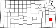 | |
| Unincorporated communities | ||
| Ghost towns | ||
| Townships | ||
| Footnotes | †This community is designated a Census-Designated Place (CDP) by the United States Census Bureau. ‡This community also has portions in an adjacent county or counties. | |
This article about a location in Allen County, Kansas is a stub. You can help Wikipedia by expanding it. |