
Hope, New Mexico
Hope, New Mexico | |
|---|---|
 Location of Hope, New Mexico | |
 Hope, New Mexico Location in the United States | |
| Coordinates: 32°48′57″N 104°44′09″W / 32.81583°N 104.73583°W | |
| Country | United States |
| State | New Mexico |
| County | Eddy |
| Area | |
| • Total | 1.22 sq mi (3.17 km2) |
| • Land | 1.22 sq mi (3.17 km2) |
| • Water | 0.00 sq mi (0.00 km2) |
| Elevation | 4,095 ft (1,248 m) |
| Population | |
| • Total | 113 |
| • Density | 92.40/sq mi (35.66/km2) |
| Time zone | UTC-7 (Mountain (MST)) |
| • Summer (DST) | UTC-6 (MDT) |
| ZIP code | 88250 |
| Area code | 575 |
| FIPS code | 35-33290 |
| GNIS feature ID | 2413559[2] |
Hope is a village in Eddy County, New Mexico, United States. It is located approximately 20 miles (32 km) west of Artesia on U.S. Route 82. It has had a post office since 1890.[4] As of the 2010 census, the village's population was 105.[5]
Geography[edit]
Hope is located in northwestern Eddy County at 32°48′43″N 104°44′01″W / 32.811916°N 104.733565°W.[6] US 82 passes through the center of the village, leading east 20 miles (32 km) to Artesia and west 90 miles (140 km) over the Sacramento Mountains to Alamogordo.
According to the United States Census Bureau, the village has a total area of 1.22 square miles (3.17 km2), all land.[5]
Climate[edit]
| Climate data for Hope, New Mexico (1991–2020 normals, extremes 1919–1946, 1966–1995, 2000–present) | |||||||||||||
|---|---|---|---|---|---|---|---|---|---|---|---|---|---|
| Month | Jan | Feb | Mar | Apr | May | Jun | Jul | Aug | Sep | Oct | Nov | Dec | Year |
| Record high °F (°C) | 81 (27) |
87 (31) |
92 (33) |
100 (38) |
109 (43) |
115 (46) |
111 (44) |
106 (41) |
104 (40) |
97 (36) |
88 (31) |
81 (27) |
115 (46) |
| Mean daily maximum °F (°C) | 56.5 (13.6) |
60.5 (15.8) |
68.2 (20.1) |
76.6 (24.8) |
85.1 (29.5) |
93.9 (34.4) |
93.1 (33.9) |
91.6 (33.1) |
85.5 (29.7) |
76.7 (24.8) |
65.1 (18.4) |
56.7 (13.7) |
75.8 (24.3) |
| Daily mean °F (°C) | 43.2 (6.2) |
46.5 (8.1) |
53.6 (12.0) |
61.4 (16.3) |
70.1 (21.2) |
78.4 (25.8) |
80.2 (26.8) |
79.3 (26.3) |
72.5 (22.5) |
62.8 (17.1) |
51.5 (10.8) |
43.7 (6.5) |
61.9 (16.6) |
| Mean daily minimum °F (°C) | 29.9 (−1.2) |
32.5 (0.3) |
38.9 (3.8) |
46.1 (7.8) |
55.1 (12.8) |
63.0 (17.2) |
67.4 (19.7) |
67.0 (19.4) |
59.5 (15.3) |
49.0 (9.4) |
38.0 (3.3) |
30.7 (−0.7) |
48.1 (8.9) |
| Record low °F (°C) | −5 (−21) |
−5 (−21) |
2 (−17) |
15 (−9) |
28 (−2) |
41 (5) |
48 (9) |
48 (9) |
35 (2) |
13 (−11) |
−4 (−20) |
−10 (−23) |
−10 (−23) |
| Average precipitation inches (mm) | 0.41 (10) |
0.36 (9.1) |
0.55 (14) |
0.58 (15) |
1.03 (26) |
0.89 (23) |
1.97 (50) |
1.88 (48) |
2.82 (72) |
1.13 (29) |
0.67 (17) |
0.57 (14) |
12.86 (327) |
| Average snowfall inches (cm) | 0.5 (1.3) |
0.7 (1.8) |
0.1 (0.25) |
0.0 (0.0) |
0.0 (0.0) |
0.0 (0.0) |
0.0 (0.0) |
0.0 (0.0) |
0.0 (0.0) |
0.1 (0.25) |
0.3 (0.76) |
1.7 (4.3) |
3.4 (8.6) |
| Average precipitation days (≥ 0.01 in) | 2.5 | 2.6 | 2.3 | 2.1 | 3.7 | 3.6 | 5.9 | 7.1 | 6.3 | 4.3 | 2.6 | 3.0 | 46.0 |
| Average snowy days (≥ 0.1 in) | 0.4 | 0.3 | 0.1 | 0.0 | 0.0 | 0.0 | 0.0 | 0.0 | 0.0 | 0.0 | 0.3 | 0.6 | 1.7 |
| Source: NOAA[7][8] | |||||||||||||
History[edit]
Founded in 1884 as "Badgerville", the name was changed in 1890 for post office purposes.[4]
The town was featured in Life magazine on May 29, 1950, with an account of the newly elected Petticoat City Government under Mayor Ethel Altman.[9]
Demographics[edit]
| Census | Pop. | Note | %± |
|---|---|---|---|
| 1910 | 417 | — | |
| 1920 | 430 | 3.1% | |
| 1930 | 275 | −36.0% | |
| 1940 | 289 | 5.1% | |
| 1950 | 186 | −35.6% | |
| 1960 | 108 | −41.9% | |
| 1970 | 90 | −16.7% | |
| 1980 | 111 | 23.3% | |
| 1990 | 101 | −9.0% | |
| 2000 | 107 | 5.9% | |
| 2010 | 105 | −1.9% | |
| 2020 | 113 | 7.6% | |
| U.S. Decennial Census[10][3] | |||
This article includes a list of references, related reading, or external links, but its sources remain unclear because it lacks inline citations. (April 2023) |
As of the census[11] of 2000, there were 107 people, 45 households, and 27 families residing in the village. The population density was 92.3 inhabitants per square mile (35.6/km2). There were 58 housing units at an average density of 50.0 per square mile (19.3/km2). The racial makeup of the village was 77.57% White, 0.93% African American, 4.67% from other races, and 16.82% from two or more races. Hispanic or Latino of any race were 16.82% of the population.
There were 45 households, out of which 26.7% had children under the age of 18 living with them, 48.9% were married couples living together, 11.1% had a female householder with no husband present, and 40.0% were non-families. 31.1% of all households were made up of individuals, and 26.7% had someone living alone who was 65 years of age or older. The average household size was 2.38 and the average family size was 3.00.
In the village, the population was spread out, with 25.2% under the age of 18, 6.5% from 18 to 24, 22.4% from 25 to 44, 18.7% from 45 to 64, and 27.1% who were 65 years of age or older. The median age was 42 years. For every 100 females, there were 109.8 males. For every 100 females age 18 and over, there were 105.1 males.
The median income for a household in the village was $17,639, and the median income for a family was $28,750. Males had a median income of $19,583 versus $43,750 for females. The per capita income for the village was $12,867. There were 10.7% of families and 20.2% of the population living below the poverty line, including no under eighteens and 7.9% of those over 64.
Education[edit]
It is within the Artesia Public Schools school district.[12] The K-8 school Peñasco Elementary School is west of Hope, and serves the Hope community.[13] Artesia Park Junior High School is the district's sole school for grade 9, and Artesia High School is the school district's sole comprehensive high school, for grades 10-12.[14]
References[edit]
- ^ "ArcGIS REST Services Directory". United States Census Bureau. Retrieved October 12, 2022.
- ^ a b U.S. Geological Survey Geographic Names Information System: Hope, New Mexico
- ^ a b "Census Population API". United States Census Bureau. Retrieved October 12, 2022.
- ^ a b Julyan, Robert (1998), "Hope". Place Names of New Mexico (2nd edition), University of New Mexico Press, Albuquerque, New Mexico, page 169, ISBN 0-8263-1689-1
- ^ a b "Geographic Identifiers: 2010 Demographic Profile Data (G001): Hope village, New Mexico". U.S. Census Bureau, American Factfinder. Retrieved February 17, 2016.[dead link]
- ^ "US Gazetteer files: 2010, 2000, and 1990". United States Census Bureau. February 12, 2011. Retrieved April 23, 2011.
- ^ "NOWData - NOAA Online Weather Data". National Oceanic and Atmospheric Administration. Retrieved January 1, 2024.
- ^ "Summary of Monthly Normals 1991-2020". National Oceanic and Atmospheric Administration. Retrieved January 1, 2024.
- ^ LIFE. Time Inc. ISSN 0024-3019. Retrieved December 6, 2014.
- ^ "Census of Population and Housing". Census.gov. Retrieved June 4, 2015.
- ^ "U.S. Census website". United States Census Bureau. Retrieved January 31, 2008.
- ^ "2020 CENSUS - SCHOOL DISTRICT REFERENCE MAP: Eddy County, NM" (PDF). U.S. Census Bureau. Retrieved June 28, 2022. - Text list
- ^ "Home". Peñasco Elementary School. Retrieved July 13, 2022.
[...]we serve students in kindergarten through the 8th grade in and around Hope.[...]12 Dunken St. Hope, NM 88250
- Not in the Hope city limits - Google Maps lists the school at "12 Pinon Dunken Rd, Hope, NM 88250" - ^ "Our Schools". Artesia Public Schools. Retrieved June 28, 2022.
12 Dunken St. Hope, NM 88250
Municipalities and communities of Eddy County, New Mexico, United States | ||
|---|---|---|
| Cities | 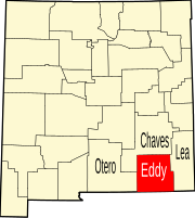 | |
| Villages | ||
| CDPs | ||
| Unincorporated communities | ||
| International | |
|---|---|
| National | |