
Heerle
This article needs additional citations for verification. (May 2022) |
Heerle | |
|---|---|
Village | |
 Former mayor's residence | |
 Heerle Location in the province of North Brabant in the Netherlands  Heerle Heerle (Netherlands) | |
| Coordinates: 51°31′6″N 4°21′33″E / 51.51833°N 4.35917°E | |
| Country | Netherlands |
| Province | North Brabant |
| Municipality | Roosendaal |
| Area | |
| • Total | 8.49 km2 (3.28 sq mi) |
| Elevation | 7 m (23 ft) |
| Population (2021)[1] | |
| • Total | 1,830 |
| • Density | 220/km2 (560/sq mi) |
| Time zone | UTC+1 (CET) |
| • Summer (DST) | UTC+2 (CEST) |
| Postal code | 4726[1] |
| Dialing code | 0165 |
| Website | heerle.info |
Heerle (Brabantic: Èrel) is a village in the municipality of Roosendaal, in the Dutch province of North Brabant. Before the municipal reorganisation of 1997, Heerle was part of the municipality of Wouw. It lies between the cities of Bergen op Zoom and Roosendaal.
Etymology[edit]
The name Heerle has been documented for the first time in the 13th century as Harella and is possibly a conjunction of the word har (meaning heightened sandy soil) and loo, a small forest. The customary local Brabantic pronunciation differs significantly from the standard Dutch one, so that linguistic misconceptions regularly occur.
History[edit]
Heerle was mentioned for the first time in a charter of the Sint-Bernardusabdij in Hemiksem, which could raise tenth penning taxes in the village for the first time in 1277. In 1307, Heerle was proclaimed an independent parish, previously it was part of the parish of Bergen op Zoom.
Regardless of having an independent church community, Heerle hadn't developed its own village governance and remained dependent on the aldermen of neighbouring Wouw. Furthermore, Heerle didn't have a village centre until the beginning of the 19th century.
Sights[edit]
- The Sint-Gertruduskerk is a church built in 1862 and 1924, situated at Herelsestraat 100.
- The Boerin met Kalf (Peasant Woman with Calf) statue in front of the Sint-Gertrudiskerk, it is customary for the villagers to dress her up during Carnaval.
Gallery[edit]
-
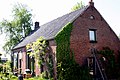 House in Heerle
 -
 St Gertrudis Church


References[edit]
- ^ a b c "Kerncijfers wijken en buurten 2021". Central Bureau of Statistics. Retrieved 18 April 2022.
- ^ "Postcodetool for 4726AA". Actueel Hoogtebestand Nederland (in Dutch). Het Waterschapshuis. Retrieved 18 April 2022.