
Göschenen
Göschenen | |
|---|---|
 | |
 Coat of arms | |
Location of Göschenen  | |
 Göschenen  Göschenen | |
| Coordinates: 46°40′N 8°35′E / 46.667°N 8.583°E | |
| Country | Switzerland |
| Canton | Uri |
| District | n.a. |
| Area | |
| • Total | 104.15 km2 (40.21 sq mi) |
| Elevation | 1,111 m (3,645 ft) |
| Population (31 December 2018)[2] | |
| • Total | 448 |
| • Density | 4.3/km2 (11/sq mi) |
| Time zone | UTC+01:00 (Central European Time) |
| • Summer (DST) | UTC+02:00 (Central European Summer Time) |
| Postal code(s) | 6487 |
| SFOS number | 1208 |
| ISO 3166 code | CH-UR |
| Surrounded by | Andermatt, Gadmen (BE), Gurtnellen, Hospental, Oberwald (VS), Realp, Wassen |
| Website | www SFSO statistics |
Göschenen locally [ɡɔʊʃɛnɛn] ⓘ (German, Italian: Casinotta, Romansh: Caschanuttais) is a village and municipality in the canton of Uri in Switzerland. It sits at the northern end of the Gotthard tunnel. The Göschenen riots (1875) saw Urner troops opening fire on Italian miners demonstrating for better working conditions and wages on the tunnel's construction site.[3]
Name[edit]
Göschenen is first mentioned in 1280 as Gesschenden. The name is from Rumantsch *cascina (modern caschigna) "alpine hut", from Latin capsum "corral", but influenced by the word for cheese, cascio. The e in the first syllable is due to Germanic i-umlaut, changed to ö in modern spelling is a hypercorrection based on the phonology of the dialect of Uri.[4]
Geography[edit]

Göschenen has an area, as of 2006[update], of 104.1 km2 (40.2 sq mi). Of this area, 7.3% is used for agricultural purposes, while 11.4% is forested. Of the rest of the land, 0.9% is settled (buildings or roads) and the remainder (80.4%) is non-productive (rivers, glaciers or mountains).[5] In the 1993/97 land survey[update], 5.1% of the total land area was heavily forested, while 5.5% is covered in small trees and shrubbery. Of the agricultural land, 0.0% is used for farming or pastures, while 0.7% is used for orchards or vine crops and 6.6% is used for alpine pastures. Of the settled areas, 0.1% is covered with buildings, 0.3% is classed as special developments, and 0.5% is transportation infrastructure. Of the unproductive areas, 1.3% is unproductive standing water (ponds or lakes), 0.9% is unproductive flowing water (rivers), 62.8% is too rocky for vegetation, and 15.4% is other unproductive land.[6]
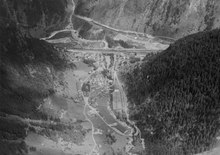
Göschenen and its railway station are located at the northern end of the Gotthard Road Tunnel and the Gotthard Rail Tunnel. The village grew up around a bridge over the Reuss. The Schöllenen Gorge in the Reuss Valley between Andermatt and Göschenen is the location of the infamous Devil's Bridge. A very short 1,000 mm (3 ft 3+3⁄8 in) metre gauge railway line, the Schöllenenbahn, connects Göschenen railway station with Andermatt railway station, via the Schöllenen Gorge.
Until 1875 it was part of the municipality of Wassen. It consists of the village of Göschenen and the hamlets of Abfrutt and the Göscheneralp.
Demographics[edit]

Göschenen has a population (as of 31 December 2020) of 428.[7] As of 2007[update], 4.2% of the population was made up of foreign nationals. Over the last 10 years the population has decreased at a rate of -26.9%. Most of the population (as of 2000[update]) speaks German (94.9%), with Portuguese being second most common ( 2.0%) and Spanish being third ( 1.2%).[5] As of 2007[update] the gender distribution of the population was 49.3% male and 50.7% female.[8]
In the 2007 federal election the FDP party received 90.4% of the vote.[5]
The entire Swiss population is generally well educated. In Göschenen about 58.4% of the population (between age 25-64) have completed either non-mandatory upper secondary education or additional higher education (either university or a Fachhochschule).[5]
Göschenen has an unemployment rate of 0.81%. As of 2005[update], there were 34 people employed in the primary economic sector and about 10 businesses involved in this sector. 75 people are employed in the secondary sector and there are 4 businesses in this sector. 96 people are employed in the tertiary sector, with 17 businesses in this sector.[5]
The historical population is given in the following table:[9][10]
| year | population |
|---|---|
| 1837 | 344 |
| 1850 | 348 |
| 1880 | 2,992a |
| 1900 | 773 |
| 1920 | 974 |
| 1950 | 698 |
| 1960 | 1,284 |
| 1970 | 888 |
| 2000 | 511 |
| 2005 | 473 |
| 2007 | 450 |
| 2010 | 410 |
- ^a Population increase due to construction of the Gotthard rail tunnel.
Weather[edit]

Göschenen has an average of 151.4 days of rain per year and on average receives 1,424 mm (56.1 in) of precipitation. The wettest month is April during which time Göschenen receives an average of 139 mm (5.5 in) of precipitation. During this month there is precipitation for an average of 14.2 days. The month with the most days of precipitation is May, with an average of 15.3, but with only 139 mm (5.5 in) of precipitation. The driest month of the year is September with an average of 102 mm (4.0 in) of precipitation over 14.2 days.[11]
References[edit]
- ^ a b "Arealstatistik Standard - Gemeinden nach 4 Hauptbereichen". Federal Statistical Office. Retrieved 13 January 2019.
- ^ "Ständige Wohnbevölkerung nach Staatsangehörigkeitskategorie Geschlecht und Gemeinde; Provisorische Jahresergebnisse; 2018". Federal Statistical Office. 9 April 2019. Retrieved 11 April 2019.
- ^ "Der brutale Gotthard". Www.tagesanzeiger.ch. 12 October 2010. Retrieved 2018-04-19.
- ^ ortsnamen.ch 1280 Gesschenden, 1290s Gescheldun, Gescheldun, Geschendon, Geschentun, Geschenden, Geschenen. 1353 Geschinen; latinized as Gestinum in Ortelius (1570), Mercator (1585). Göschinen first in 1455, the modern spelling Göschenen first in 1620. Geschenen auch Gestinen, Göschenen, Gestilen in Leu, Lexikon (1754) 8, p. 473. Gestinen oder Göschenen Ebel, Anleitung (1804) 2, p. 44. The form Gestinen falls out of use in the 19th century. The spelling in ö becomes prevalent after 1870, and is recognized as hypercorrection by Brandstätter, 'Urseren', Vaterland 69 (1907): "Die unrichtige Schreibweise mit ‹ö› entstand dadurch, das im Urnerdialekt das ‹ö› eben auch wie ‹e› ausgesprochen wird. Das ‹e› in den beiden genannten Namen ist aber Umlaut von ‹a›, d. h. ursprünglich ‹ä›."
- ^ a b c d e Swiss Federal Statistical Office Archived 2011-11-16 at the Wayback Machine accessed 09-Sep-2009
- ^ Canton Uri - Ground use statistics Archived 2011-07-07 at the Wayback Machine (in German) accessed 8 September 2009
- ^ "Ständige und nichtständige Wohnbevölkerung nach institutionellen Gliederungen, Geburtsort und Staatsangehörigkeit". bfs.admin.ch (in German). Swiss Federal Statistical Office - STAT-TAB. 31 December 2020. Retrieved 21 September 2021.
- ^ Uri Population statistics Archived 2011-07-07 at the Wayback Machine (in German) accessed 8 September 2009
- ^ Göschenen in German, French and Italian in the online Historical Dictionary of Switzerland.
- ^ Uri in Numbers 2009/10 edition Archived 2011-07-07 at the Wayback Machine (in German) accessed 8 September 2009
- ^ "Temperature and Precipitation Average Values-Table, 1961-1990" (in German, French, and Italian). Federal Office of Meteorology and Climatology - MeteoSwiss. Archived from the original on 27 June 2009. Retrieved 8 May 2009., the weather station elevation is 1099 meters above sea level.
External links[edit]
- Official website

- Hans Stadler: Göschenen in German, French and Italian in the online Historical Dictionary of Switzerland, 2005-09-14.
- Wages Switzerland
Municipalities in the Canton of Uri, Switzerland | ||
|---|---|---|
| International | |
|---|---|
| National | |
| Other | |