
Greenwood, Wisconsin
Greenwood, Wisconsin | |
|---|---|
 Looking south in downtown Greenwood on WIS73 | |
 Location of Greenwood in Clark County, Wisconsin. | |
| Coordinates: 44°46′4″N 90°35′56″W / 44.76778°N 90.59889°W | |
| Country | |
| State | |
| County | Clark |
| Area | |
| • Total | 2.76 sq mi (7.15 km2) |
| • Land | 2.68 sq mi (6.93 km2) |
| • Water | 0.08 sq mi (0.22 km2) |
| Elevation | 1,181 ft (360 m) |
| Population | |
| • Total | 1,026 |
| • Estimate (2019)[4] | 998 |
| • Density | 372.94/sq mi (143.97/km2) |
| Time zone | UTC-6 (Central (CST)) |
| • Summer (DST) | UTC-5 (CDT) |
| Area code(s) | 715 & 534 |
| FIPS code | 55-31575[5] |
| GNIS feature ID | 1565856[2] |
| Website | greenwoodwi |
Greenwood is a city in Clark County in the U.S. state of Wisconsin. The population was 1,026 at the 2010 census.
Geography[edit]
Greenwood is located at 44°46′4″N 90°35′56″W / 44.76778°N 90.59889°W (44.767826, -90.598959).[6]
According to the United States Census Bureau, the city has a total area of 2.86 square miles (7.41 km2), of which, 2.78 square miles (7.20 km2) is land and 0.08 square miles (0.21 km2) is water.[7]
The town has a peace memorial, created by Ernest Durig from an artificial stone made using concrete and fine white sand.[8] Unveiled in 1937, it was restored in 1982,[9] and sits adjacent to the 1934 City Hall, on the corner of Main Street and Division Street.[10]
Demographics[edit]
| Census | Pop. | Note | %± |
|---|---|---|---|
| 1900 | 708 | — | |
| 1910 | 665 | −6.1% | |
| 1920 | 761 | 14.4% | |
| 1930 | 651 | −14.5% | |
| 1940 | 776 | 19.2% | |
| 1950 | 956 | 23.2% | |
| 1960 | 1,041 | 8.9% | |
| 1970 | 1,036 | −0.5% | |
| 1980 | 1,124 | 8.5% | |
| 1990 | 969 | −13.8% | |
| 2000 | 1,079 | 11.4% | |
| 2010 | 1,026 | −4.9% | |
| 2019 (est.) | 998 | [4] | −2.7% |
| U.S. Decennial Census[11] | |||
2010 census[edit]
As of the census[3] of 2010, there were 1,026 people, 464 households, and 259 families living in the city. The population density was 369.1 inhabitants per square mile (142.5/km2). There were 520 housing units at an average density of 187.1 per square mile (72.2/km2). The racial makeup of the city was 97.5% White, 0.9% African American, 0.4% Native American, 0.1% Asian, 0.7% from other races, and 0.5% from two or more races. Hispanic or Latino of any race were 1.5% of the population.
There were 464 households, of which 24.4% had children under the age of 18 living with them, 43.8% were married couples living together, 7.5% had a female householder with no husband present, 4.5% had a male householder with no wife present, and 44.2% were non-families. 36.6% of all households were made up of individuals, and 16.2% had someone living alone who was 65 years of age or older. The average household size was 2.18 and the average family size was 2.87.
The median age in the city was 44.1 years. 22.5% of residents were under the age of 18; 7.6% were between the ages of 18 and 24; 21.2% were from 25 to 44; 27.1% were from 45 to 64; and 21.7% were 65 years of age or older. The gender makeup of the city was 48.1% male and 51.9% female.
2000 census[edit]
As of the census[5] of 2000, there were 1,079 people, 468 households, and 287 families living in the city. The population density was 381.9 people per square mile (147.2/km2). There were 502 housing units at an average density of 177.7 per square mile (68.5/km2). The racial makeup of the city was 99.17% White, 0.19% Native American, 0.09% Asian, 0.09% from other races, and 0.46% from two or more races. Hispanic or Latino of any race were 1.11% of the population.
There were 468 households, out of which 27.8% had children under the age of 18 living with them, 50.9% were married couples living together, 6.4% had a female householder with no husband present, and 38.5% were non-families. 34.2% of all households were made up of individuals, and 19.2% had someone living alone who was 65 years of age or older. The average household size was 2.27 and the average family size was 2.93.
In the city, the population was spread out, with 23.6% under the age of 18, 7.5% from 18 to 24, 28.5% from 25 to 44, 18.6% from 45 to 64, and 21.8% who were 65 years of age or older. The median age was 38 years. For every 100 females, there were 93.7 males. For every 100 females age 18 and over, there were 93.9 males.
The median income for a household in the city was $32,917, and the median income for a family was $43,438. Males had a median income of $33,750 versus $22,132 for females. The per capita income for the city was $18,841. About 5.7% of families and 9.3% of the population were below the poverty line, including 13.1% of those under age 18 and 11.1% of those age 65 or over.
Notable people[edit]
- Mildred Barber Abel, Wisconsin State Representative
- Jeremy Schmidt, NCAA Basketball Player for St. Cloud State University, Educator
- Joseph L. Barber, Wisconsin State Senator
- Cy Buker, Major League Baseball pitcher for the Brooklyn Dodgers
- Harland Carl, National Football League player with the Chicago Bears
- Mose Gingerich, host of reality TV series about Amish people
- William C. Kavanaugh, Wisconsin State Representative
- Larry Krause, National Football League player with the Green Bay Packers
- Bill Miklich, National Football League player with the New York Giants and Detroit Lions
- Mae Schunk, Lieutenant Governor of Minnesota
Images[edit]
-
 Greenwood City Hall and Public Library
 -
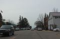 Looking south in Greenwood on WIS 73
 -


References[edit]
- ^ "2019 U.S. Gazetteer Files". United States Census Bureau. Retrieved August 7, 2020.
- ^ a b "US Board on Geographic Names". United States Geological Survey. October 25, 2007. Retrieved January 31, 2008.
- ^ a b "U.S. Census website". United States Census Bureau. Retrieved November 18, 2012.
- ^ a b "Population and Housing Unit Estimates". United States Census Bureau. May 24, 2020. Retrieved May 27, 2020.
- ^ a b "U.S. Census website". United States Census Bureau. Retrieved January 31, 2008.
- ^ "US Gazetteer files: 2010, 2000, and 1990". United States Census Bureau. February 12, 2011. Retrieved April 23, 2011.
- ^ "US Gazetteer files 2010". United States Census Bureau. Archived from the original on January 25, 2012. Retrieved November 18, 2012.
- ^ "Greenwood, Wisconsin's Peace Memorial". Retrieved July 31, 2016.
- ^ Garbush, Florence (August 4, 1982). "Peace monument part of Greenwood's history". Eau Claire Leader Telegram. p. 28.
- ^ 44°46′02″N 90°35′53″W / 44.767143°N 90.597952°W
- ^ "Census of Population and Housing". Census.gov. Retrieved June 4, 2015.
External links[edit]
- City of Greenwood
- Sanborn fire insurance maps: 1894 1902 1922
Municipalities and communities of Clark County, Wisconsin, United States | ||
|---|---|---|
| Cities |  | |
| Villages | ||
| Towns | ||
| CDPs | ||
| Unincorporated communities | ||
| Ghost towns | ||
| Indian reservation | ||
| Footnotes | ‡This populated place also has portions in an adjacent county or counties | |