
Grand Trunk Road
| Grand Trunk Road | |
|---|---|
| Uttarapath, Sadak-e-Azam, Shah Rah-e-Azam, Badshahi Sadak, Long Walk[a] | |
| Route information | |
| Length | 3,655 km[2] (2,271 mi) |
| Status | Currently functional |
| Existed | before 322 BCE–present |
| History | Mauryan, Sur, Mughal and British Empires |
| Time period | 16th century–present |
| Cultural significance | History of the Indian subcontinent and South Asian history |
| Known for | Trading |
| Major junctions | |
| East end | Teknaf, Bangladesh |
| West end | Kabul, Afghanistan |
| Location | |
| Major cities | Cox's Bazar, Chittagong, Feni, Comilla, Narayanganj, Dhaka, Rajshahi,Chandannagar,Kolkata, Bardhaman, Durgapur, Asansol, Dhanbad, Varanasi, Prayagraj, Kanpur, Agra, Mathura, Aligarh, Delhi, Ghaziabad, Sonipat, Panipat, Karnal, Kurukshetra, Ambala, Ludhiana, Jalandhar, Amritsar, Lahore, Gujranwala, Pakistan |

The Grand Trunk Road (formerly known as Uttarapath, Sarak-e-Azam, Shah Rah-e-Azam, Badshahi Sarak, and Long Walk)[1] is one of Asia's oldest and longest major roads. For at least 2,500 years[3] it has linked Central Asia to the Indian subcontinent. It runs roughly 3,655 km (2,271 mi)[2] from Teknaf, Bangladesh on the border with Myanmar[4][5] west to Kabul, Afghanistan, passing through Chittagong and Dhaka in Bangladesh, Kolkata, Kanpur, Agra, Aligarh, Delhi, Amritsar in India, and Lahore, Gujrat, Rawalpindi, and Peshawar in Pakistan.[6][1]
The highway was built along an ancient route called Uttarapatha in the 3rd century BCE,[7] extending it from the mouth of the Ganges to the north-western frontier of India. Further improvements to this road were made under Ashoka.[citation needed] The old route was re-aligned by Sher Shah Suri to Sonargaon and Rohtas.[7][8] The Afghan end of the road was rebuilt under Mahmud Shah Durrani.[9][7] The road was considerably rebuilt in the British period between 1833 and 1860.[10]
Over the centuries, the road acted as one of the major trade routes in the region and facilitated both travel and postal communication. The Grand Trunk Road is still used for transportation in the present-day Indian subcontinent, where parts of the road have been widened and included in the national highway system.[11]
The road coincides with the current N1, Feni (Chittagong to Dhaka), N4 & N405 (Dhaka to Sirajganj), N507 (Sirajganj to Natore) and N6 (Natore to Rajshahi towards Purnea in India; NH 12 (Purnea to Bakkhali), NH 27 (Purnea to Patna), NH 19 (Kolkata to Agra), NH 44 (Agra to Jalandhar via New Delhi, Panipat, Karnal, Ambala and Ludhiana) and NH 3 (Jalandhar to Attari, Amritsar in India towards Lahore in Pakistan) via Wagah; N-5 (Lahore, Gujranwala, Gujrat, Lalamusa, Kharian, Jhelum, Rawalpindi, Peshawar and Khyber Pass towards Jalalabad in Afghanistan) in Pakistan and AH1 (Torkham-Jalalabad to Kabul) to Ghazni in Afghanistan.
History[edit]
Ancient times[edit]
The Buddhist literature and Indian epics such as Mahabharata refer to the existence of Grand Trunk road even before the Maurya Empire and was called Uttarapatha or the "Northern road". The road connected the eastern region of India with Central Asia, the terminus of the Khorasan Road.[12]
Mauryan Empire[edit]
The precursor of the modern Grand Trunk road was built on the orders of the emperor Chandragupta Maurya and was inspired by the Persian Royal Road[13] (more precisely, its eastern stretch, the Great Khurasan Road that ran from Media to Bactria). During the time of the Mauryan Empire in the 3rd century BCE, overland trade between India and several parts of Western Asia and Bactria world went through the cities of the north-west, primarily Takshashila and Purushapura (present-day Taxila and Peshawar respectively, in Pakistan). Takshashila was well connected by roads with other parts of the Mauryan Empire. The Mauryas had maintained this very ancient highway from Takshashila to Patliputra (present-day Patna in India). Chandragupta Maurya had a whole army of officials overseeing the maintenance of this road as told by the Greek diplomat Megasthenes who spent fifteen years at the Mauryan court. Constructed in eight stages, this road is said to have connected the cities of Purushapura, Takshashila, Hastinapura, Kanyakubja, Prayag, Patliputra and Tamralipta, a distance of around 2,600 kilometres (1,600 mi).[9]
The route of Chandragupta was built over the ancient "Uttarapatha" or the Northern Road, which had been mentioned by Pāṇini. The emperor Ashoka had it recorded in his edict about having trees planted, wells built at every half kos and many "nimisdhayas", which is often translated as rest-houses along the route for the travelers. The emperor Kanishka is also known to have controlled the Uttarapatha.[7][14][15]
Suri and Mughal Empires[edit]
Sher Shah Suri, the medieval ruler of the Sur Empire, took to repair The Chandragupta's Royal Road in the 16th century. The old route was further rerouted at Sonargaon and Rohtas and its breadth increased, a sarai was built, the number of kos minars and baolis increased. Gardens were also built alongside some sections of the highway. Those who stopped at the sarai were provided food for free. His son Islam Shah Suri constructed an additional sarai in-between every sarai originally built by Sher Shah Suri on the road toward Bengal. More sarais were built under the Mughals. Jahangir under his reign issued a decree that all sarais be built of burnt brick and stone. Broad-leaved trees were planted in the stretch between Lahore and Agra and he built bridges over all water bodies that were situated on the path of the highways.[7][16] The route was referred to as "Sadak-e-Azam" by Suri and "Badshahi Sadak" by the Mughals.[17]
British Empire[edit]

In the 1830s the East India Company started a program of metalled road construction, for both commercial and administrative purposes. The road, now named the Grand Trunk Road, from Calcutta, through Delhi, to Kabul, Afghanistan was rebuilt at a cost of £1000/mile.
The road is mentioned in a number of literary works including those of Foster and Rudyard Kipling. Kipling described the road as: "Look! Look again! and chumars, bankers and tinkers, barbers and bunnias, pilgrims – and potters – all the world going and coming. It is to me as a river from which I am withdrawn like a log after a flood. And truly the Grand Trunk Road is a wonderful spectacle. It runs straight, bearing without crowding India's traffic for fifteen hundred miles – such a river of life as nowhere else exists in the world."[18]
Republic of India[edit]
The ensemble of historic sites along the road in India was submitted to the tentative list of UNESCO World Heritage Sites in 2015, under the title "Sites along the Uttarapath, Badshahi Sadak, Sadak-e-Azam, Banho, Grand Trunk Road".[1] The Indian sections of the Grand Trunk Road coincide with NH 19, NH 112 and NH 44 of the National Highways in India.
Psephologists sometimes refer to the area around the GT Road as the "GT Road belt" it is also known as Gujarat road sometimes within the context of elections. For example, during the elections in Haryana the area on either side of the GT Road from Ambala to Sonipat, which has 28 legislative assembly constituencies where there is no dominance of one caste or community, is referred to as the "GT road belt of Haryana".[19][20]
Distance Guide Between Cities[edit]
- Teknaf-Dhaka-Kolkata = 778 kilometres (483 mi)
- Kolkata-Varanasi-Delhi = 1,562 kilometres (971 mi)
- Delhi-Wagah Border = 462 kilometres (287 mi)
- Wagah Border-Rawalpindi-Landi Kotal = 613 kilometres (381 mi)
- Landi Kotal-Kabul = 240 kilometres (150 mi)
- Distance calculation is based as per Google Maps
Gallery[edit]
-

-
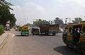 Grand Trunk Road in Uttarpradesh, India
 -

-
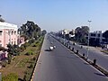
 Grand Trunk Road towards Burdwan from Hooghly.
 -
-
 GT road in Gujranwala, Pakistan.
 -
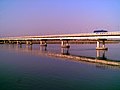 GT Road above the River Jhelum, Pakistan.
 -
-
 Newly realigned GT Road passing by the westernmost point of Margalla Hills to Kala Chitta Range, Pakistan.
 -
 Kabul–Jalalabad Road, Afghanistan, is westernmost stretch of the GT Road.
 -
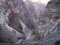 Mountain pass on the Kabul–Jalalabad Road, Afghanistan.


.jpg)

See also[edit]
- Royal Road
- Roman roads
- Via Regia
- Silk Road – ancient Sino-Indo-European route
- Via Maris (International Trunk Road) – modern name of main ancient international route between Egypt and Mesopotamia
Modern roads in Asia[edit]
- AH1, or Asian Highway 1 – the longest route of the Asian Highway Network, running from Japan to Turkey
- Asian Highway Network (AH) aka the Great Asian Highway - project to improve the highway systems in Asia
- Afghanistan
- Highway 1 (Afghanistan) – 2,200 km (1,400 mi) circular road network inside Afghanistan
- Pakistan
- National Highways of Pakistan, all government highways
- Motorways of Pakistan – network of major expressways
- India
- National highways in India – network of government-managed highways
- Expressways in India – the highest class of roads in the Indian road network
- Golden Quadrilateral – highway network connecting major centres of northern, western, southern and eastern India
- National Highways Development Project – a project to upgrade and widen major highways in India
- National Highways Authority of India
Notes[edit]
References[edit]
- ^ a b c d "Sites along the Uttarapath, Badshahi Sadak, Sadak-e-Azam, Grand Trunk Road". UNESCO World Heritage Centre. Retrieved 26 December 2018.
- ^ a b The Atlantic: "India's Grand Trunk Road"
- ^ UNESCO, Caravanserais along the Grand Trunk Road in Pakistan
- ^ Steel, Tim (1 January 2015). "A road to empires". Dhaka Tribune. Retrieved 19 July 2016.
- ^ Jhimli Mukherjee Pandey (15 September 2015). "Cuisine along G T Road". The Times of India. Calcutta. Retrieved 19 July 2016.
- ^ Khanna, Parag. "How to Redraw the World Map". The New York Times. ISSN 0362-4331. Retrieved 19 July 2016.
- ^ a b c d e Vadime Elisseeff, p. 159-162, The Silk Roads: Highways of Culture and Commerce
- ^ Farooqui Salma Ahmed, p. 234, A Comprehensive History of Medieval India: From Twelfth to the Mid-Eighteenth Century
- ^ a b K. M. Sarkar (1927). The Grand Trunk Road in the Punjab: 1849-1886. Atlantic Publishers & Distri. pp. 2–. GGKEY:GQWKH1K79D6.
- ^ David Arnold (historian); Science, technology, and medicine in colonial India (New Cambr hist India v.III.5) Cambridge University Press, 2000, 234 pages p. 106
- ^ Singh, Raghubir (1995). The Grand Trunk Road: A Passage Through India (First ed.). Aperture Books. ISBN 9780893816445.
- ^ Sanjeev, Sanyal (15 November 2012). Land of the Seven Rivers: A Brief History of India's Geography. Penguin Random House India Private Limited. pp. 72–73, 103. ISBN 9788184756715.
- ^ Benjamin Walker, p. 69, Hindu World: An Encyclopedic Survey of Hinduism. In Two Volumes. Volume II M-Z
- ^ "Grand Trunk Road since Pre Mahabharata Times; Here are Evidences". 20 April 2020.
- ^ "Grand Trunk Road: Uttarapatha, The Silk Route of India". 26 August 2021.
- ^ Romila Thapar (2002). Early India: From the Origins to AD 1300. University of California Press. p. 263. ISBN 0-520-23899-0.
The Mauryas had built a Royal Highway from Taxila to Pataliputra, a road that was almost continuously rebuilt in some approximation to the original during the period of Sher Shah, the Mughals and the British. The British referred to it as the Grand Trunk Road.
- ^ Anu Kapur, p. 84, Mapping Place Names of India
- ^ A description of the road by Kipling, found both in his letters and in the novel Kim.
- ^ NuNu BJP on a strong footing in northern districts, Hindustan Times, 30 March 2016.
- ^ Haryana assembly elections: BJP counts on strategy, Times of India, 6 October 2019.
External links[edit]
- Farooque, Abdul Khair Muhammad (1977), Roads and Communications in Mughal India. Delhi: Idarah-i Adabiyat-i Delli.
- Weller, Anthony (1997), Days and Nights on the Grand Trunk Road: Calcutta to Khyber. Marlowe & Company.
- Kipling, Rudyard (1901), Kim. Considered one of Kipling's finest works, it is set mostly along the Grand Trunk Road. Free e-texts are available, for instance here.
- Usha Masson Luther; Moonis Raza (1990). Historical routes of north west Indian Subcontinent, Lahore to Delhi, 1550s–1850s A.D. Sagar Publications.
- Arden, Harvey (May 1990). "Along the Grand Trunk Road". National Geographic. 177 (5): 118–38.
- Mozammel, Md Muktadir Arif (2012). "Grand Trunk Road". In Islam, Sirajul; Jamal, Ahmed A. (eds.). Banglapedia: National Encyclopedia of Bangladesh (Second ed.). Asiatic Society of Bangladesh.
- Tayler, Jeffrey (November 1999). "India's Grand Trunk Road". The Atlantic Monthly. 284 (5): 42–48.
- National Highway Authority of India
- National Highway Authority of Pakistan
- NPR: Along the Grand Trunk Road


| International | |
|---|---|
| National | |
- AH1
- Roads in Asia
- Roads in Afghanistan
- Roads in Bangladesh
- Roads in Pakistan
- Ancient roads and tracks
- Trade routes
- Maurya Empire
- Sur Empire
- British India
- History of transport in India
- History of transport in Pakistan
- Roads in Delhi
- Roads in Khyber Pakhtunkhwa
- Roads in Punjab, India
- Roads in Punjab, Pakistan
- Roads in Uttar Pradesh
- Roads in West Bengal
- Rail transport in Howrah
- Transport in Kabul
- Transport in Lahore
- Historic trails and roads in India
- History of transport in Uttar Pradesh