
Gove Township, Gove County, Kansas
Gove Township | |
|---|---|
 Location in Gove County | |
| Coordinates: 38°56′15″N 100°31′41″W / 38.93750°N 100.52806°W | |
| Country | United States |
| State | Kansas |
| County | Gove |
| Area | |
| • Total | 116.28 sq mi (301.17 km2) |
| • Land | 116.28 sq mi (301.17 km2) |
| • Water | 0 sq mi (0 km2) 0% |
| Elevation | 2,779 ft (847 m) |
| Population (2000) | |
| • Total | 215 |
| • Density | 1.8/sq mi (0.7/km2) |
| GNIS feature ID | 0471377 |
Gove Township is a township in Gove County, Kansas, USA. As of the 2000 census, its population was 215.
Geography[edit]
Gove Township covers an area of 116.28 square miles (301.2 km2) and contains one incorporated settlement, Gove City (the county seat). According to the USGS, it contains one cemetery, Gove.
The streams of Middle Branch Hackberry Creek, North Branch Hackberry Creek, South Branch Hackberry Creek and West Spring Creek run through this township.
References[edit]
External links[edit]
Municipalities and communities of Gove County, Kansas, United States | ||
|---|---|---|
| Cities | 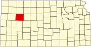 | |
| Ghost towns | ||
| Townships | ||
| Footnotes | ‡This community also has portions in an adjacent county or counties. | |
This article about a location in Gove County, Kansas is a stub. You can help Wikipedia by expanding it. |