
Gatesville, North Carolina
Gatesville, North Carolina | |
|---|---|
 Buildings along Court Street | |
 Location of Gatesville, North Carolina | |
| Coordinates: 36°24′26″N 76°45′24″W / 36.40722°N 76.75667°W | |
| Country | United States |
| State | North Carolina |
| County | Gates |
| Founded | 1779 |
| Incorporated | 1830 |
| Named for | Horatio Gates[1] |
| Area | |
| • Total | 0.40 sq mi (1.05 km2) |
| • Land | 0.40 sq mi (1.05 km2) |
| • Water | 0.00 sq mi (0.00 km2) |
| Elevation | 23 ft (7 m) |
| Population (2020) | |
| • Total | 267 |
| • Density | 660.89/sq mi (255.31/km2) |
| Time zone | UTC-5 (Eastern (EST)) |
| • Summer (DST) | UTC-4 (EDT) |
| ZIP code | 27938 |
| Area code | 252 |
| FIPS code | 37-25680[4] |
| GNIS feature ID | 2406552[3] |
Gatesville is a town in Gates County, North Carolina, United States.[3] The population was 321 at the 2010 census. It is the county seat of Gates County.[5]
History[edit]
The area which presently encompasses Gatesville was originally known as Bennetts Creek Landing. From 1779 it was known as Gates Courthouse until its incorporation in 1830 as Gatesville,[6] being named for Horatio Gates, a commander in the American Revolutionary War.[7]
The Elmwood Plantation, Eure-Roberts House, Gates County Courthouse, Roberts-Carter House, Rountree Family Farm and Reid's Grove School are listed on the National Register of Historic Places.[8][9]
Geography[edit]
According to the United States Census Bureau, the town has a total area of 0.4 square miles (1.0 km2), all land.
Demographics[edit]
| Census | Pop. | Note | %± |
|---|---|---|---|
| 1870 | 156 | — | |
| 1880 | 187 | 19.9% | |
| 1890 | 232 | 24.1% | |
| 1900 | 200 | −13.8% | |
| 1910 | 203 | 1.5% | |
| 1930 | 320 | — | |
| 1940 | 297 | −7.2% | |
| 1950 | 323 | 8.8% | |
| 1960 | 460 | 42.4% | |
| 1970 | 338 | −26.5% | |
| 1980 | 363 | 7.4% | |
| 1990 | 308 | −15.2% | |
| 2000 | 281 | −8.8% | |
| 2010 | 321 | 14.2% | |
| 2020 | 267 | −16.8% | |
| U.S. Decennial Census[10] | |||
2020 census[edit]
| Race | Number | Percentage |
|---|---|---|
| White (non-Hispanic) | 230 | 86.14% |
| Black or African American (non-Hispanic) | 28 | 10.49% |
| Native American | 2 | 0.75% |
| Other/Mixed | 5 | 1.87% |
| Hispanic or Latino | 2 | 0.75% |
As of the 2020 United States census, there were 267 people, 120 households, and 71 families residing in the town.
2000 census[edit]
As of the census[4] of 2000, there were 281 people, 117 households, and 80 families residing in the town. The population density was 675.8 inhabitants per square mile (260.9/km2). There were 142 housing units at an average density of 341.5 per square mile (131.9/km2). The racial makeup of the town was 87.54% White, 11.03% African American, 0.36% Native American, and 1.07% from two or more races. Hispanic or Latino of any race were 0.36% of the population.
There were 117 households, out of which 29.9% had children under the age of 18 living with them, 59.0% were married couples living together, 7.7% had a female householder with no husband present, and 30.8% were non-families. 29.1% of all households were made up of individuals, and 17.9% had someone living alone who was 65 years of age or older. The average household size was 2.40 and the average family size was 3.00.
In the town, the population was spread out, with 25.3% under the age of 18, 5.3% from 18 to 24, 24.6% from 25 to 44, 24.2% from 45 to 64, and 20.6% who were 65 years of age or older. The median age was 41 years. For every 100 females there were 82.5 males. For every 100 females age 18 and over, there were 85.8 males.
The median income for a household in the town was $49,375, and the median income for a family was $62,500. Males had a median income of $40,625 versus $27,500 for females. The per capita income for the town was $18,190. About 2.8% of families and 3.9% of the population were below the poverty line, including 5.4% of those under the age of eighteen and 9.8% of those 65 or over.
Notable people[edit]
- Jessie Britt (born 1963), football player
- Calvin Earl (born 1952), performer & educator of the African American Spirituals.
- Charles Walter Greene (1849–1926), educator
- John M. Harrell (1828–1907), lawyer and writer
- L. Glenn Perry (1944–1998), former Chief Accountant of the United States Securities and Exchange Commission
- Floyd Millard Riddick (1908–2000), senior civil servant
- Herman Riddick (1907–1968), football player and coach
- William Paul Roberts (1841–1910), politician and diplomat
- Thomas Smith (born 1970), football player
- Delmar T. Spivey (1905–1982), military officer
- Andrew Jackson Stedman (1828–1884), publisher
- Hallett Sydney Ward (1870–1956), Congressman
References[edit]
- ^ "North Carolina Gazetteer". Retrieved November 25, 2023.
- ^ "ArcGIS REST Services Directory". United States Census Bureau. Retrieved September 20, 2022.
- ^ a b c U.S. Geological Survey Geographic Names Information System: Gatesville, North Carolina
- ^ a b "U.S. Census website". United States Census Bureau. Retrieved 2008-01-31.
- ^ "Find a County". National Association of Counties. Archived from the original on 2011-05-31. Retrieved 2011-06-07.
- ^ Powell, William S. (1976). The North Carolina Gazetteer: A Dictionary of Tar Heel Places. Chapel Hill: The University of North Carolina Press. p. 188. ISBN 9780807812471.
- ^ Gannett, Henry (1905). The Origin of Certain Place Names in the United States. Govt. Print. Off. pp. 135.
- ^ "National Register Information System". National Register of Historic Places. National Park Service. July 9, 2010.
- ^ "National Register of Historic Places Listings". Weekly List of Actions Taken on Properties: 8/29/11 through 9/02/11. National Park Service. 2011-09-09.
- ^ "Census of Population and Housing". Census.gov. Retrieved June 4, 2015.
- ^ "Explore Census Data". data.census.gov. Retrieved 2021-12-22.
Municipalities and communities of Gates County, North Carolina, United States | ||
|---|---|---|
| Town | 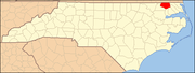 | |
| CDP | ||
| Unincorporated communities | ||