
Gaeland Township, Gove County, Kansas
Gaeland Township | |
|---|---|
 Location in Gove County | |
| Coordinates: 38°56′21″N 100°43′55″W / 38.93917°N 100.73194°W | |
| Country | United States |
| State | Kansas |
| County | Gove |
| Area | |
| • Total | 80.37 sq mi (208.15 km2) |
| • Land | 80.37 sq mi (208.15 km2) |
| • Water | 0 sq mi (0 km2) 0% |
| Elevation | 2,943 ft (897 m) |
| Population (2000) | |
| • Total | 46 |
| • Density | 0.6/sq mi (0.2/km2) |
| GNIS feature ID | 0471376 |
Gaeland Township is a township in Gove County, Kansas, USA. As of the 2000 census, its population was 46.
Geography[edit]
Gaeland Township covers an area of 80.37 square miles (208.2 km2) and contains no incorporated settlements.
Transportation[edit]
Gaeland Township contains two airports or landing strips: Evans Airport and Stevenson Airport.
References[edit]
External links[edit]
Municipalities and communities of Gove County, Kansas, United States | ||
|---|---|---|
| Cities | 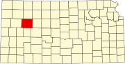 | |
| Ghost towns | ||
| Townships | ||
| Footnotes | ‡This community also has portions in an adjacent county or counties. | |
This article about a location in Gove County, Kansas is a stub. You can help Wikipedia by expanding it. |