
Flatwillow, Montana
Flatwillow | |
|---|---|
 Flatwillow Location within the state of Montana | |
| Coordinates: 46°49′55″N 108°24′0″W / 46.83194°N 108.40000°W | |
| Country | United States |
| State | Montana |
| County | Petroleum |
| Elevation | 3,225 ft (983 m) |
| Time zone | UTC-7 (Mountain (MST)) |
| • Summer (DST) | UTC-6 (MDT) |
| GNIS feature ID | 771461[1] |
Flatwillow (also Flatwillow Crossing) is a former unincorporated town in southern Petroleum County, Montana, United States. All buildings of the town are now gone, and the land is now privately owned farmland.
History[edit]
Flatwillow lay along local roads south of the town of Winnett, the county seat of Petroleum County.[2] at an elevation of 3,225 feet (983 m).[1] Flatwillow's post office first opened on March 27, 1883 and closed on April 15, 1907, only to be reopened on August 1, 1908. The post office was again closed on April 30, 1946.[3]
Climate[edit]
Flatwillow has a cold semi-arid climate (BSk). Winter is cold, dry and variable. It can alternate between periods of extreme cold and milder stretches with days well above freezing. The average annual minimum is -26, placing it in hardiness zone 4A. Lows fall below 0 on 20 days per year while highs stay below 0 on 2 days a year. Spring comes quickly in March but still gets snow as late as May. This is the wettest time of year with frequent showers and thunderstorms. Summer is hot and dry with chilly nights. Days pass 90 on 35 days/year and 100 on just over 3. However, there is still a decent amount of cool days and nights are pleasantly cool. Fall comes rapidly with snow possible in September.
The freeze-free season ranges from May 24 to September 23. The coldest temperature was -48 (-44.4 C) on December 18, 1924 while the record high is 108 (42.2 C), most recently on July 22, 1963. The most snow in one season is at least 83.0” in 2017–2018. Snowfall in April and May has not been counted yet, so that number will be gene higher. The least snow in a season was 7.3” in 1915–1916.
| Climate data for Flatwillow 4ENE 1981-2010, extremes 1913-2018 | |||||||||||||
|---|---|---|---|---|---|---|---|---|---|---|---|---|---|
| Month | Jan | Feb | Mar | Apr | May | Jun | Jul | Aug | Sep | Oct | Nov | Dec | Year |
| Record high °F (°C) | 72 (22) |
76 (24) |
80 (27) |
91 (33) |
98 (37) |
107 (42) |
108 (42) |
108 (42) |
104 (40) |
94 (34) |
81 (27) |
70 (21) |
108 (42) |
| Mean daily maximum °F (°C) | 38.2 (3.4) |
41.7 (5.4) |
50.4 (10.2) |
60.9 (16.1) |
69.9 (21.1) |
78.0 (25.6) |
87.4 (30.8) |
87.2 (30.7) |
75.6 (24.2) |
62.5 (16.9) |
47.6 (8.7) |
37.6 (3.1) |
61.4 (16.3) |
| Mean daily minimum °F (°C) | 13.0 (−10.6) |
15.5 (−9.2) |
23.4 (−4.8) |
30.8 (−0.7) |
39.6 (4.2) |
48.3 (9.1) |
53.6 (12.0) |
52.3 (11.3) |
42.9 (6.1) |
33.2 (0.7) |
21.9 (−5.6) |
12.3 (−10.9) |
32.2 (0.1) |
| Record low °F (°C) | −42 (−41) |
−46 (−43) |
−30 (−34) |
−14 (−26) |
8 (−13) |
27 (−3) |
34 (1) |
30 (−1) |
8 (−13) |
−18 (−28) |
−29 (−34) |
−48 (−44) |
−48 (−44) |
| Average precipitation inches (mm) | 0.39 (9.9) |
0.33 (8.4) |
0.68 (17) |
1.26 (32) |
2.57 (65) |
2.50 (64) |
1.34 (34) |
1.06 (27) |
0.96 (24) |
0.96 (24) |
0.44 (11) |
0.69 (18) |
13.18 (334.3) |
| Average snowfall inches (cm) | 7.3 (19) |
5.8 (15) |
7.0 (18) |
4.0 (10) |
0.8 (2.0) |
— | 0 (0) |
0 (0) |
0.5 (1.3) |
2.8 (7.1) |
4.5 (11) |
7.4 (19) |
40.1 (102) |
| Average precipitation days (≥ 0.04 in) | 3.5 | 2.9 | 5.0 | 5.9 | 8.8 | 8.6 | 5.3 | 4.6 | 4.3 | 4.5 | 2.9 | 3.6 | 59.9 |
| Average snowy days (≥ 0.4 in) | 5 | 4 | 4 | 2 | .3 | 0 | 0 | 0 | .1 | 1 | 3 | 4 | 23.4 |
| Source: NWS NOWDATA for Flatwillow 4ENE from the NWS Glasgow Area | |||||||||||||
References[edit]
- ^ a b "Flatwillow, Montana". Geographic Names Information System. United States Geological Survey, United States Department of the Interior.
- ^ Rand McNally. The Road Atlas '08. Chicago: Rand McNally, 2008, p. 61,
- ^ U.S. Geological Survey Geographic Names Information System: Flatwillow Post Office
Municipalities and communities of Petroleum County, Montana, United States | ||
|---|---|---|
| Town | 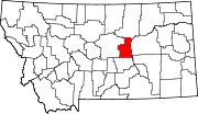 | |
| Unincorporated communities | ||
| International | |
|---|---|
| National | |
This Petroleum County, Montana state location article is a stub. You can help Wikipedia by expanding it. |