
File:WIMap-doton-The Holyland.png
No higher resolution available.
WIMap-doton-The_Holyland.png (292 × 310 pixels, file size: 15 KB, MIME type: image/png)
| This is a file from the Wikimedia Commons. Information from its description page there is shown below. Commons is a freely licensed media file repository. You can help. |
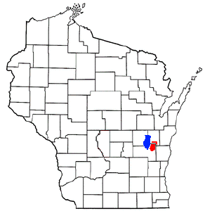
| Description | Adapted from Wikipedia's WI county maps by Bumm13. The red area shows the location of w:The Holyland (Wisconsin) and blue shows w:Lake Winnebago. |
| Date | (UTC) |
| Source | |
| Author |
|
| This is a retouched picture, which means that it has been digitally altered from its original version. Modifications: Added red area to describe w:The Holyland (Wisconsin) region, blue for w:Lake Winnebago. The original can be viewed here: WIMap-doton-Mount Calvary.png:
|
I, the copyright holder of this work, hereby publish it under the following license:
| This file is licensed under the Creative Commons Attribution-Share Alike 3.0 Unported license. Subject to disclaimers. | ||
| ||
| This licensing tag was added to this file as part of the GFDL licensing update. |

|
Permission is granted to copy, distribute and/or modify this document under the terms of the GNU Free Documentation License, Version 1.2 or any later version published by the Free Software Foundation; with no Invariant Sections, no Front-Cover Texts, and no Back-Cover Texts. A copy of the license is included in the section entitled GNU Free Documentation License. Subject to disclaimers. |
Original upload log
This image is a derivative work of the following images:
- Image:WIMap-doton-Mount_Calvary.png licensed with GFDL-en
- 2007-07-13T20:13:20Z SieBot 292x310 (26256 Bytes) {{Information |Description=Adapted from Wikipedia's WI county maps by Bumm13. |Source=Originally from [http://en.wikipedia.org en.wikipedia]; description page is/was [http://en.wikipedia.org/w/index.php?title=Image%3AWIMap-d
Uploaded with derivativeFX
File history
Click on a date/time to view the file as it appeared at that time.
| Date/Time | Thumbnail | Dimensions | User | Comment | |
|---|---|---|---|---|---|
| current | 04:51, 15 September 2008 | | 292 × 310 (15 KB) | Royalbroil | {{Information |Description=Adapted from Wikipedia's WI county maps by Bumm13. The red area shows the location of w:The Holyland (Wisconsin) and blue shows w:Lake Winnebago. |Source=*Image:WIMap-doton-Mount_Calvary.png |Date=2008-09-15 04:49 |
File usage
The following pages on the English Wikipedia use this file (pages on other projects are not listed):