
File:Vernal Regional Airport.jpg
Size of this preview: 368 × 599 pixels. Other resolutions: 147 × 240 pixels | 294 × 480 pixels | 471 × 768 pixels | 628 × 1,024 pixels | 1,515 × 2,468 pixels.
Original file (1,515 × 2,468 pixels, file size: 1.12 MB, MIME type: image/jpeg)
| This is a file from the Wikimedia Commons. Information from its description page there is shown below. Commons is a freely licensed media file repository. You can help. |
Summary
| Description | |
| Date | |
| Source |
USGS The National Map, via MSR Maps (formerly TerraServer-USA) |
| Author | United States Geological Survey (USGS) |
| Permission (Reusing this file) |
Public domain |
Licensing
This image is in the public domain in the United States because it only contains materials that originally came from the United States Geological Survey, an agency of the United States Department of the Interior. For more information, see the official USGS copyright policy.
|
File history
Click on a date/time to view the file as it appeared at that time.
| Date/Time | Thumbnail | Dimensions | User | Comment | |
|---|---|---|---|---|---|
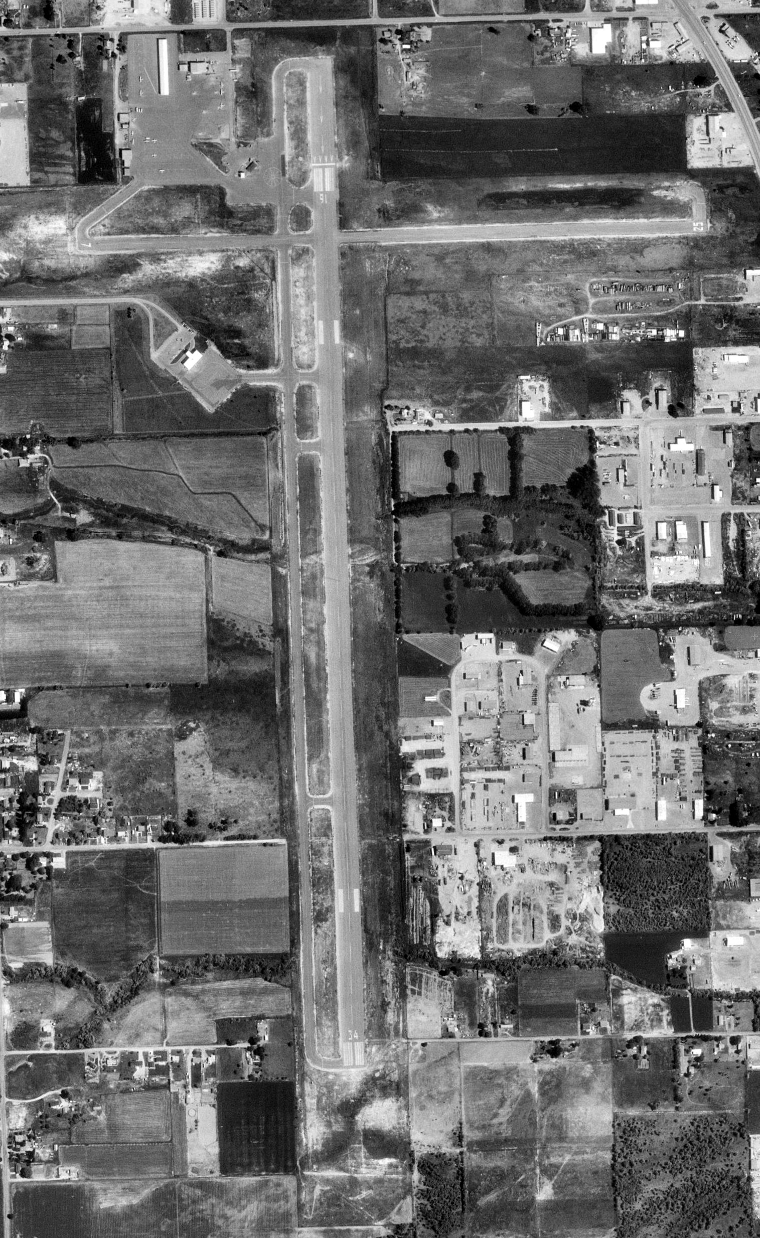
| current | 03:04, 12 June 2009 | | 1,515 × 2,468 (1.12 MB) | AuburnPilot | == Summary == {{Information |Description=Satellite image of Vernal Regional Airport in Vernal, Utah on 4 July 1997 |Source=United States Geological Survey, TerraServer-USA |Date=1997-07-04 |Author=USGS |Permission=Public dom |
File usage
The following pages on the English Wikipedia use this file (pages on other projects are not listed):
Global file usage
The following other wikis use this file:
- Usage on arz.wikipedia.org
- Usage on ceb.wikipedia.org
- Usage on fa.wikipedia.org
- Usage on fy.wikipedia.org
- Usage on tg.wikipedia.org
- Usage on ur.wikipedia.org
- Usage on www.wikidata.org