
File:Urritiamapoftubac.jpg

Size of this preview: 784 × 600 pixels. Other resolutions: 314 × 240 pixels | 628 × 480 pixels | 1,004 × 768 pixels | 1,280 × 979 pixels | 2,560 × 1,958 pixels | 3,036 × 2,322 pixels.
Original file (3,036 × 2,322 pixels, file size: 4.7 MB, MIME type: image/jpeg)
| This is a file from the Wikimedia Commons. Information from its description page there is shown below. Commons is a freely licensed media file repository. You can help. |
| Description |
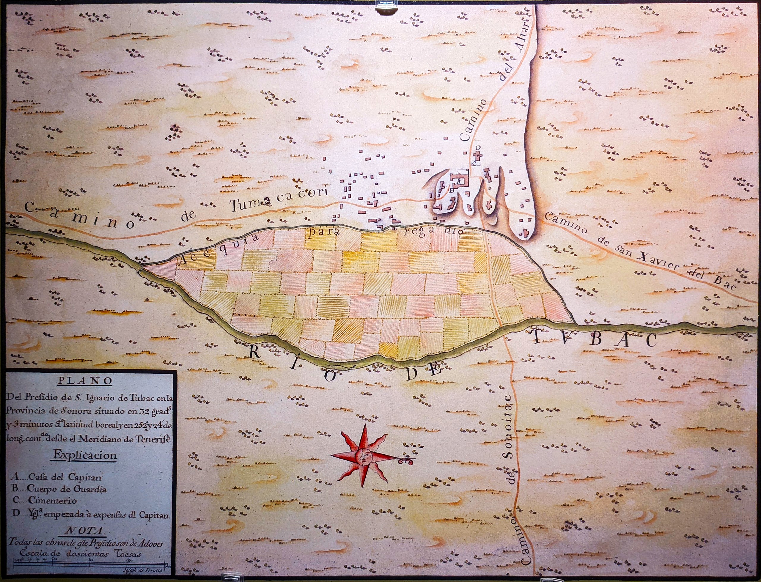
Urrutia Map of Tubac: December 1766—January 1767
|
||
| Date | 18th century, 1760s | ||
| Source | [1] (University of Arizona) | ||
| Author | Unknown author | ||
| Permission (Reusing this file) |
|
||
| Other versions |
![[1]](http://parentseyes.arizona.edu/tubac/images/urritiamapoftubac_600.jpg)
File history
Click on a date/time to view the file as it appeared at that time.
| Date/Time | Thumbnail | Dimensions | User | Comment | |
|---|---|---|---|---|---|
| current | 19:24, 12 June 2022 | | 3,036 × 2,322 (4.7 MB) | Hallpatt | Better quality. Photo taken at Tubac museum by Canon SL2 |
| 07:31, 28 November 2007 |  | 600 × 470 (58 KB) | Dominic | {{Information |Description=''Urrutia Map of Tubac: December 1766-January 1767''; an early Spanish colonial map of the present-day w:Tubac, Arizona, and location of the San Ignacio de Tubac Presidio. |Source= [http://parentseyes.arizona.edu/tubac/image |
File usage
The following pages on the English Wikipedia use this file (pages on other projects are not listed):
Global file usage
The following other wikis use this file:
- Usage on azb.wikipedia.org
- Usage on es.wikipedia.org
- Usage on fa.wikipedia.org
- Usage on fr.wikipedia.org