
File:Ukraine (1991-2014) location map.svg

Size of this PNG preview of this SVG file: 800 × 537 pixels. Other resolutions: 320 × 215 pixels | 640 × 430 pixels | 1,024 × 688 pixels | 1,280 × 859 pixels | 2,560 × 1,719 pixels | 1,546 × 1,038 pixels.
Original file (SVG file, nominally 1,546 × 1,038 pixels, file size: 477 KB)
| This is a file from the Wikimedia Commons. Information from its description page there is shown below. Commons is a freely licensed media file repository. You can help. |
Summary
| Description |
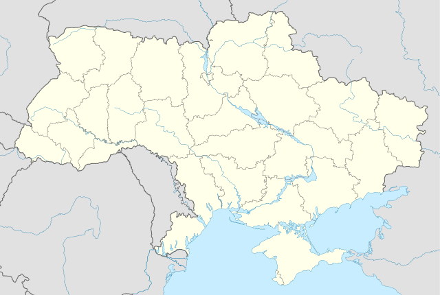
Deutsch: Positionskarte der Ukraine} (1991–2014)
Quadratische Plattkarte, N-S-Streckung 150 %. Geographische Begrenzung der Karte:
English: Location map of Ukraine (1991–2014)
Equirectangular projection, N/S stretching 150 %. Geographic limits of the map:
Français : Carte de localisation de l'Ukraine (1991–2014)
|
||
| Date | |||
| Source |
Own work using:
|
||
| Author | NordNordWest | ||
| Other versions |
|
||
| SVG development | This locator map was created with Inkscape by NordNordWest. and with Adobe.
|


_location_map.svg)
Licensing
I, the copyright holder of this work, hereby publish it under the following licenses:

|
Permission is granted to copy, distribute and/or modify this document under the terms of the GNU Free Documentation License, Version 1.2 or any later version published by the Free Software Foundation; with no Invariant Sections, no Front-Cover Texts, and no Back-Cover Texts. A copy of the license is included in the section entitled GNU Free Documentation License. |
This file is licensed under the Creative Commons Attribution-Share Alike 3.0 Unported license.
- You are free:
- to share – to copy, distribute and transmit the work
- to remix – to adapt the work
- Under the following conditions:
- attribution – You must give appropriate credit, provide a link to the license, and indicate if changes were made. You may do so in any reasonable manner, but not in any way that suggests the licensor endorses you or your use.
- share alike – If you remix, transform, or build upon the material, you must distribute your contributions under the same or compatible license as the original.
You may select the license of your choice.
File history
Click on a date/time to view the file as it appeared at that time.
| Date/Time | Thumbnail | Dimensions | User | Comment | |
|---|---|---|---|---|---|
| current | 17:14, 15 April 2024 | | 1,546 × 1,038 (477 KB) | NordNordWest | + rivers |
| 05:36, 30 January 2015 |  | 1,546 × 1,038 (435 KB) | Leftcry | Border fix | |
| 16:27, 21 March 2014 |  | 1,546 × 1,038 (429 KB) | NordNordWest | == {{int:filedesc}} == {{Information |Description= {{de|Positionskarte der Ukraine} (1991–2014)}} Quadratische Plattkarte, N-S-Streckung 150 %. Geographische Begrenzung der Karte: * N: 52.7° N * S: 44.1° N * W: 21.5° O * O: 40.7°... |
File usage
More than 100 pages use this file. The following list shows the first 100 pages that use this file only. A full list is available.
_location_map.svg)
- 1964 KFK competitions (Ukraine)
- 1986 Soviet Second League, Zone 6
- 1987 Soviet Second League, Zone 6
- 1988 Soviet Second League, Zone 6
- 1989 Soviet Second League, Zone 6
- 1990 Soviet Lower Second League, Zone 1
- 1991 Soviet Lower Second League, Zone 1
- 1992 Ukrainian First League
- 1992 Ukrainian Transitional League
- 1992 Vyshcha Liha
- 1992–93 Ukrainian First League
- 1992–93 Ukrainian Football Amateur League
- 1992–93 Ukrainian Second League
- 1992–93 Ukrainian Transitional League
- 1992–93 Vyshcha Liha
- 1993–94 Ukrainian First League
- 1993–94 Ukrainian Football Amateur League
- 1993–94 Ukrainian Second League
- 1993–94 Vyshcha Liha
- 1994–95 Ukrainian First League
- 1994–95 Ukrainian Football Amateur League
- 1994–95 Ukrainian Second League
- 1994–95 Vyshcha Liha
- 1995–96 Ukrainian First League
- 1995–96 Ukrainian Football Amateur League
- 1995–96 Ukrainian Second League
- 1995–96 Vyshcha Liha
- 1996–97 Ukrainian First League
- 1996–97 Ukrainian Football Amateur League
- 1996–97 Ukrainian Second League
- 1996–97 Vyshcha Liha
- 1997–98 Ukrainian First League
- 1997–98 Ukrainian Football Amateur League
- 1997–98 Ukrainian Second League
- 1997–98 Vyshcha Liha
- 1998–99 Ukrainian First League
- 1998–99 Ukrainian Football Amateur League
- 1998–99 Ukrainian Second League
- 1998–99 Vyshcha Liha
- 1999 Ukrainian Football Amateur League
- 1999–2000 Ukrainian First League
- 1999–2000 Ukrainian Second League
- 1999–2000 Vyshcha Liha
- 2000 Ukrainian Football Amateur League
- 2000–01 Ukrainian First League
- 2000–01 Ukrainian Second League
- 2000–01 Vyshcha Liha
- 2001 Ukrainian Football Amateur League
- 2001–02 Ukrainian First League
- 2001–02 Ukrainian Second League
- 2001–02 Vyshcha Liha
- 2002 Ukrainian Football Amateur League
- 2002–03 Ukrainian First League
- 2002–03 Ukrainian Second League
- 2002–03 Vyshcha Liha
- 2003 Ukrainian Football Amateur League
- 2003–04 Ukrainian First League
- 2003–04 Ukrainian Second League
- 2003–04 Vyshcha Liha
- 2004 Ukrainian Football Amateur League
- 2004–05 Ukrainian First League
- 2004–05 Ukrainian Second League
- 2004–05 Vyshcha Liha
- 2005 Ukrainian Football Amateur League
- 2005–06 Ukrainian First League
- 2005–06 Ukrainian Second League
- 2005–06 Vyshcha Liha
- 2006 Ukrainian Football Amateur League
- 2006–07 Ukrainian First League
- 2006–07 Ukrainian Second League
- 2006–07 Vyshcha Liha
- 2007 Ukrainian Football Amateur League
- 2007–08 Ukrainian First League
- 2007–08 Ukrainian Second League
- 2007–08 Vyshcha Liha
- 2008 Ukrainian Football Amateur League
- 2008–09 Ukrainian First League
- 2008–09 Ukrainian Premier League
- 2008–09 Ukrainian Second League
- 2009 Ukrainian Football Amateur League
- 2009–10 Ukrainian First League
- 2009–10 Ukrainian Premier League
- 2009–10 Ukrainian Second League
- 2010 Ukrainian Football Amateur League
- 2010–11 Ukrainian First League
- 2010–11 Ukrainian Premier League
- 2010–11 Ukrainian Second League
- 2011 Ukrainian Football Amateur League
- 2011–12 Ukrainian First League
- 2011–12 Ukrainian Premier League
- 2011–12 Ukrainian Second League
- 2012 Ukrainian Football Amateur League
- 2012–13 Ukrainian First League
- 2012–13 Ukrainian Premier League
- 2012–13 Ukrainian Second League
- 2013 Ukrainian Football Amateur League
- 2013–14 Ukrainian First League
- 2013–14 Ukrainian Premier League
- 2013–14 Ukrainian Second League
- UEFA Euro 2012
View more links to this file.
Global file usage
The following other wikis use this file:
- Usage on ar.wikipedia.org
- Usage on ast.wikipedia.org
- Usage on ban.wikipedia.org
- Usage on de.wikipedia.org
- Fußball-Europameisterschaft 2012
- Vorlage:Positionskarte Ukraine
- Premjer-Liha 2008/09
- Premjer-Liha 2009/10
- Eishockey-Weltmeisterschaft der Herren 2011
- Premjer-Liha 2010/11
- Eishockey-Weltmeisterschaft der U18-Junioren 2010
- Eishockey-Weltmeisterschaft der U18-Junioren 2011
- Eishockey-Weltmeisterschaft der Herren 2013
- Eishockey-Weltmeisterschaft der U20-Junioren 2012
- Eishockey-Weltmeisterschaft der U20-Junioren 2013
- Premjer-Liha 2011/12
- Premjer-Liha 2012/13
- Premjer-Liha 2013/14
- Premjer-Liha 2014/15
- Premjer-Liha 2015/16
- Wyschtscha Liha 1992
- Wyschtscha Liha 1992/93
- Wyschtscha Liha 1993/94
- Wyschtscha Liha 1994/95
- Wyschtscha Liha 1995/96
- Wyschtscha Liha 1996/97
- Wyschtscha Liha 1997/98
- Wyschtscha Liha 1998/99
- Wyschtscha Liha 1999/2000
- Wyschtscha Liha 2000/01
- Wyschtscha Liha 2001/02
- Wyschtscha Liha 2002/03
- Wyschtscha Liha 2003/04
- Wyschtscha Liha 2004/05
- Wyschtscha Liha 2005/06
- Wyschtscha Liha 2006/07
- Wyschtscha Liha 2007/08
- Usage on es.wikipedia.org
- Usage on fa.wikipedia.org
- Usage on fr.wikipedia.org
- Usage on hu.wiktionary.org
- Usage on id.wikipedia.org
- Usage on ja.wikipedia.org
- Usage on ka.wikipedia.org
View more global usage of this file.
_location_map.svg)
_location_map.svg)