
File:USGS 1947 Rochester 250K topo cropped.png

Size of this preview: 800 × 477 pixels. Other resolutions: 320 × 191 pixels | 640 × 382 pixels | 1,130 × 674 pixels.
Original file (1,130 × 674 pixels, file size: 1.46 MB, MIME type: image/png)
| This is a file from the Wikimedia Commons. Information from its description page there is shown below. Commons is a freely licensed media file repository. You can help. |
Summary
| Description |
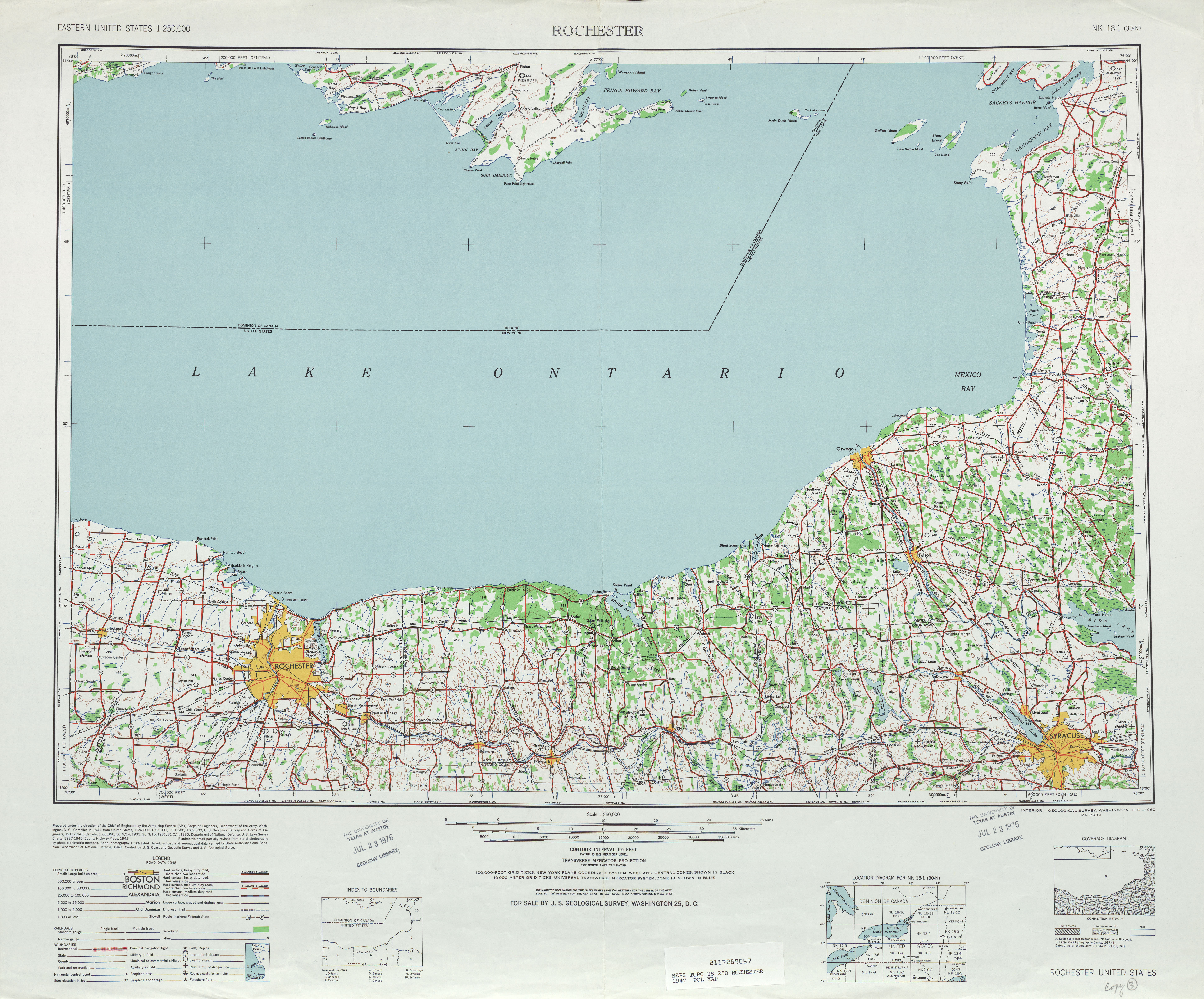
English: Cropped section of the United States Geological Survey's 1947 1:250,000 scale topographic map of Rochester, New York. This crop is intended to depict the former extension of NY 383 east of the city of Rochester, but may be useful for other situations as well. |
| Date | |
| Source | http://www.lib.utexas.edu/maps/topo/250k/txu-pclmaps-topo-us-rochester-1947.jpg |
| Author | United States Geological Survey |
Licensing
This image is in the public domain in the United States because it only contains materials that originally came from the United States Geological Survey, an agency of the United States Department of the Interior. For more information, see the official USGS copyright policy.
|
File history
Click on a date/time to view the file as it appeared at that time.
| Date/Time | Thumbnail | Dimensions | User | Comment | |
|---|---|---|---|---|---|
| current | 10:23, 27 April 2009 | | 1,130 × 674 (1.46 MB) | TwinsMetsFan | {{Information |Description={{en|1=Cropped section of the United States Geological Survey's 1947 1:250,000 scale topographic map of Rochester, New York. This crop is intended to depict the former extension of NY 383 east of the city of Rochester, but may b |
File usage
The following pages on the English Wikipedia use this file (pages on other projects are not listed):