
File:Thornaby station Down freight passing geograph-2873885-by-Ben-Brooksbank.jpg
Size of this preview: 800 × 495 pixels. Other resolutions: 320 × 198 pixels | 640 × 396 pixels | 1,024 × 634 pixels | 1,280 × 792 pixels | 2,340 × 1,448 pixels.
Original file (2,340 × 1,448 pixels, file size: 1.41 MB, MIME type: image/jpeg)
| This is a file from the Wikimedia Commons. Information from its description page there is shown below. Commons is a freely licensed media file repository. You can help. |
Summary
| Description |
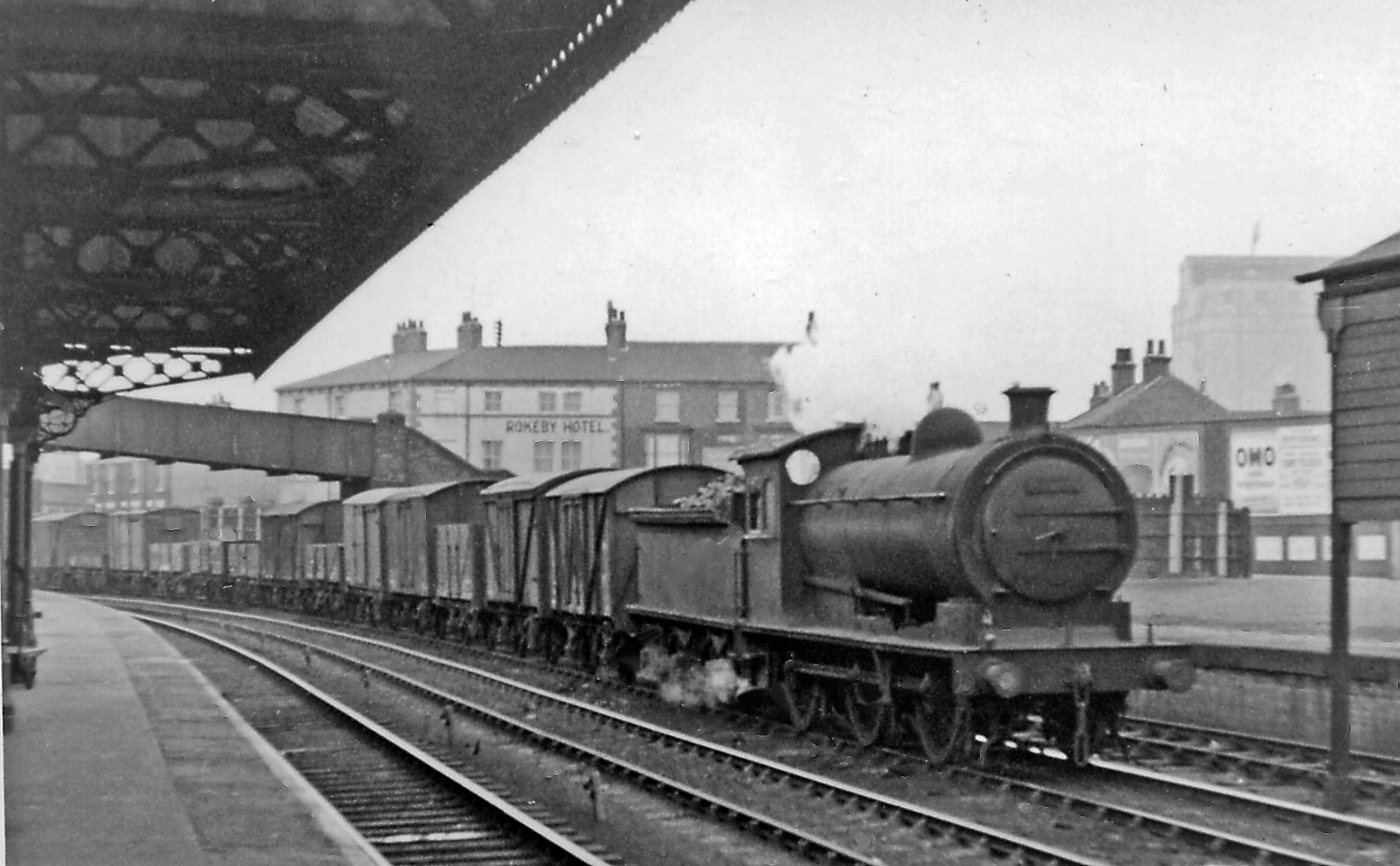
English: Down freight passing Thornaby station. View westward, towards Bowesfield Junction and the division of main lines northward to Stockton and across Co. Durham to Ferryhill, Sunderland and Newcastle by three routes, also westward to Eaglescliffe thence Darlington or Northallerton and the South: eastward from here was Newport Yard, Middlesbroug with all its great industry, then Saltburn and the Cleveland lines to Whitby etc. Therefore passing through Thornaby was a constant procession of heavy freight traffic. Here a Class J freight is headed by one of the ex-NER W. Worsdell class P2 (LNER J26) 0-6-0s concentrated in the area, No. 65774 (built as No. 525 in 10/1905, renumbered in 1946 as 5774, withdrawn 7/61). |
| Date | |
| Source | From geograph.org.uk |
| Author | Ben Brooksbank |
| Permission (Reusing this file) |
Creative Commons Attribution Share-alike license 2.0 |
| Attribution (required by the license) | Ben Brooksbank / Down freight passing Thornaby station / |
| Camera location | | View this and other nearby images on: OpenStreetMap |
|---|
Licensing

|
This image was taken from the Geograph project collection. See this photograph's page on the Geograph website for the photographer's contact details. The copyright on this image is owned by Ben Brooksbank and is licensed for reuse under the Creative Commons Attribution-ShareAlike 2.0 license.
|
This file is licensed under the Creative Commons Attribution-Share Alike 2.0 Generic license.
Attribution: Ben Brooksbank
- You are free:
- to share – to copy, distribute and transmit the work
- to remix – to adapt the work
- Under the following conditions:
- attribution – You must give appropriate credit, provide a link to the license, and indicate if changes were made. You may do so in any reasonable manner, but not in any way that suggests the licensor endorses you or your use.
- share alike – If you remix, transform, or build upon the material, you must distribute your contributions under the same or compatible license as the original.
File history
Click on a date/time to view the file as it appeared at that time.
| Date/Time | Thumbnail | Dimensions | User | Comment | |
|---|---|---|---|---|---|
| current | 12:51, 4 April 2012 | | 2,340 × 1,448 (1.41 MB) | Chevin | == {{int:filedesc}} == {{Information |Description={{en|1='''Down freight passing Thornaby station.'''<br/> View westward, towards Bowesfield Junction and the division of main lines northward to Stockton and across Co. Durham to Ferryhill, Sunderland an... |
File usage
The following pages on the English Wikipedia use this file (pages on other projects are not listed):
Global file usage
The following other wikis use this file:
- Usage on www.wikidata.org