
File:Stockport Transport Interchange (geograph 7738373).jpg

Size of this preview: 800 × 567 pixels. Other resolutions: 320 × 227 pixels | 640 × 453 pixels | 1,024 × 725 pixels | 1,280 × 907 pixels | 1,920 × 1,360 pixels.
Original file (1,920 × 1,360 pixels, file size: 1.49 MB, MIME type: image/jpeg)
| This is a file from the Wikimedia Commons. Information from its description page there is shown below. Commons is a freely licensed media file repository. You can help. |
.jpg)
Summary
| Description |
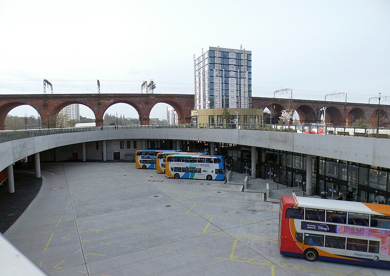
English: Looking down from Viaduct Park at the bus stands underneath. There would be a splendid view of a long length of the railway viaduct were it not for the Weir Mill development, a high rise apartment block being built on Astley Street. |
| Date | |
| Source | From geograph.org.uk |
| Author | Gerald England |
| Permission (Reusing this file) |
Creative Commons Attribution Share-alike license 2.0 |
| Attribution (required by the license) | Gerald England / Stockport Transport Interchange / |
| Camera location | | View this and other nearby images on: OpenStreetMap |
|---|
.jpg¶ms=053.408773_N_-002.162875_E_globe:Earth_type:camera_source:geograph-osgb36(SJ89279023)_heading:270.00&language=en)
| Object location | | View this and other nearby images on: OpenStreetMap |
|---|
.jpg¶ms=053.408860_N_-002.163330_E_globe:Earth_class:object_type:object_source:geograph-osgb36(SJ89249024)_heading:270.00&language=en)
Licensing

|
This image was taken from the Geograph project collection. See this photograph's page on the Geograph website for the photographer's contact details. The copyright on this image is owned by Gerald England and is licensed for reuse under the Creative Commons Attribution-ShareAlike 2.0 license.
|
This file is licensed under the Creative Commons Attribution-Share Alike 2.0 Generic license.
Attribution: Gerald England
- You are free:
- to share – to copy, distribute and transmit the work
- to remix – to adapt the work
- Under the following conditions:
- attribution – You must give appropriate credit, provide a link to the license, and indicate if changes were made. You may do so in any reasonable manner, but not in any way that suggests the licensor endorses you or your use.
- share alike – If you remix, transform, or build upon the material, you must distribute your contributions under the same or compatible license as the original.
File history
Click on a date/time to view the file as it appeared at that time.
| Date/Time | Thumbnail | Dimensions | User | Comment | |
|---|---|---|---|---|---|
| current | 07:02, 1 April 2024 | | 1,920 × 1,360 (1.49 MB) | Hullian111-Flickr2Commons | == {{int:filedesc}} == {{Information |Description={{en|1=Looking down from Viaduct Park at the bus stands underneath. There would be a splendid view of a long length of the railway viaduct were it not for the Weir Mill development, a high rise apartment block being built on Astley Street.}} |Source=From [https://www.geograph.org.uk/photo/7738373 geograph.org.uk] |Date=2024-03-26 |Author=[https://www.geograph.org.uk/profile/22742 Gerald England] |Permission=Creative Commons Attribution Share-a... |
File usage
The following pages on the English Wikipedia use this file (pages on other projects are not listed):
Global file usage
The following other wikis use this file:
- Usage on www.wikidata.org
.jpg)