
File:Silver Line service plan map, 2005.jpg

Size of this preview: 744 × 599 pixels. Other resolutions: 298 × 240 pixels | 596 × 480 pixels | 953 × 768 pixels | 1,271 × 1,024 pixels | 2,542 × 2,048 pixels | 2,933 × 2,363 pixels.
Original file (2,933 × 2,363 pixels, file size: 1.23 MB, MIME type: image/jpeg)
| This is a file from the Wikimedia Commons. Information from its description page there is shown below. Commons is a freely licensed media file repository. You can help. |
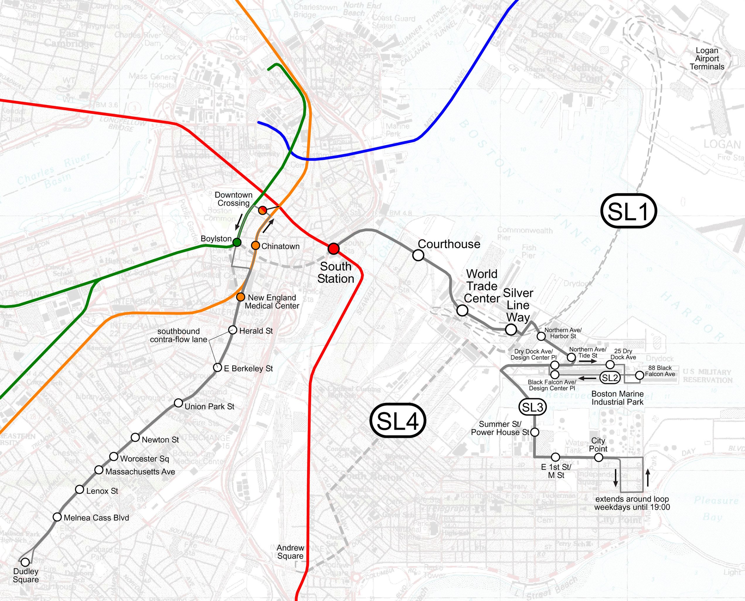
| Description | Map of Boston's Silver Line plans as of 2005. The SL3 route was discontinued in 2009; the Phase III tunnel and the SL4 service shown were never implemented. Instead, an SL4 service running on the surface to South Station was added. |
| Date | |
| Source | Own work over public-domain USGS map background |
| Author | User:SPUI |
| This work has been released into the public domain by its author, SPUI. This applies worldwide. In some countries this may not be legally possible; if so: |
File history
Click on a date/time to view the file as it appeared at that time.
| Date/Time | Thumbnail | Dimensions | User | Comment | |
|---|---|---|---|---|---|
| current | 03:45, 3 May 2005 | | 2,933 × 2,363 (1.23 MB) | SPUI~commonswiki | {{spuimap}} Boston's Silver Line (Bus Rapid Transit) category:railroad mapscategory:Boston subway |
File usage
The following pages on the English Wikipedia use this file (pages on other projects are not listed):
Global file usage
The following other wikis use this file:
- Usage on de.wikipedia.org
- Usage on fr.wikipedia.org
- Usage on sr.wikipedia.org