
File:Savoie department location map.svg

Size of this PNG preview of this SVG file: 714 × 600 pixels. Other resolutions: 286 × 240 pixels | 572 × 480 pixels | 915 × 768 pixels | 1,220 × 1,024 pixels | 2,439 × 2,048 pixels | 1,104 × 927 pixels.
Original file (SVG file, nominally 1,104 × 927 pixels, file size: 164 KB)
| This is a file from the Wikimedia Commons. Information from its description page there is shown below. Commons is a freely licensed media file repository. You can help. |
Summary
| Camera location | | View this and other nearby images on: OpenStreetMap |
|---|
| Description |
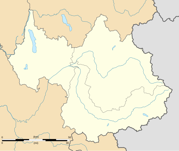
English: Blank administrative map of the department of Savoie, France, for geo-location purpose.
Scale : 1:800,000 (precision : 200 m) Français : Carte administrative vierge du département de la Savoie, France, destinée à la géolocalisation.
Échelle : 1:800 000 (précision : 200 m) Equirectangular projection, WGS84 datum
Geographic limits of the map :
|
||
| Date | |||
| Source |
Own work
|
||
| Author | Eric Gaba (Sting - fr:Sting) | ||
| Permission (Reusing this file) |
|
||
| Other versions |
Derivative works of this file: Territoires de la Savoie (CG73).PNG
|

.PNG)
Licensing
I, the copyright holder of this work, hereby publish it under the following licenses:
This file is licensed under the Creative Commons Attribution-Share Alike 3.0 Unported license.
- You are free:
- to share – to copy, distribute and transmit the work
- to remix – to adapt the work
- Under the following conditions:
- attribution – You must give appropriate credit, provide a link to the license, and indicate if changes were made. You may do so in any reasonable manner, but not in any way that suggests the licensor endorses you or your use.
- share alike – If you remix, transform, or build upon the material, you must distribute your contributions under the same or compatible license as the original.

|
Permission is granted to copy, distribute and/or modify this document under the terms of the GNU Free Documentation License, Version 1.2 or any later version published by the Free Software Foundation; with no Invariant Sections, no Front-Cover Texts, and no Back-Cover Texts. A copy of the license is included in the section entitled GNU Free Documentation License. |
You may select the license of your choice.
File history
Click on a date/time to view the file as it appeared at that time.
| Date/Time | Thumbnail | Dimensions | User | Comment | |
|---|---|---|---|---|---|
| current | 01:07, 4 September 2008 | | 1,104 × 927 (164 KB) | Sting | Color of the lakes |
| 00:19, 5 August 2008 |  | 1,104 × 927 (164 KB) | Sting | More precise boundaries | |
| 18:53, 30 July 2008 |  | 1,104 × 927 (124 KB) | Sting | + rivers ; int. boundary passing on top of Mont Blanc | |
| 18:06, 25 July 2008 |  | 1,104 × 927 (74 KB) | Sting | - border | |
| 23:40, 19 July 2008 |  | 1,104 × 927 (77 KB) | Sting | == Summary == {{Location|45|30|00|N|06|24|00|E|scale:1000000}} <br/> {{Information |Description={{en|Blank map of the department of Savoie, France, for geo-location purpose.<br/>Scale : 1:800,000 (precision : 200 m)}} {{fr|Carte vierge du d |
File usage
The following pages on the English Wikipedia use this file (pages on other projects are not listed):
- Courchevel Altiport
- Lac d'Aiguebelette
- Lac de Lessy
- Lac de Tignes
- Lac des Évettes
- Lac du Bourget
- Le Chabichou
- Molard Noir
- Vanoise National Park
- Talk:Battle of Kursk/Archive 2
- Wikipedia:WikiProject Maps/Conventions/Location maps
- Wikipedia:WikiProject Maps/Conventions/Location maps (series N)
- Wikipedia talk:WikiProject Maps/Archive 2009
- Module:Location map/data/France Savoie
- Module:Location map/data/France Savoie/doc
Global file usage
The following other wikis use this file:
- Usage on als.wikipedia.org
- Usage on ar.wikipedia.org
- Usage on ban.wikipedia.org
- Usage on bs.wikipedia.org
- Usage on ceb.wikipedia.org
- Usage on cs.wikipedia.org
- Usage on da.wikipedia.org
- Usage on de.wikipedia.org
- Usage on el.wikipedia.org
- Usage on eo.wikipedia.org
- Montmélian
- Peisey-Nancroix
- La Chapelle (Savoie)
- Frontenex
- Ŝablono:Situo sur mapo Francio Savoie
- Bourg-Saint-Maurice
- Saint-Jean-de-Maurienne
- La Motte-Servolex
- Modane
- Tignes
- Valloire
- Bourg-Saint-Maurice (stacidomo)
- Aiguebelette-le-Lac
- Aillon-le-Jeune
- Aillon-le-Vieux
- Aime-la-Plagne
- Aiton (Savoie)
- Albiez-le-Jeune
- Albiez-Montrond
- Allondaz
- Les Allues
- Apremont (Savoie)
- Arbin
- Arith
- Attignat-Oncin
- Les Avanchers-Valmorel
- Avressieux
- Avrieux
- Ayn (Savoie)
- La Balme
- Barberaz
- Barby (Savoie)
- Bassens (Savoie)
- La Bâthie
- La Bauche
- Beaufort (Savoie)
- Belmont-Tramonet
View more global usage of this file.