
File:Rubus phoenicolasius - Wineberry.jpg
Original file (3,264 × 2,448 pixels, file size: 3.64 MB, MIME type: image/jpeg)
| This is a file from the Wikimedia Commons. Information from its description page there is shown below. Commons is a freely licensed media file repository. You can help. |
Summary
| Description |
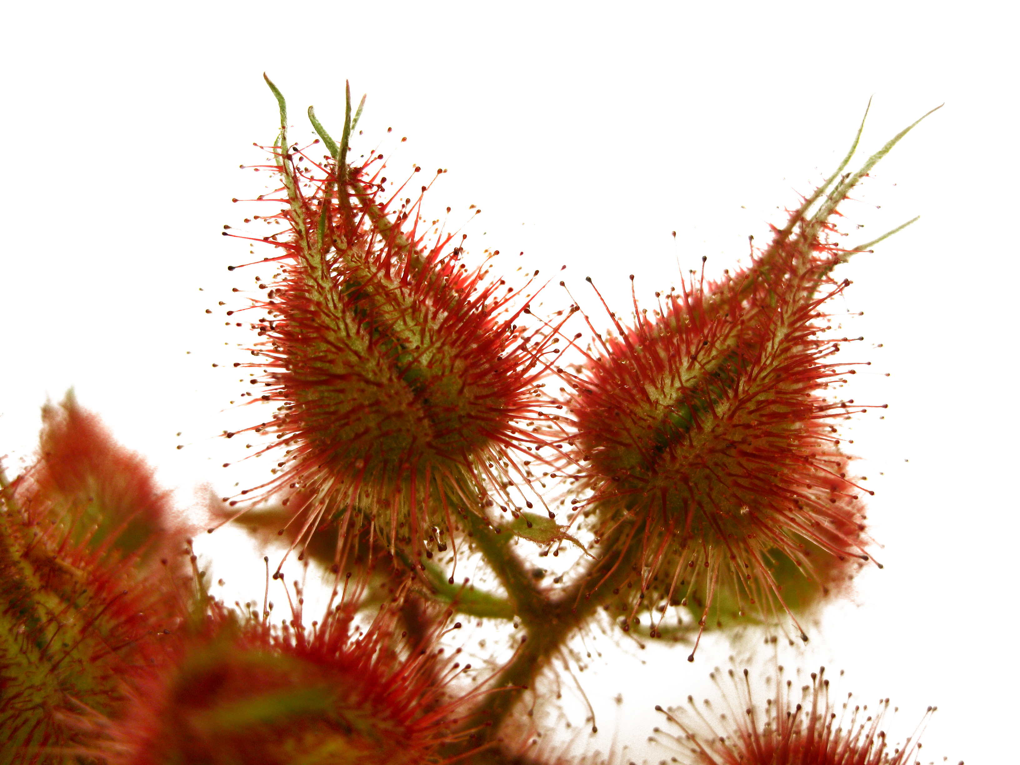
English: NATIVE RANGE
Japan, Korea and China DESCRIPTION Wineberry, or wine raspberry, is a typical species in the genus Rubus, which contains blackberry and raspberry. The name Rubus phoenicolasius translates as "blackberry with purple hairs." The mature plant has long stems (canes) that are upright and arching and covered with distinctive glandular red hairs and small spines. The hairs give the canes a reddish color when seen from a distance. Under favorable conditions, canes may grow to a length of 9 feet. Leaves consist of three heart-shaped, serrated leaflets with purplish veins and are silvery white tomentose on the underside. Small greenish flowers with white petals and reddish hairs occur in Spring. The very edible raspberry like fruit is bright red and ripens during June and July. BACKGROUND Wineberry was introduced into the United States in 1890 as breeding stock for new Rubus cultivars. It is used today by berry breeders to add specific genes to berry varieties or species. Wineberry is an example of one man's flower being another man's weed. Given containment, wineberry has desirable and useful qualities, but due to its invasive nature, it is considered a significant pest of agricultural and natural ecosystems. Wineberry has been used as a virus indicator for raspberry yellow spot and wineberry latent virus and numerous plant viruses have been isolated from it. Source: Plant Conservation Alliance, Alien Plant Working Group. www.nps.gov/plants/alien/fact/ruph1.htm |
| Date | |
| Source | https://www.flickr.com/photos/evelynfitzgerald/3807391912/ |
| Author | Virens (Latin for greening) |
| Camera location | | View this and other nearby images on: OpenStreetMap |
|---|
Licensing
- You are free:
- to share – to copy, distribute and transmit the work
- to remix – to adapt the work
- Under the following conditions:
- attribution – You must give appropriate credit, provide a link to the license, and indicate if changes were made. You may do so in any reasonable manner, but not in any way that suggests the licensor endorses you or your use.
| This image was originally posted to Flickr by Virens (Latin for greening) at https://flickr.com/photos/35147122@N00/3807391912. It was reviewed on 22 July 2021 by FlickreviewR 2 and was confirmed to be licensed under the terms of the cc-by-2.0. |
File history
Click on a date/time to view the file as it appeared at that time.
| Date/Time | Thumbnail | Dimensions | User | Comment | |
|---|---|---|---|---|---|
| current | 07:37, 22 July 2021 | | 3,264 × 2,448 (3.64 MB) | Shapeyness | Uploaded a work by Virens (Latin for greening) from https://www.flickr.com/photos/evelynfitzgerald/3807391912/ with UploadWizard |
File usage
Global file usage
The following other wikis use this file:
- Usage on ar.wikipedia.org
- Usage on fr.wikipedia.org