
File:Railway Viaduct of Beni Amrane on the Algiers-Constantine Line.jpg

Size of this preview: 800 × 534 pixels. Other resolutions: 320 × 214 pixels | 640 × 427 pixels | 1,024 × 684 pixels | 1,280 × 855 pixels | 1,604 × 1,071 pixels.
Original file (1,604 × 1,071 pixels, file size: 436 KB, MIME type: image/jpeg)
| This is a file from the Wikimedia Commons. Information from its description page there is shown below. Commons is a freely licensed media file repository. You can help. |
Summary
| Description |
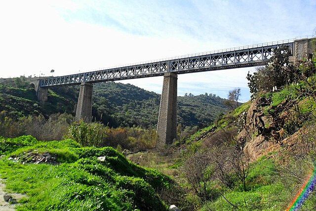
English: The railway viaduct of Beni Amrane on the line from Algiers to Constantine.
Français : Le viaduc ferroviaire de Beni Amrane sur la ligne d'Alger à Constantine.
العربية: الجسر الحديدي لبني عمران على خط القطار من الجزائر إلى قسنطينة.
Italiano: Il viadotto ferroviario di Beni Amrane sulla linea da Algeri a Costantina.
Español: El viaducto ferroviario de Beni Amrane en la línea de Argel a Constantina. |
| Source | panoramio |
| Author | habib kaki |
| Camera location | | View this and other nearby images on: OpenStreetMap |
|---|
Licensing
This file is licensed under the Creative Commons Attribution 3.0 Unported license.
- You are free:
- to share – to copy, distribute and transmit the work
- to remix – to adapt the work
- Under the following conditions:
- attribution – You must give appropriate credit, provide a link to the license, and indicate if changes were made. You may do so in any reasonable manner, but not in any way that suggests the licensor endorses you or your use.
| This image, which was originally posted to Panoramio, was reviewed on 26 March 2012 by the administrator or trusted user Materialscientist, who confirmed that it was available on Panoramio under the above license on that date. |
|
According to article 50 of the Algerian copyright law, it shall be lawful to reproduce or to communicate to the public, without authorization of the author and without remuneration, a work of architecture or the fine arts, a work of applied arts or a photographic work that is permanently situated in a public place, with the exception of art galleries, museums and classified cultural or natural sites.
See COM:CRT/Algeria#Freedom of panorama for more information.
|
File history
Click on a date/time to view the file as it appeared at that time.
| Date/Time | Thumbnail | Dimensions | User | Comment | |
|---|---|---|---|---|---|
| current | 18:48, 31 July 2023 | | 1,604 × 1,071 (436 KB) | Riad Salih | Brightness |
| 20:47, 28 July 2023 |  | 1,604 × 1,071 (436 KB) | Riad Salih | Color optimisation | |
| 21:42, 26 March 2012 |  | 1,604 × 1,071 (397 KB) | Glabb | {{Information |Description=Beni amrane بني عمران |Source=[http://www.panoramio.com/photo/65280237 panoramio] |Date= |Author=[http://www.panoramio.com/user/5095076 habib kaki] |Permission= |other_versions= }} {{Location dec|36.646118|3.590091|so... |
File usage
The following pages on the English Wikipedia use this file (pages on other projects are not listed):
Global file usage
The following other wikis use this file:
- Usage on ar.wikipedia.org
- Usage on arz.wikipedia.org
- Usage on azb.wikipedia.org
- Usage on az.wikipedia.org
- Usage on ceb.wikipedia.org
- Usage on es.wikipedia.org
- Usage on fa.wikipedia.org
- Usage on fr.wikipedia.org
- Usage on ha.wikipedia.org
- Usage on ig.wikipedia.org
- Usage on it.wikipedia.org
- Usage on kab.wikipedia.org
- Usage on lt.wikipedia.org
- Usage on pt.wikipedia.org
- Usage on ro.wikipedia.org
- Usage on sv.wikipedia.org
- Usage on sw.wikipedia.org
- Usage on ts.wikipedia.org
- Usage on tum.wikipedia.org
- Usage on uk.wikipedia.org
- Usage on vi.wikipedia.org
- Usage on www.wikidata.org
- Usage on yo.wikipedia.org
- Usage on zu.wikipedia.org