
File:Pierre Gustave Toutant de Beauregard-1845-1846.jpg

Size of this preview: 532 × 600 pixels. Other resolutions: 213 × 240 pixels | 426 × 480 pixels | 681 × 768 pixels | 908 × 1,024 pixels | 1,973 × 2,225 pixels.
Original file (1,973 × 2,225 pixels, file size: 3.14 MB, MIME type: image/jpeg)
| This is a file from the Wikimedia Commons. Information from its description page there is shown below. Commons is a freely licensed media file repository. You can help. |
Summary
| Description |
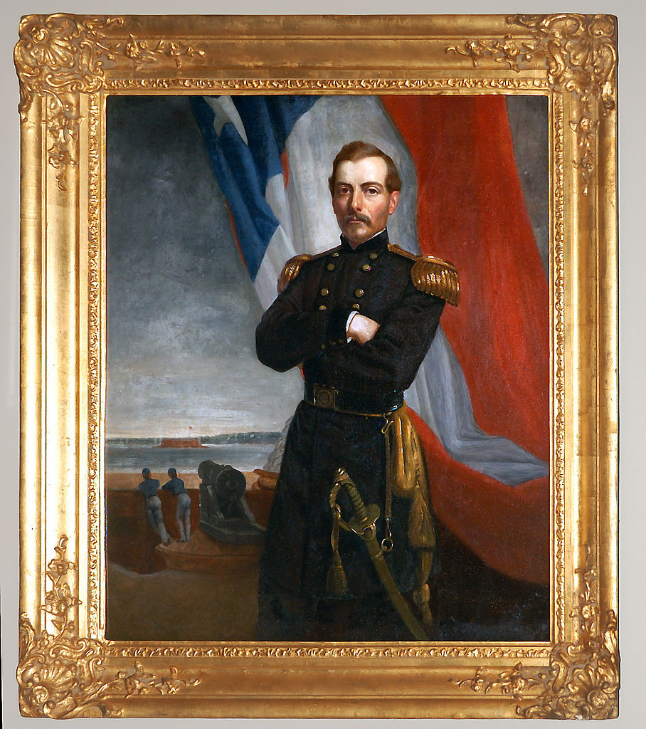
English: Lt. Pierre Toutant Gustave Beauregard, ca. 1845-1846. Attributed to Alexander Charles Jaume (French 1813-1858), Presbytère, Louisiana State Museum. Note: One of the most notable Louisianians to serve in the Civil War was P. G. T. Beauregard, a graduate of West Point and the Confederacy's first brigadier general. As commander of the Confederate forces at Charleston, S. C., Beauregard ordered the bombardment of Fort Sumter on April 12, 1861, firing the first shot of the Civil War. Like many Civil War troops and officers, Beauregard received his early combat experience in the Mexican War of 1846-1848. Français : Un Louisianais des plus notables ayant servi dans la guerre civile, P.G. T. Beauregard est un diplômé de West Point et le premier brigadier-général de la Confédération. Le 12 Avril 1861, en tant que commandant des forces confédérées à Charleston, Carfoline du Sud, Beauregard ordonna le bombardement de Fort Sumter: ce fut le premier tir de la guerre civile. Comme beaucoup de soldats et d'officiers de la guerre civile, Beauregard s'initia au combat lors de la guerre américano-mexicaine de 1846 à 1848. |
| Date | |
| Source | Own work |
| Author | Pierre5018 |
| Camera location | | View this and other nearby images on: OpenStreetMap |
|---|
Licensing
I, the copyright holder of this work, hereby publish it under the following license:
This file is licensed under the Creative Commons Attribution-Share Alike 4.0 International license.
- You are free:
- to share – to copy, distribute and transmit the work
- to remix – to adapt the work
- Under the following conditions:
- attribution – You must give appropriate credit, provide a link to the license, and indicate if changes were made. You may do so in any reasonable manner, but not in any way that suggests the licensor endorses you or your use.
- share alike – If you remix, transform, or build upon the material, you must distribute your contributions under the same or compatible license as the original.
File history
Click on a date/time to view the file as it appeared at that time.
| Date/Time | Thumbnail | Dimensions | User | Comment | |
|---|---|---|---|---|---|
| current | 03:29, 25 November 2014 | | 1,973 × 2,225 (3.14 MB) | Pierre5018 | User created page with UploadWizard |
File usage
The following pages on the English Wikipedia use this file (pages on other projects are not listed):
Global file usage
The following other wikis use this file:
- Usage on azb.wikipedia.org
- Usage on fr.wikipedia.org