
File:NPS great-basin-map.jpg

Size of this preview: 664 × 600 pixels. Other resolutions: 266 × 240 pixels | 532 × 480 pixels | 851 × 768 pixels | 1,134 × 1,024 pixels | 2,268 × 2,048 pixels | 2,856 × 2,579 pixels.
Original file (2,856 × 2,579 pixels, file size: 950 KB, MIME type: image/jpeg)
| This is a file from the Wikimedia Commons. Information from its description page there is shown below. Commons is a freely licensed media file repository. You can help. |
Summary
| Description |
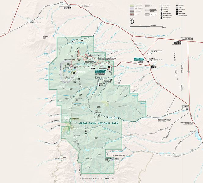
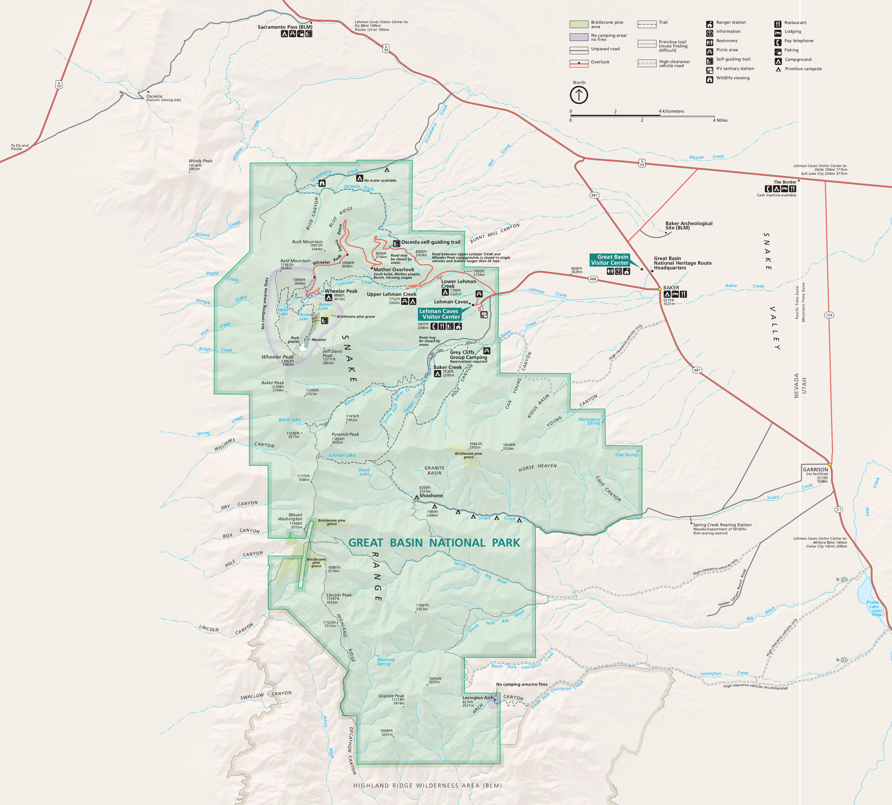
English: Great Basin map from the park brochure, showing the viewpoints, roads, trails, Wheeler Peak, and Lehman Caves. |
| Date | |
| Source | U.S. National Park Service (http://npmaps.com/wp-content/uploads/great-basin-map.jpg) |
| Author | U.S. National Park Service, restoration/cleanup by Matt Holly |
| Other versions |
 |
Licensing
| This image or media file contains material based on a work of a National Park Service employee, created as part of that person's official duties. As a work of the U.S. federal government, such work is in the public domain in the United States. See the NPS website and NPS copyright policy for more information. |
File history
Click on a date/time to view the file as it appeared at that time.
| Date/Time | Thumbnail | Dimensions | User | Comment | |
|---|---|---|---|---|---|
| current | 23:27, 16 May 2017 | | 2,856 × 2,579 (950 KB) | RKBot | =={{int:filedesc}}== {{Information |description= {{en|1=Great Basin map from the park brochure, showing the viewpoints, roads, trails, Wheeler Peak, and Lehman Caves.}} |date= 2015-08-09 |source= U.S. National Park Service (http://npmaps.com/wp-content... |
File usage
The following pages on the English Wikipedia use this file (pages on other projects are not listed):
Global file usage
The following other wikis use this file:
- Usage on de.wikipedia.org