
File:MindenFischerstadt.jpg
Size of this preview: 799 × 328 pixels. Other resolutions: 320 × 131 pixels | 640 × 263 pixels | 1,024 × 420 pixels | 2,214 × 909 pixels.
Original file (2,214 × 909 pixels, file size: 433 KB, MIME type: image/jpeg)
| This is a file from the Wikimedia Commons. Information from its description page there is shown below. Commons is a freely licensed media file repository. You can help. |
Summary
| Camera location | | View this and other nearby images on: OpenStreetMap |
|---|
| Description |
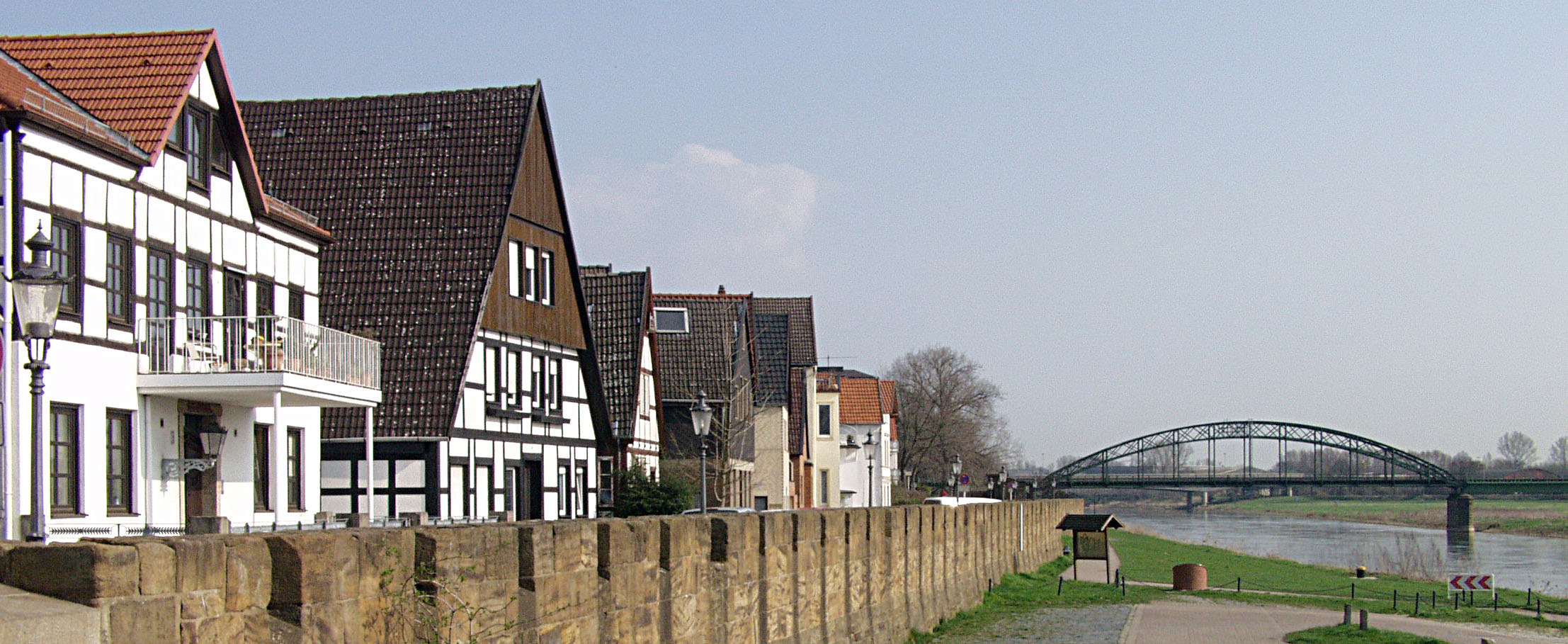
Deutsch: Blick auf die Mindener Fischerstadt am linken Weserufer in Nordrhein-Westfalen. Die vordere Brücke über die Weser ist die Eisenbahnbrücke der Strecke Bahnstrecke Minden–Uchte, die hintere ist die Nordbrücke über die die Ringstraße über den Weserstrom geführt wird. Die Mauer (Fischerstadtmauer) vor den Häusern dient sowohl dem Hochwasserschutz als auch (vor der Erniedrigung) der militärischen Sicherung im Komplex der Festungsbauwerke der preußischen Festung Minden. Weiterführendes auf dieser Website. Unten am Weserufer eine Station des Planetenwegs. |
| Date | |
| Source | fotografiert von Stebra |
| Author | Stebra |
| Permission (Reusing this file) |
GFDL |
| Other versions | copied from de.wikipedia [1] 18:19, 2005-11-25 . . 2.214×909 (433 KB) . . Stebra |
![[1]](https://de.wikipedia.org/wiki/Bild:MindenFischerstadt.jpg)
Stebra at the German-language Wikipedia, the copyright holder of this work, hereby publishes it under the following license:

|
Permission is granted to copy, distribute and/or modify this document under the terms of the GNU Free Documentation License, Version 1.2 or any later version published by the Free Software Foundation; with no Invariant Sections, no Front-Cover Texts, and no Back-Cover Texts. A copy of the license is included in the section entitled GNU Free Documentation License. |
| This file is licensed under the Creative Commons Attribution-Share Alike 3.0 Unported license. | ||
| Attribution: Stebra | ||
| ||
| This licensing tag was added to this file as part of the GFDL licensing update. |
File history
Click on a date/time to view the file as it appeared at that time.
| Date/Time | Thumbnail | Dimensions | User | Comment | |
|---|---|---|---|---|---|
| current | 18:26, 26 November 2008 | 2,214 × 909 (433 KB) | Bdk | {{Information |Description={{de|Blick auf die Mindener Fischerstadt am linken Weserufer.}} |Source=fotografiert von Stebra |Date=2005-04-04 |Author=Stebra |Permission=GFDL |other_versions=copied from de.wikipedia [http://de.wikipedia.o |
File usage
The following pages on the English Wikipedia use this file (pages on other projects are not listed):
Global file usage
The following other wikis use this file:
- Usage on de.wikipedia.org
- Minden
- Festung Minden
- Portal:Ostwestfalen-Lippe/Bildarchiv
- Liste der Baudenkmäler in Minden (links der Weser)
- Benutzer:Aeggy/Baustelle/Liste Denkmal Minden
- Wikipedia:Diskussionen über Bilder/Archiv/2012/Mai
- Portal:Ostwestfalen-Lippe/Bild des Jahres 2012
- Wikipedia Diskussion:WikiProjekt Ostwestfalen-Lippe/Archiv/2013
- Usage on ja.wikipedia.org
- Usage on nl.wikipedia.org