
File:Maryland Presidential Election Results 1840.png

Size of this preview: 800 × 466 pixels. Other resolutions: 320 × 186 pixels | 640 × 373 pixels | 1,024 × 596 pixels | 1,280 × 745 pixels | 3,000 × 1,747 pixels.
Original file (3,000 × 1,747 pixels, file size: 441 KB, MIME type: image/png)
| This is a file from the Wikimedia Commons. Information from its description page there is shown below. Commons is a freely licensed media file repository. You can help. |
Summary
| Description |
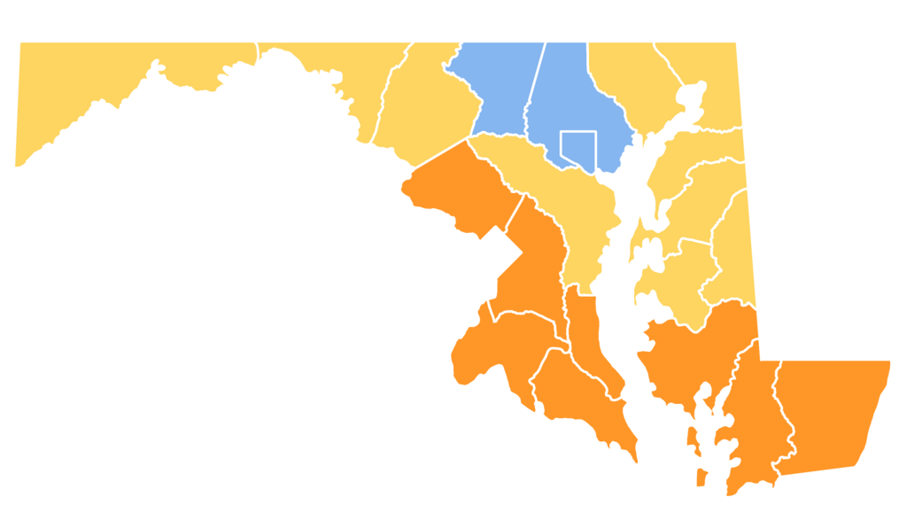
English: A map of the United States Presidential Election of 1840 in Maryland by county.
Harrison 60-70%
Harrison 50-60%
Van Buren 50-60% |
| Date | |
| Source | http://geoelections.free.fr/EU/elec_comtes/1840.htm https://suncatcherstudio.com/patterns/usa-county-maps/maryland-county-map/ |
| Author | Kosobay |
Licensing
This file is licensed under the Creative Commons Attribution-Share Alike 4.0 International license.
- You are free:
- to share – to copy, distribute and transmit the work
- to remix – to adapt the work
- Under the following conditions:
- attribution – You must give appropriate credit, provide a link to the license, and indicate if changes were made. You may do so in any reasonable manner, but not in any way that suggests the licensor endorses you or your use.
- share alike – If you remix, transform, or build upon the material, you must distribute your contributions under the same or compatible license as the original.
File history
Click on a date/time to view the file as it appeared at that time.
| Date/Time | Thumbnail | Dimensions | User | Comment | |
|---|---|---|---|---|---|
| current | 07:06, 12 November 2022 | | 3,000 × 1,747 (441 KB) | Kosobay | Uploaded a work by Kosobay from http://geoelections.free.fr/EU/elec_comtes/1840.htm https://suncatcherstudio.com/patterns/usa-county-maps/maryland-county-map/ with UploadWizard |
File usage
The following pages on the English Wikipedia use this file (pages on other projects are not listed):