
File:Map of Sullivan County Indiana Townships.svg

Size of this PNG preview of this SVG file: 512 × 512 pixels. Other resolutions: 240 × 240 pixels | 480 × 480 pixels | 768 × 768 pixels | 1,024 × 1,024 pixels | 2,048 × 2,048 pixels.
Original file (SVG file, nominally 512 × 512 pixels, file size: 53 KB)
| This is a file from the Wikimedia Commons. Information from its description page there is shown below. Commons is a freely licensed media file repository. You can help. |
| Description |
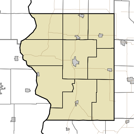
English: This is a map of the townships in Sullivan County, Indiana, USA. |
| Date | (UTC) |
| Source | |
| Author |
|
I, the copyright holder of this work, hereby publish it under the following license:
| I, the copyright holder of this work, release this work into the public domain. This applies worldwide. In some countries this may not be legally possible; if so: I grant anyone the right to use this work for any purpose, without any conditions, unless such conditions are required by law. |
Original upload log
This image is a derivative work of the following images:
- File:Map_highlighting_Cass_Township,_Sullivan_County,_Indiana.svg licensed with PD-self
- 2007-11-24T20:01:54Z File Upload Bot (Omnedon) 512x512 (26387 Bytes) == Summary == {{Information |Description={{en|This is a map of Sullivan County, Indiana, USA which highlights the location of Cass Township.}} |Source=My own work, using freely-available TIGER data and custom-written MapScri
Uploaded with derivativeFX
File history
Click on a date/time to view the file as it appeared at that time.
| Date/Time | Thumbnail | Dimensions | User | Comment | |
|---|---|---|---|---|---|
| current | 18:17, 17 August 2010 | | 512 × 512 (53 KB) | Sweet kate | {{Information |Description={{en|This is a map of the townships in Sullivan County, Indiana, USA.}} |Source=*File:Map_highlighting_Cass_Township,_Sullivan_County,_Indiana.svg |Date=2010-08-17 18:13 (UTC) |Author=*[[:File:Map_highlighting_Cass_Townshi |
File usage
The following pages on the English Wikipedia use this file (pages on other projects are not listed):
- Baker, Indiana
- Baldridge, Indiana
- Benefiel Corner, Indiana
- Bucktown, Indiana
- Caledonia, Indiana
- Cass, Indiana
- Curryville, Sullivan County, Indiana
- Dodds Bridge, Indiana
- East Shelburn, Indiana
- Fairbanks, Indiana
- Farnsworth, Indiana
- Gambill, Indiana
- Glendora, Indiana
- Graysville, Indiana
- Greenville, Sullivan County, Indiana
- Hawton, Indiana
- Jackson Hill, Indiana
- Jericho, Indiana
- Massacre, Indiana
- Merom Station, Indiana
- New Lebanon, Indiana
- Paxton, Indiana
- Pleasantville, Indiana
- Riverton, Indiana
- Riverview, Indiana
- Scotchtown, Indiana
- Scott City, Indiana
- Shelburn station
- Sherman Building (Sullivan, Indiana)
- Shiloh, Indiana
- Standard, Indiana
- Stringtown, Sullivan County, Indiana
- Sullivan County Airport
- Sullivan County Courthouse (Indiana)
- Union Christian College, Merom
- Wilfred, Indiana
- Module:Location map/data/USA Indiana Sullivan County
- Module:Location map/data/USA Indiana Sullivan County/doc
Global file usage
The following other wikis use this file:
- Usage on ar.wikipedia.org
- Usage on azb.wikipedia.org
- Usage on ceb.wikipedia.org
- Usage on fa.wikipedia.org
- Usage on fr.wikipedia.org
- Usage on kn.wikipedia.org
- Usage on si.wikipedia.org
- Usage on tr.wikipedia.org
- Usage on ur.wikipedia.org
- Usage on war.wikipedia.org