
File:Map of Mallee Woodlands and Shrublands plant communities across southern Australia.png
Size of this preview: 600 × 600 pixels. Other resolutions: 240 × 240 pixels | 480 × 480 pixels | 768 × 768 pixels | 1,024 × 1,024 pixels | 2,000 × 2,000 pixels.
Original file (2,000 × 2,000 pixels, file size: 118 KB, MIME type: image/png)
| This is a file from the Wikimedia Commons. Information from its description page there is shown below. Commons is a freely licensed media file repository. You can help. |
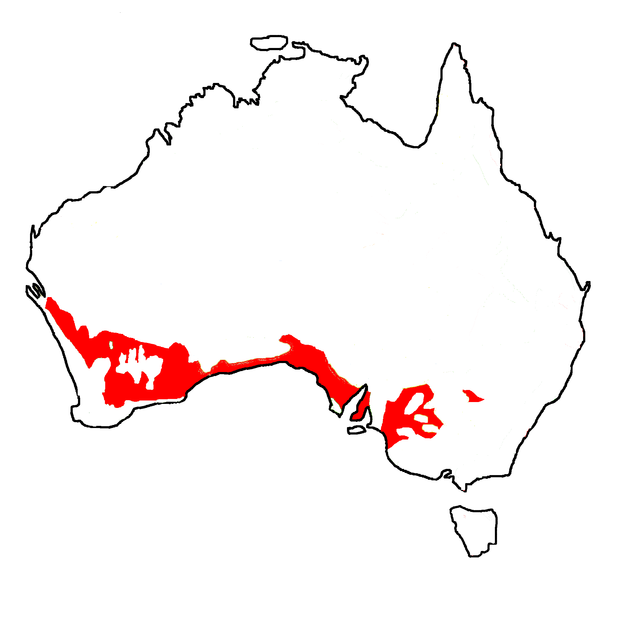
| Description | simplified Map of Australian natural Vegetation: Mallee. |
| Date | (UTC) |
| Source | |
| Author |
|
| This is a retouched picture, which means that it has been digitally altered from its original version. Modifications: reduced to mallee only. The original can be viewed here: Australian Vegetation.png:
|
I, the copyright holder of this work, hereby publish it under the following licenses:
This file is licensed under the Creative Commons Attribution-Share Alike 3.0 Unported, 2.5 Generic, 2.0 Generic and 1.0 Generic license.
- You are free:
- to share – to copy, distribute and transmit the work
- to remix – to adapt the work
- Under the following conditions:
- attribution – You must give appropriate credit, provide a link to the license, and indicate if changes were made. You may do so in any reasonable manner, but not in any way that suggests the licensor endorses you or your use.
- share alike – If you remix, transform, or build upon the material, you must distribute your contributions under the same or compatible license as the original.

|
Permission is granted to copy, distribute and/or modify this document under the terms of the GNU Free Documentation License, Version 1.2 or any later version published by the Free Software Foundation; with no Invariant Sections, no Front-Cover Texts, and no Back-Cover Texts. A copy of the license is included in the section entitled GNU Free Documentation License. |
You may select the license of your choice.
Original upload log
This image is a derivative work of the following images:
- File:Australian_Vegetation.png licensed with Cc-by-sa-3.0,2.5,2.0,1.0, GFDL
- 2007-09-29T18:14:48Z Griensteidl 2000x2000 (234272 Bytes) {{Information |Description=simplified Map of Australian natural Vegetation. 1 rainforest, 2 tall open forest, 3 open eucalypt fores, 4 tropical euc savanna, 5 humid euc woodland, 6 dry euc woodlands, 7 mallee, 8 melaleuca for
- 2007-09-21T14:57:24Z Griensteidl 2000x2000 (239190 Bytes) {{Information |Description=simplified Map of Australian natural Vegetation. 1 rainforest, 2 tall open forest, 3 open eucalypt fores, 4 tropical euc savanna, 5 humid euc woodland, 6 dry euc woodlands, 7 mallee, 8 melaleuca for
Uploaded with derivativeFX
File history
Click on a date/time to view the file as it appeared at that time.
| Date/Time | Thumbnail | Dimensions | User | Comment | |
|---|---|---|---|---|---|
| current | 00:45, 18 October 2009 | | 2,000 × 2,000 (118 KB) | Papphase | {{Information |Description=simplified Map of Australian natural Vegetation: Mallee. |Source=*File:Australian_Vegetation.png |Date=2009-10-18 00:44 (UTC) |Author=*File:Australian_Vegetation.png: Griensteidl *derivative work |
File usage
The following pages on the English Wikipedia use this file (pages on other projects are not listed):
Global file usage
The following other wikis use this file:
- Usage on de.wikipedia.org