
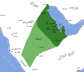
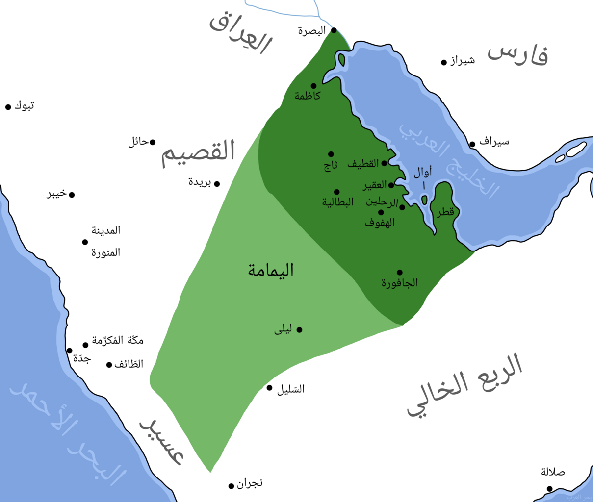
File:Map of Jarwanid Emirate.png

Size of this preview: 708 × 599 pixels. Other resolutions: 284 × 240 pixels | 567 × 480 pixels | 907 × 768 pixels | 1,209 × 1,024 pixels | 2,419 × 2,048 pixels | 9,779 × 8,280 pixels.
Original file (9,779 × 8,280 pixels, file size: 3.45 MB, MIME type: image/png)
| This is a file from the Wikimedia Commons. Information from its description page there is shown below. Commons is a freely licensed media file repository. You can help. |
Summary
| Description |
العربية: خريطة الإمارة الجروانية
English: Map of Jarwanid Emirate |
| Date | |
| Source |
|
| Author | عبدالعزيز علي |
Licensing
| This work has been released into the public domain by its author, عبدالعزيز علي at Arabic Wikipedia. This applies worldwide. In some countries this may not be legally possible; if so: عبدالعزيز علي grants anyone the right to use this work for any purpose, without any conditions, unless such conditions are required by law. |
File history
Click on a date/time to view the file as it appeared at that time.
| Date/Time | Thumbnail | Dimensions | User | Comment | |
|---|---|---|---|---|---|
| current | 07:15, 2 July 2023 | | 9,779 × 8,280 (3.45 MB) | عبد العزيز علي | إزالة اسم الدولة |
| 03:17, 2 July 2023 |  | 9,779 × 8,280 (3.64 MB) | عبد العزيز علي | Uploaded own work with UploadWizard |
File usage
The following pages on the English Wikipedia use this file (pages on other projects are not listed):
Global file usage
The following other wikis use this file:
- Usage on ar.wikipedia.org
- Usage on www.wikidata.org