
File:Map of Harper's Ferry.jpg

Size of this preview: 800 × 548 pixels. Other resolutions: 320 × 219 pixels | 640 × 439 pixels | 1,024 × 702 pixels | 1,323 × 907 pixels.
Original file (1,323 × 907 pixels, file size: 591 KB, MIME type: image/jpeg)
| This is a file from the Wikimedia Commons. Information from its description page there is shown below. Commons is a freely licensed media file repository. You can help. |
Summary
| Description |
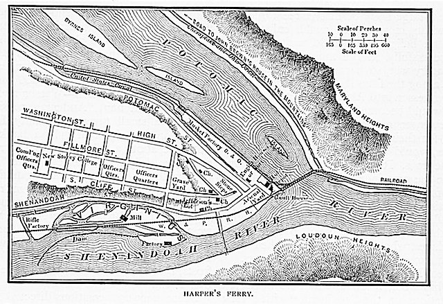
English: Picture has been digitally enhanced. |
| Date | |
| Source | https://archive.org/details/century-1883-v-4/page/401/mode/1up?q=John+brown |
| Author | Unknown author |
Licensing
|
This work is in the public domain in its country of origin and other countries and areas where the copyright term is the author's life plus 70 years or fewer. This work is in the public domain in the United States because it was published (or registered with the U.S. Copyright Office) before January 1, 1929. | |
| This file has been identified as being free of known restrictions under copyright law, including all related and neighboring rights. | |
File history
Click on a date/time to view the file as it appeared at that time.
| Date/Time | Thumbnail | Dimensions | User | Comment | |
|---|---|---|---|---|---|
| current | 16:41, 13 January 2021 | | 1,323 × 907 (591 KB) | Deisenbe | Uploaded a work by Unknown from https://archive.org/details/century-1883-v-4/page/401/mode/1up?q=John+brown with UploadWizard |
File usage
The following pages on the English Wikipedia use this file (pages on other projects are not listed):
Global file usage
The following other wikis use this file:
- Usage on ca.wikipedia.org
- Usage on de.wikipedia.org
- Usage on tt.wikipedia.org
- Usage on www.wikidata.org