
File:Map for First Battle of St Alban's by Ramsay.jpg
Size of this preview: 800 × 573 pixels. Other resolutions: 320 × 229 pixels | 640 × 458 pixels | 1,024 × 733 pixels | 1,280 × 917 pixels | 2,120 × 1,518 pixels.
Original file (2,120 × 1,518 pixels, file size: 434 KB, MIME type: image/jpeg)
| This is a file from the Wikimedia Commons. Information from its description page there is shown below. Commons is a freely licensed media file repository. You can help. |
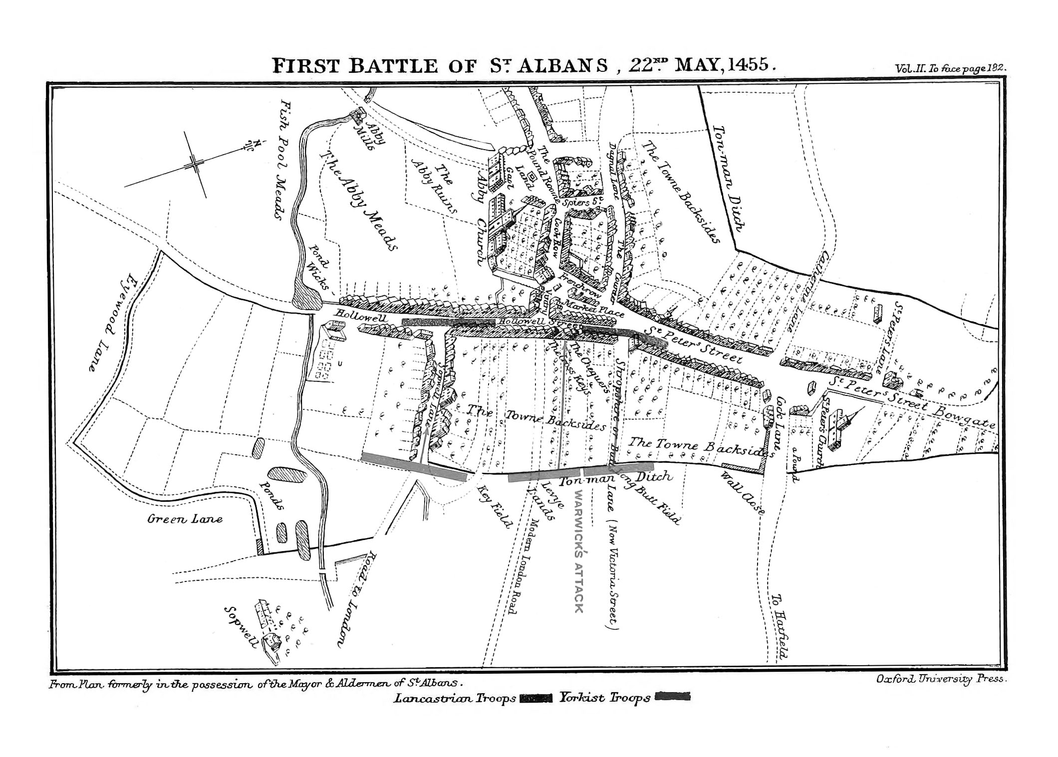
| Description | Map for the First Battle of St Albans | ||||
| Date | |||||
| Source | Ramsay, James Henry (1892) "First Battle of St. Alban's" in Lancaster and York: A Century of English History (A.D. 1399–1485), Volume II, Oxford, United Kingdom: Clarendon Press, pp. p. 182 Retrieved on 14 December 2010. | ||||
| Author | James Henry Ramsay (1859–1925)[1] | ||||
| Permission (Reusing this file) |
|
||||
File history
Click on a date/time to view the file as it appeared at that time.
| Date/Time | Thumbnail | Dimensions | User | Comment | |
|---|---|---|---|---|---|
| current | 00:02, 6 January 2020 | | 2,120 × 1,518 (434 KB) | SteinsplitterBot | Bot: Image rotated by 90° |
| 01:30, 4 January 2011 |  | 1,518 × 2,126 (390 KB) | Jappalang | {{Information |description=Map for the First Battle of St Albans |date=1889 |source={{cite book | last = Ramsay | first = James Henry | year = 1892 | title = Lancaster and York: A Century of En |
File usage
The following pages on the English Wikipedia use this file (pages on other projects are not listed):
Global file usage
The following other wikis use this file:
- Usage on da.wikipedia.org
- Usage on fr.wikipedia.org
- Usage on it.wikipedia.org
- Usage on nl.wikipedia.org