
File:Llywernog Silver-Lead Mine Museum- waterwheels (geograph 5725660).jpg
Size of this preview: 800 × 538 pixels. Other resolutions: 320 × 215 pixels | 640 × 430 pixels | 1,024 × 688 pixels | 1,280 × 860 pixels | 1,600 × 1,075 pixels.
Original file (1,600 × 1,075 pixels, file size: 714 KB, MIME type: image/jpeg)
| This is a file from the Wikimedia Commons. Information from its description page there is shown below. Commons is a freely licensed media file repository. You can help. |
.jpg)
Summary
| Description |
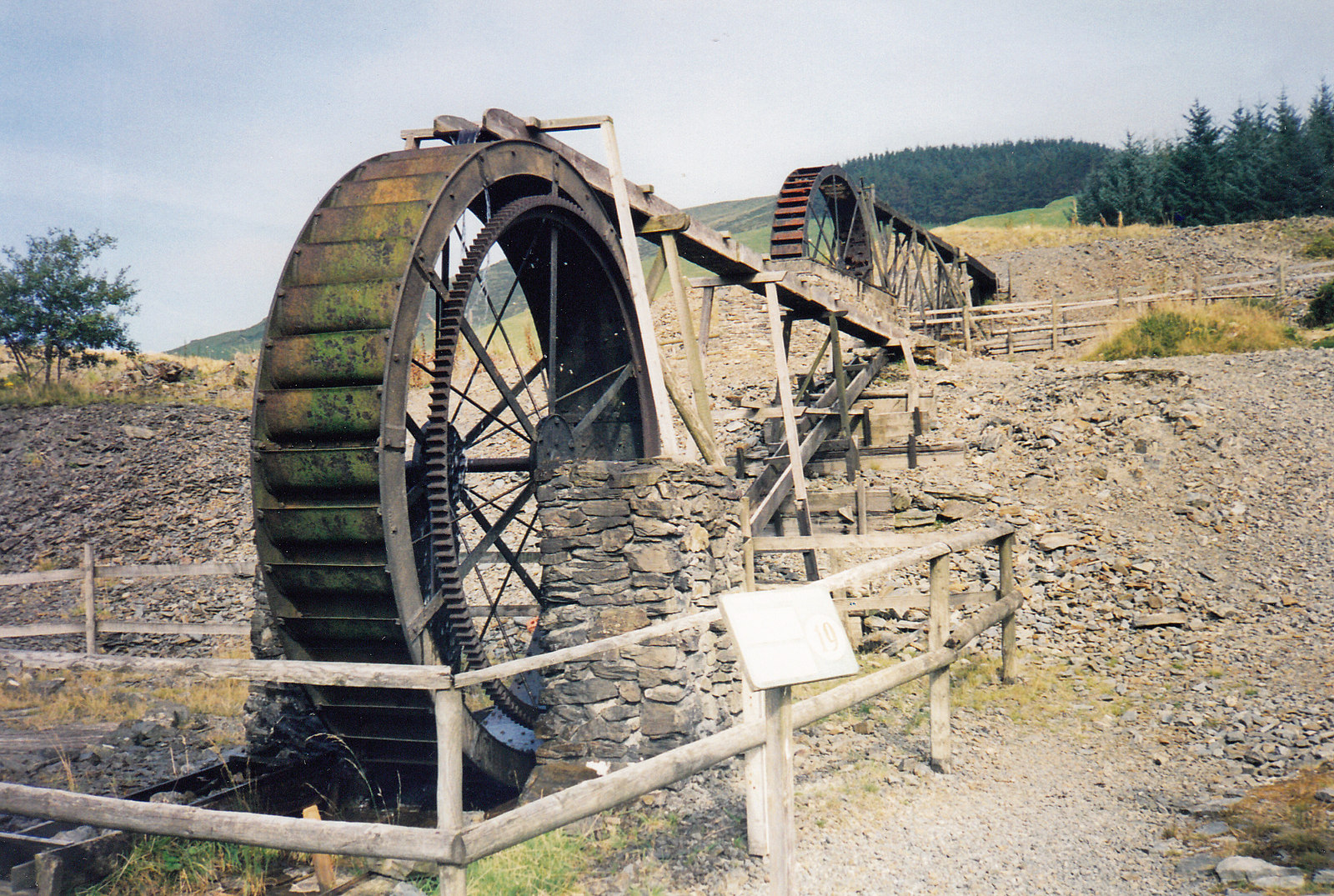
English: Llywernog Silver-Lead Mine Museum: waterwheels. The wheel closest to the camera was cast by the 'Woodward Cardigan Foundry' and is about 11ft in diameter, all iron overshot with attached ring gear. The further wheel was cast by cast by the Central Foundry, Aberystwyth in 1910 and is a high breastshot type. |
| Date | |
| Source | From geograph.org.uk |
| Author | Martin Bodman |
| Permission (Reusing this file) |
Creative Commons Attribution Share-alike license 2.0 |
| Attribution (required by the license) | Martin Bodman / Llywernog Silver-Lead Mine Museum: waterwheels / |
| Camera location | | View this and other nearby images on: OpenStreetMap |
|---|
.jpg¶ms=052.411626_N_-003.865931_E_globe:Earth_type:camera_source:geograph-osgb36(SN73188093)_heading:337.00&language=en)
| Object location | | View this and other nearby images on: OpenStreetMap |
|---|
.jpg¶ms=052.411710_N_-003.866080_E_globe:Earth_class:object_type:object_source:geograph-osgb36(SN73178094)_heading:337.00&language=en)
Licensing

|
This image was taken from the Geograph project collection. See this photograph's page on the Geograph website for the photographer's contact details. The copyright on this image is owned by Martin Bodman and is licensed for reuse under the Creative Commons Attribution-ShareAlike 2.0 license.
|
This file is licensed under the Creative Commons Attribution-Share Alike 2.0 Generic license.
Attribution: Martin Bodman
- You are free:
- to share – to copy, distribute and transmit the work
- to remix – to adapt the work
- Under the following conditions:
- attribution – You must give appropriate credit, provide a link to the license, and indicate if changes were made. You may do so in any reasonable manner, but not in any way that suggests the licensor endorses you or your use.
- share alike – If you remix, transform, or build upon the material, you must distribute your contributions under the same or compatible license as the original.
File history
Click on a date/time to view the file as it appeared at that time.
| Date/Time | Thumbnail | Dimensions | User | Comment | |
|---|---|---|---|---|---|
| current | 14:52, 4 April 2018 | | 1,600 × 1,075 (714 KB) | Chris j wood | Transferred from geograph.co.uk using [https://tools.wmflabs.org/geograph2commons/ geograph2commons] |
File usage
The following pages on the English Wikipedia use this file (pages on other projects are not listed):
Global file usage
The following other wikis use this file:
- Usage on cy.wikipedia.org
- Usage on www.wikidata.org
.jpg)