
File:Kaisou District Map.png
No higher resolution available.
Kaisou_District_Map.png (749 × 599 pixels, file size: 89 KB, MIME type: image/png)
| This is a file from the Wikimedia Commons. Information from its description page there is shown below. Commons is a freely licensed media file repository. You can help. |
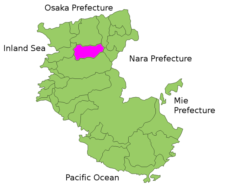
Summary
| Description | Map of Kaisou District, Wakayama Prefecture, Japan |
| Date | 20 October 2006 (original upload date) |
| Source |
Transferred from nl.wikipedia to Commons. |
| Author |
The original uploader was Krisgrotius at Dutch Wikipedia. |
Licensing

|
Shigenobu AOKI, the copyright holder of this work, allows anyone to use it for any purpose including unrestricted redistribution, commercial use, and modification. |
Original upload log
The original description page was here. All following user names refer to nl.wikipedia.
- 2006-10-20 14:34 Krisgrotius 749×599×8 (90739 bytes) {{Information| |Description= Map of Kaisou District, Wakayama Prefecture, Japan |Source= own work |Date= |Author= ~~~~ |Permission= public |other_versions= }}
File history
Click on a date/time to view the file as it appeared at that time.
| Date/Time | Thumbnail | Dimensions | User | Comment | |
|---|---|---|---|---|---|
| current | 22:48, 22 March 2007 | | 749 × 599 (89 KB) | SieBot | {{Information |Description=Map of Kaisou District, Wakayama Prefecture, Japan |Source=Originally from [http://nl.wikipedia.org nl.wikipedia]; description page is/was [http://nl.wikipedia.org/w/index.php?title=Image%3AKaisou_District_Map.png here].<br/> ( |
File usage
The following pages on the English Wikipedia use this file (pages on other projects are not listed):