
File:Kaiser Crater - color altimetry - barchan dune.jpg

Size of this preview: 289 × 598 pixels. Other resolutions: 116 × 240 pixels | 232 × 480 pixels | 371 × 768 pixels | 495 × 1,024 pixels | 1,612 × 3,336 pixels.
Original file (1,612 × 3,336 pixels, file size: 1.5 MB, MIME type: image/jpeg)
| This is a file from the Wikimedia Commons. Information from its description page there is shown below. Commons is a freely licensed media file repository. You can help. |
Summary
| Description |
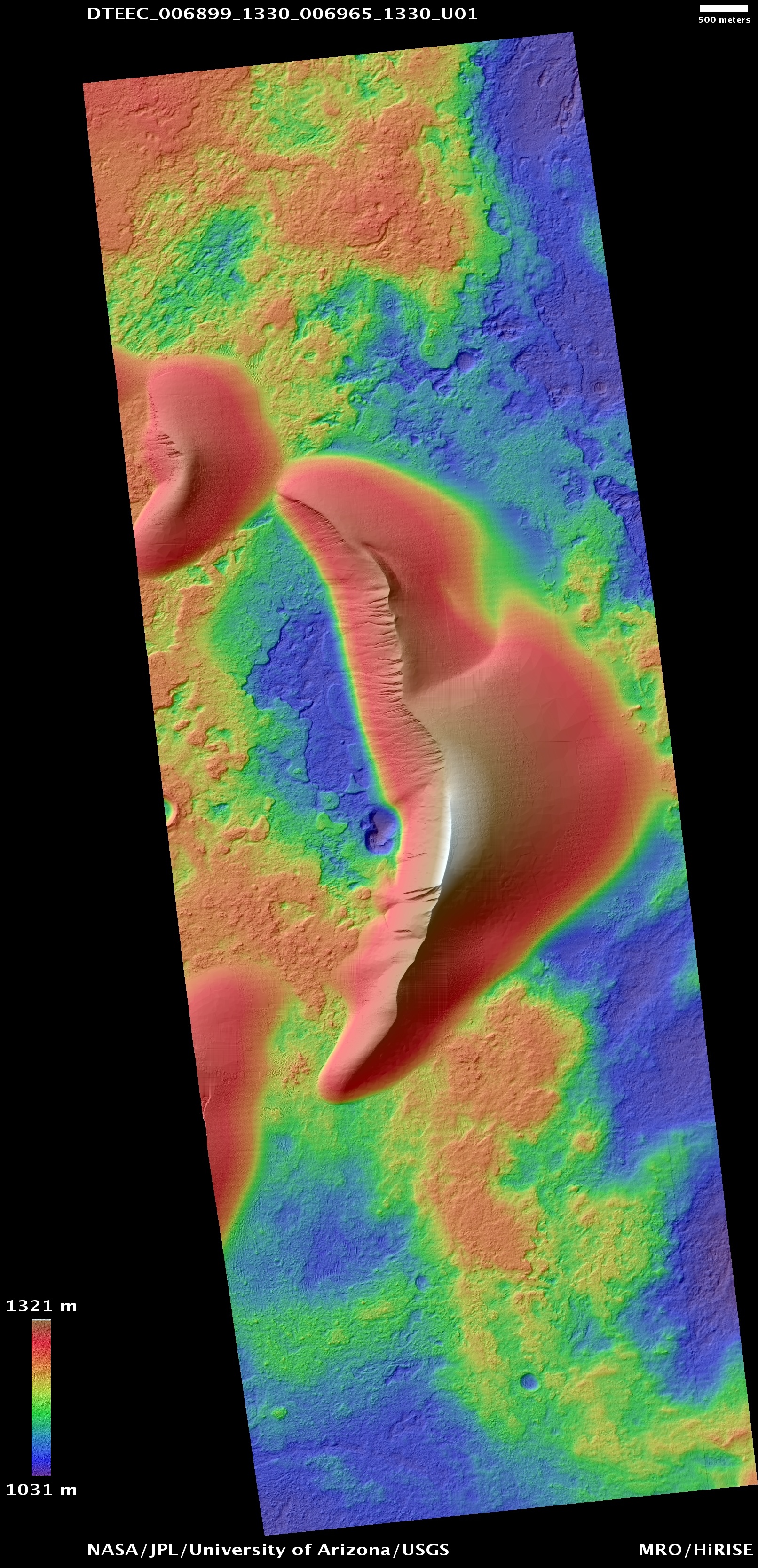
English: Kaiser Crater color altimetry showing avalanche features of dune slip face seen in MOC Image R06-00380. Location is Latitude (center): -46.7 degrees, Longitude (center): 20.14 degrees. Digital terrain model derived from HiRISE stereo pair; left observation PSP_006899_1330 and right observation PSP_006965_1330 acquired in January 2008. |
| Date | |
| Source | Main page, color altimetry file |
| Author | NASA/JPL/University of Arizona/USGS |
Licensing
| This file is in the public domain in the United States because it was solely created by NASA. NASA copyright policy states that "NASA material is not protected by copyright unless noted". (See Template:PD-USGov, NASA copyright policy page or JPL Image Use Policy.) | ||
 |
Warnings:
|
File history
Click on a date/time to view the file as it appeared at that time.
| Date/Time | Thumbnail | Dimensions | User | Comment | |
|---|---|---|---|---|---|
| current | 12:32, 2 October 2011 | | 1,612 × 3,336 (1.5 MB) | Sean.hoyland | == {{int:filedesc}} == {{Information |Description={{en|1=Kaiser Crater color altimetry showing avalanche features of dune slip face seen in MOC Image R06-00380. Location is Latitude (center): -46.7 degrees, Longitude (center): 20.14 degrees .}} |Source=[h |
File usage
The following pages on the English Wikipedia use this file (pages on other projects are not listed):
Global file usage
The following other wikis use this file:
- Usage on es.wikipedia.org
- Usage on uk.wikipedia.org
- Usage on zh.wikipedia.org